MyTopo
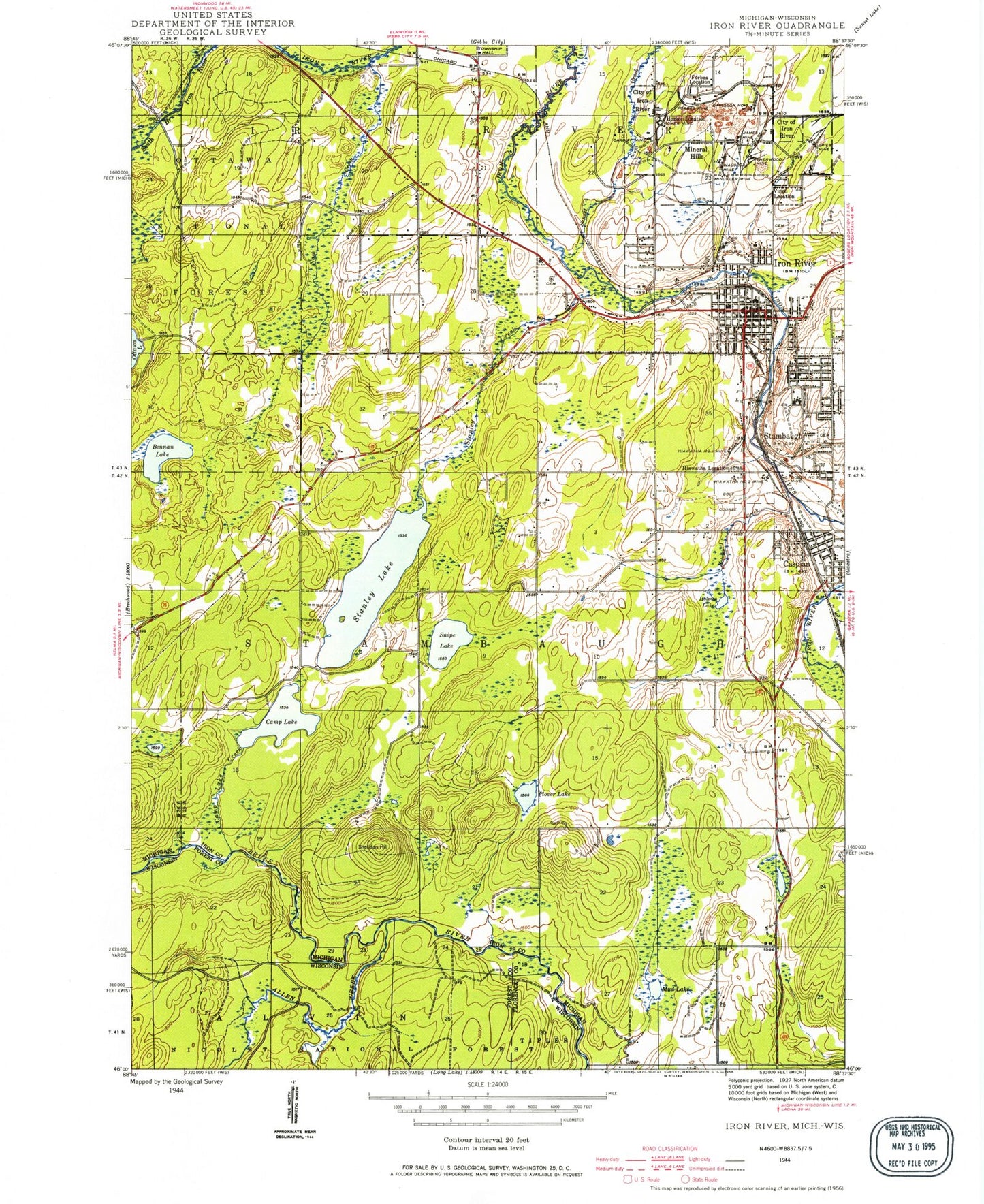
Classic USGS Iron River Michigan 7.5'x7.5' Topo Map
Couldn't load pickup availability
Historical USGS topographic quad map of Iron River in the states of Michigan, Wisconsin. Map scale may vary for some years, but is generally around 1:24,000. Print size is approximately 24" x 27"
This quadrangle is in the following counties: Florence, Forest, Iron.
The map contains contour lines, roads, rivers, towns, and lakes. Printed on high-quality waterproof paper with UV fade-resistant inks, and shipped rolled.
Contains the following named places: Ace High School, Allen Creek, Bachman Park, Bennan Lake, Big Bear Ski Trail, Brule Mountain Ski Area, Camp Lake, Camp Lake Creek, Cardiff Mine, Caspian, Caspian / Gaastra Volunteer Fire Department, Caspian Police Department, Caspian Post Office, Caspian Station, City of Caspian, City of Iron River, City of Stambaugh, Community Church of Nazarene, Davidson Number Three Mine, Dober Number 2 Mine, Double Doodle Ski Trail, First Assembly of God Church, First Baptist Church, First Lutheran Church, First Presbyterian Church, Forbes Location, Forbes Mine, Gaspardo Creek, Grace Covenant Church, Hiawatha Location, Hiawatha Number One Mine, Hiawatha Number Two Mine, Holmes Creek, Holmes Lake, Homer Location, Homer Mine, Homestead Ski Trail, Hoover Park, Hot Cider Ski Trail, Iron County Fairgrounds, Iron County Historical Museum, Iron County Ice Arena, Iron Inn Historical Marker, Iron Lake Creek, Iron River, Iron River Care Center, Iron River Cemetery, Iron River City Hall, Iron River Country Club, Iron River Police Department, Iron River Post Office, Iron River RV Park, Iron River Seventh-Day Adventist Church, Iron River Station, James Mine, Laurel Lake, Log Jam Ski Trail, MacKinnon House Historical Marker, Maple Syrup Ski Trail, Mattol Park, Michigan State Police Department, Minckler Mine, Mineral Hills, Mud Lake, Nanaimo Park, Nash Creek, Nelson Field, North Forty Ski Trail, Otterslide Ski Trail, Plover Lake, Raymond Gustafson Archive Library, Resthaven Cemetery, Saint Agnes Catholic Church, Saint Cecilia Church, Saint John's Episcopal Church, Saint Paul's Lutheran Church, Saint Peters Lutheran Church, Sheridan Hill, Sherwood Mine, Snipe Lake, Snow Shoe Ski Trail, Spies Mine, Spillway Ski Trail, Stambaugh, Stambaugh Airport, Stambaugh Cemetery, Stambaugh Elementary School, Stambaugh Post Office, Stambaugh Station, Stanley Creek, Stanley Lake, Sunrise Ski Trail, Sunset Creek, The Rapids Ski Trail, Timberdoodle Ski Trail, Township of Stambaugh, Trinity Lutheran Church, Virgil Location, Wauseca Mine, Wesley United Methodist Church, West Iron County Fire Department, West Iron County High School, West Iron District Library, West Iron Middle School, Whitewater Ski Trail, WIKB-AM (Iron River)