MyTopo
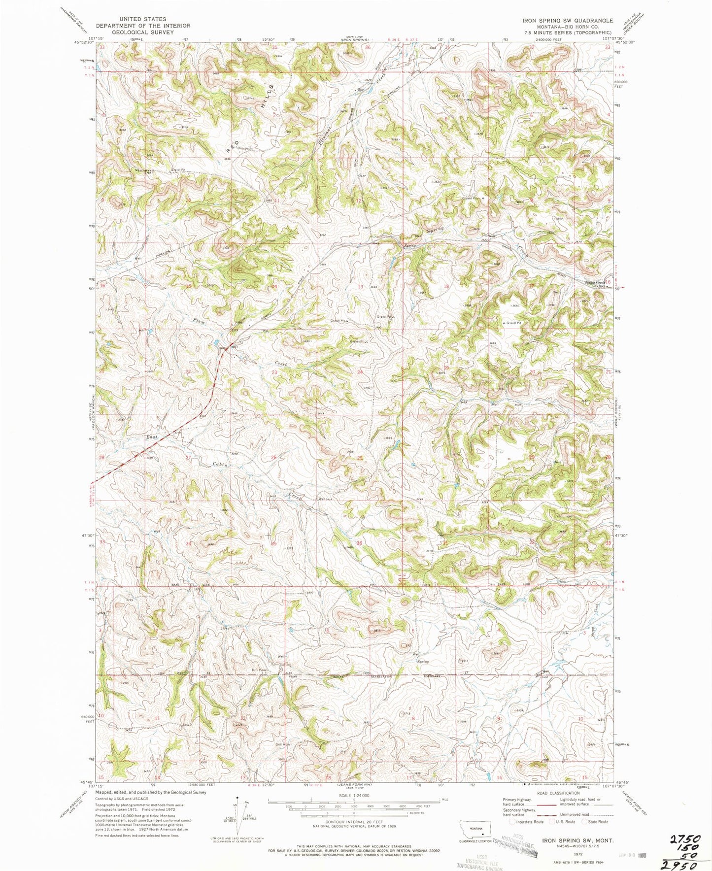
Classic USGS Iron Spring SW Montana 7.5'x7.5' Topo Map
Couldn't load pickup availability
Historical USGS topographic quad map of Iron Spring SW in the state of Montana. Map scale may vary for some years, but is generally around 1:24,000. Print size is approximately 24" x 27"
This quadrangle is in the following counties: Big Horn.
The map contains contour lines, roads, rivers, towns, and lakes. Printed on high-quality waterproof paper with UV fade-resistant inks, and shipped rolled.
Contains the following named places: 01N36E01ABCD01 Spring, 01N36E01BACA01 Well, 01N36E01BADD01 Spring, 01N36E01DCBD01 Spring, 01N36E14CCCA01 Well, 01N36E14CCDA01 Well, 01N36E22AADA01 Well, 01N36E23BABA01 Well, 01N36E25CCCC01 Well, 01N36E36CABA01 Well, 01N37E06ACAD01 Well, 01N37E07CCAA01 Spring, 01N37E07DBAC01 Spring, 01N37E08CCAD01 Well, 01N37E08CCCC01 Well, 01N37E13CCAD01 Spring, 01N37E18AABA01 Well, 01N37E18ACDA01 Spring, 01N37E18BABC01 Well, 01N37E18BBBB01 Spring, 01N37E19CDDA01 Spring, 01N37E20ABCB01 Well, 01N37E20BADC01 Spring, 01N37E20BDAC01 Spring, 01N37E20CCBC01 Well, 01N37E29DABB01 Well, 01N37E32BCDA01 Spring, 01N37E32DDCC01 Well, 01S36E01BDCD01 Well, 01S36E02DDCD01 Well, 01S37E03AABD01 Well, 01S37E03CCCC01 Well, 01S37E04ADDD01 Well, 01S37E04BDAB01 Well, 01S37E05DBCD01 Well, 01S37E06CCBB01 Well, 01S37E08CBDA01 Well, 02N36E36DDAC01 Spring, 02N37E31CBCD01 Well, 02N37E31CBDB01 Well, 02N37E31CCCB01 Well, Maschetah Post Office, Maschetah School, Spring Creek School