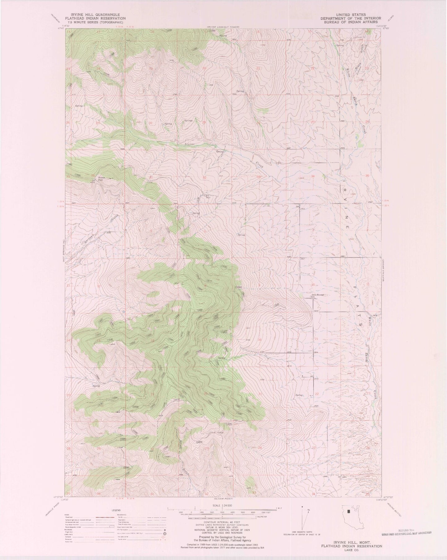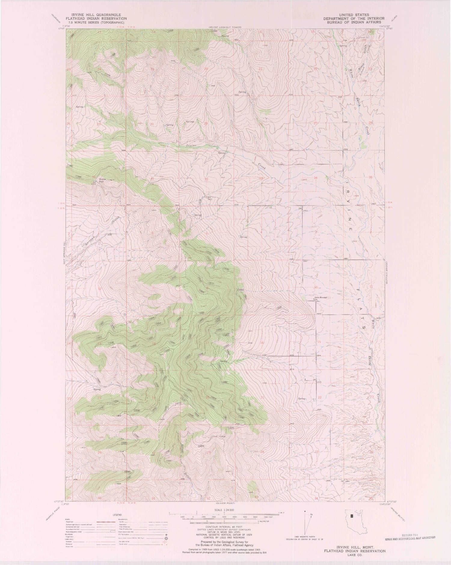
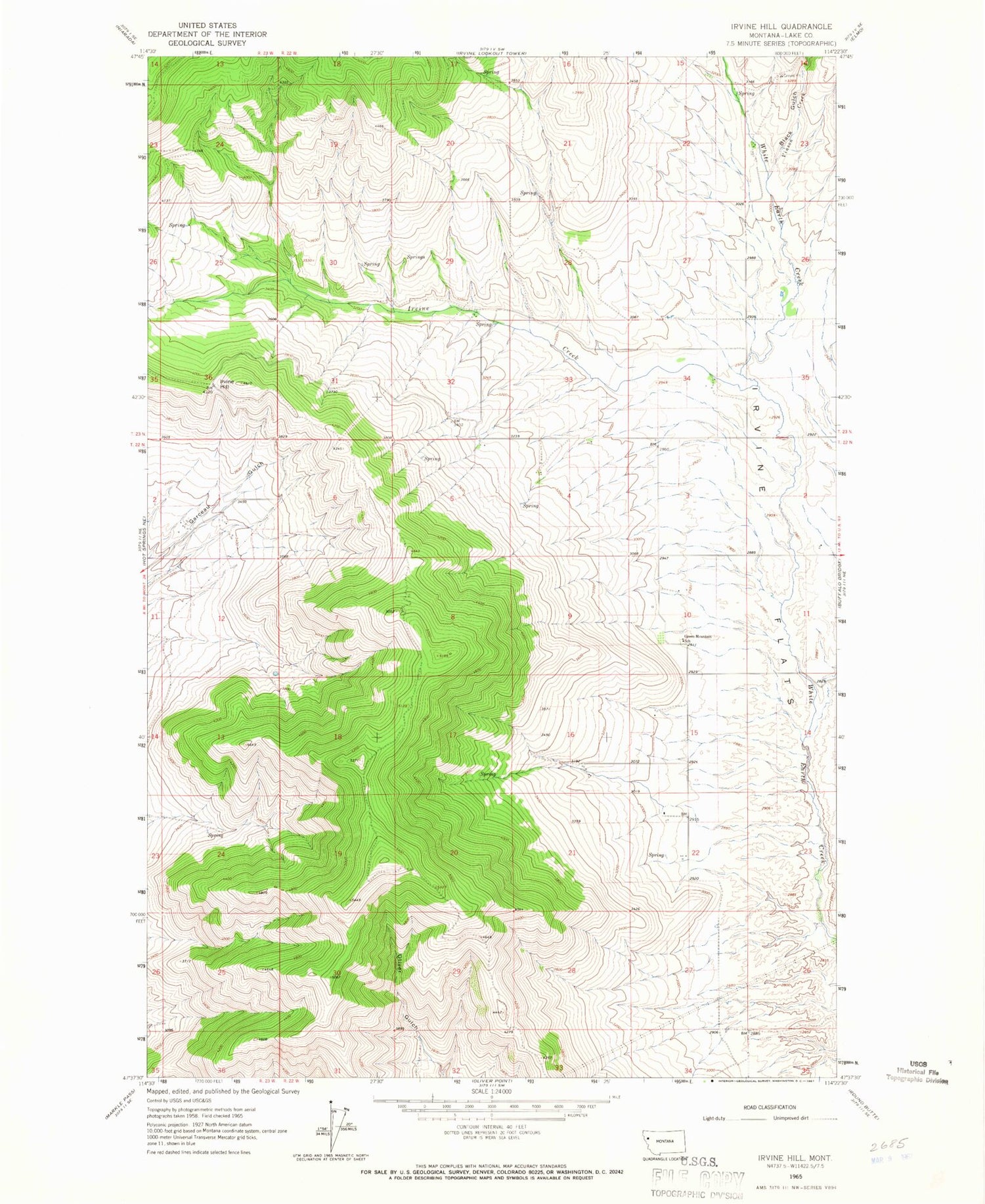
MyTopo
Classic USGS Irvine Hill Montana 7.5'x7.5' Topo Map
Regular price
$16.95
Regular price
Sale price
$16.95
Unit price
per
Couldn't load pickup availability
Historical USGS topographic quad map of Irvine Hill in the state of Montana. Map scale may vary for some years, but is generally around 1:24,000. Print size is approximately 24" x 27"
This quadrangle is in the following counties: Lake.
The map contains contour lines, roads, rivers, towns, and lakes. Printed on high-quality waterproof paper with UV fade-resistant inks, and shipped rolled.
Contains the following named places: 22N19W32BCAD01 Well, 22N22W02DCD_01 Well, 22N22W04ABA_01 Well, 22N22W22BABC01 Well, 23N22W26BDCC01 Well, 23N22W35CDB_01 Well, 24N22W30BCAC01 Well, Black Gulch, Green Mountain School, Irvine Creek, Irvine Flats, Irvine Hill, Vinson Creek