MyTopo
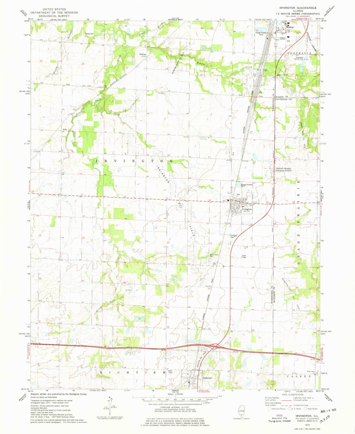
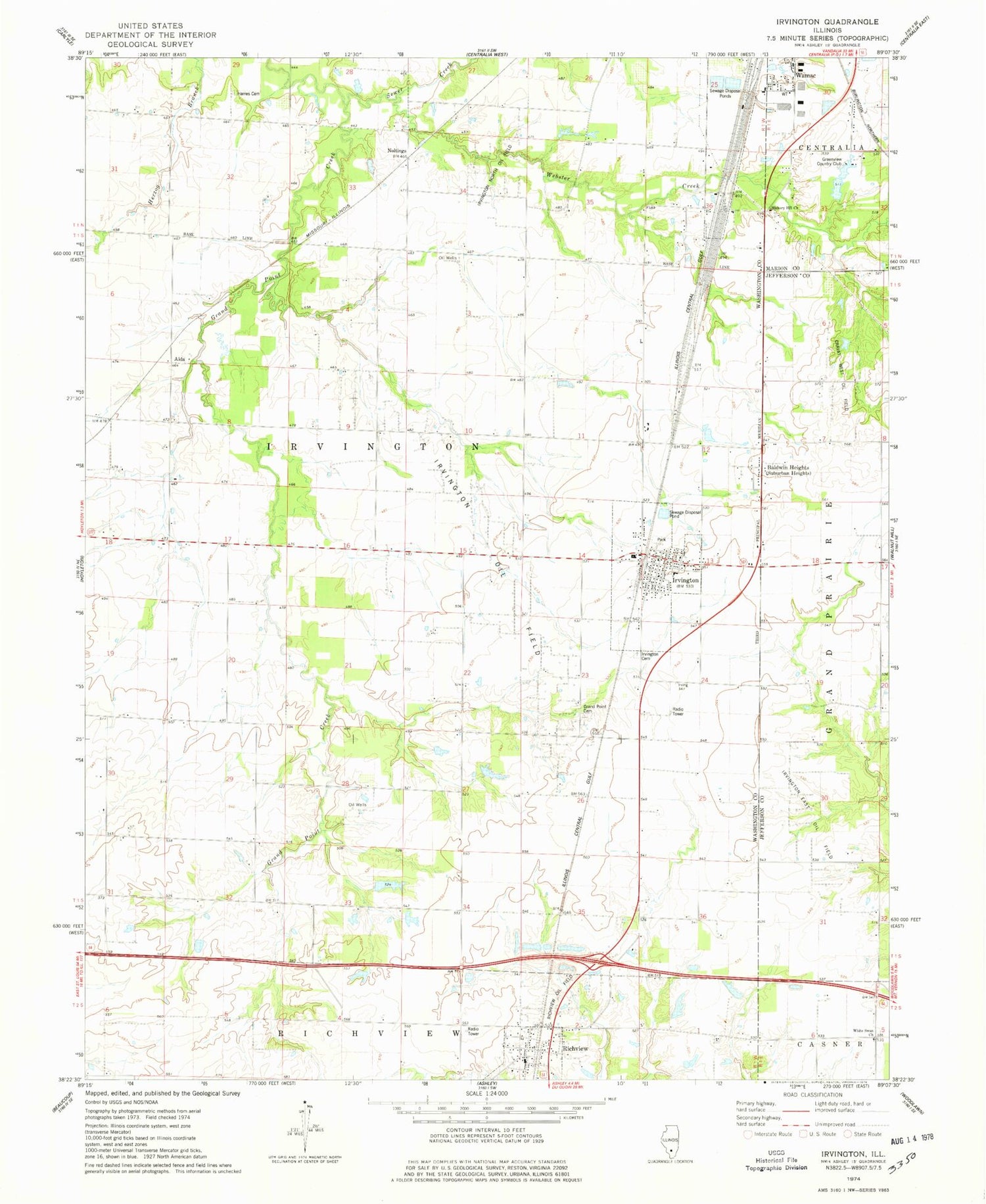
Classic USGS Irvington Illinois 7.5'x7.5' Topo Map
Couldn't load pickup availability
Historical USGS topographic quad map of Irvington in the state of Illinois. Map scale may vary for some years, but is generally around 1:24,000. Print size is approximately 24" x 27"
This quadrangle is in the following counties: Jefferson, Marion, Washington.
The map contains contour lines, roads, rivers, towns, and lakes. Printed on high-quality waterproof paper with UV fade-resistant inks, and shipped rolled.
Contains the following named places: Alda, Atherton School, Baldridge School, Baldwin Heights, Bend School, Breeze School, Centralia Industrial Park, City of Wamac, Clay Hill School, Clover Hill School, Cravat West Oil Field, Fulton School, Grand Point Cemetery, Grand Point Church, Grand Point Creek, Grand Point School, Greenview Country Club, Greenview Country Club Pond One, Greenview Country Club Pond One Dam, Harres Cemetery, Hewette School, Hickory Hill Church, Irvington, Irvington Cemetery, Irvington East Oil Field, Irvington Elementary School, Irvington Fire Protection District, Irvington North Oil Field, Irvington Oil Field, Irvington Police Department, Irvington Post Office, Johnson School, Maple Grove Church, Noltings, Prairie Airport, Richview, Richview Missionary Baptist Church, Richview Oil Field, Richview Post Office, Sewer Creek, Taylor School, Township of Irvington, Village of Irvington, Village of Richview, Webster Creek, White School, White Swan Church, Whittenberg School, ZIP Codes: 62848, 62877