
MyTopo
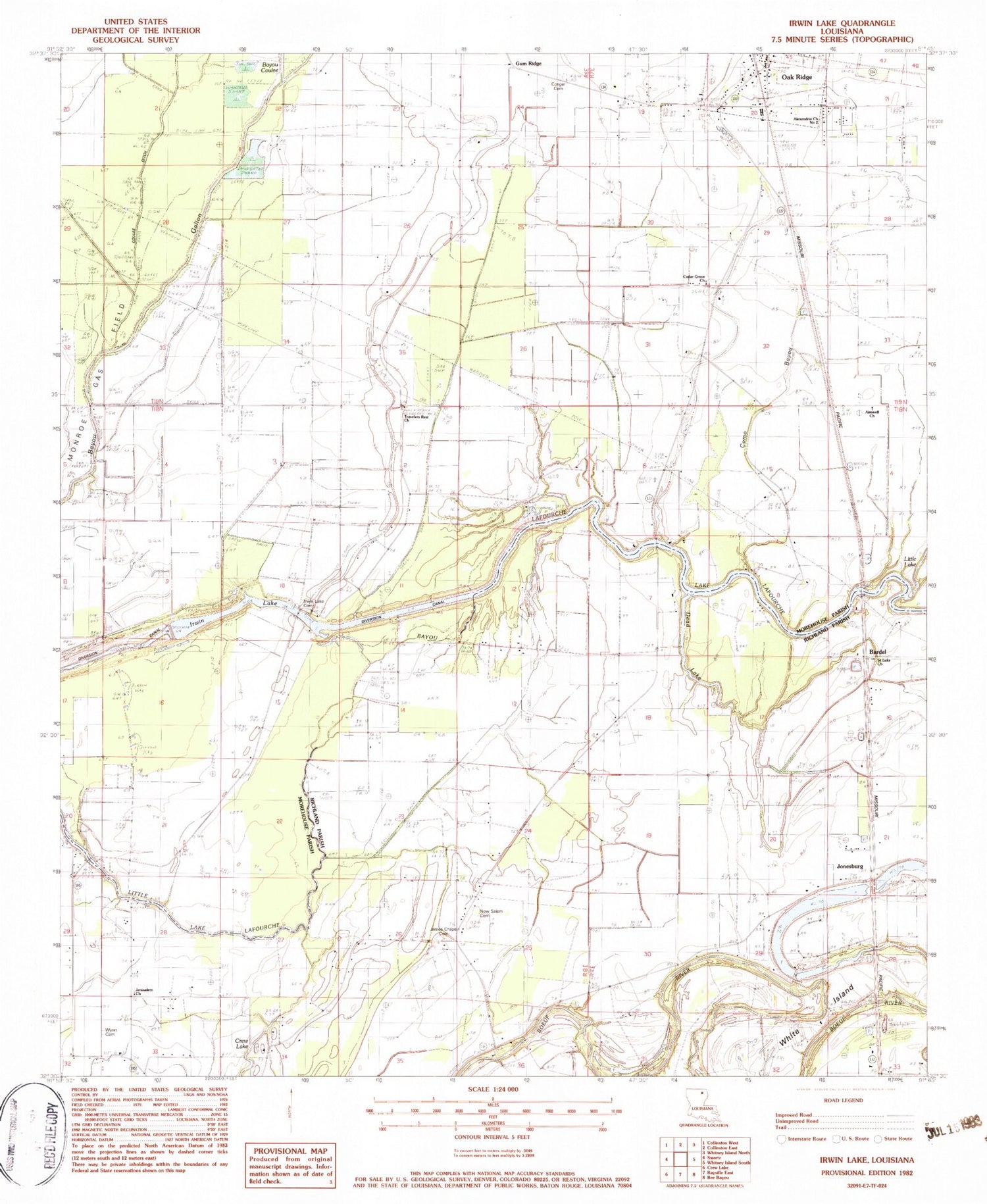
Classic USGS Irwin Lake Louisiana 7.5'x7.5' Topo Map
Couldn't load pickup availability
Historical USGS topographic quad map of Irwin Lake in the state of Louisiana. Map scale may vary for some years, but is generally around 1:24,000. Print size is approximately 24" x 27"
This quadrangle is in the following counties: Morehouse, Richland.
The map contains contour lines, roads, rivers, towns, and lakes. Printed on high-quality waterproof paper with UV fade-resistant inks, and shipped rolled.
Contains the following named places: Aimwell Church, Alexandria Church Number 2, Alligator Bayou, Bardel, Battle Chapel, Bayou Coulee, Bordenax, Carter School, Cedar Grove Church, Cedar Grove School, Como Bayou, Conger Cemetery, Cooks Slough, Dead Lake, Easons Ferry, Irwin Lake, Irwin Lake Cemetery, James Chapel Cemetery, Jerusalem Church, Jones Ferry, Jonesburg, Little Lake Lafourche, Lorrlas Ferry, New Salem Cemetery, New Salem Church, Oak Ridge, Oak Ridge Volunteer Fire Department, Ridges Island, Saint Luke Church, Smith Bridge, Smith Plantation, Travelers Rest Church, Village of Oak Ridge, White Island, Wynn Cemetery, ZIP Code: 71264


