
MyTopo
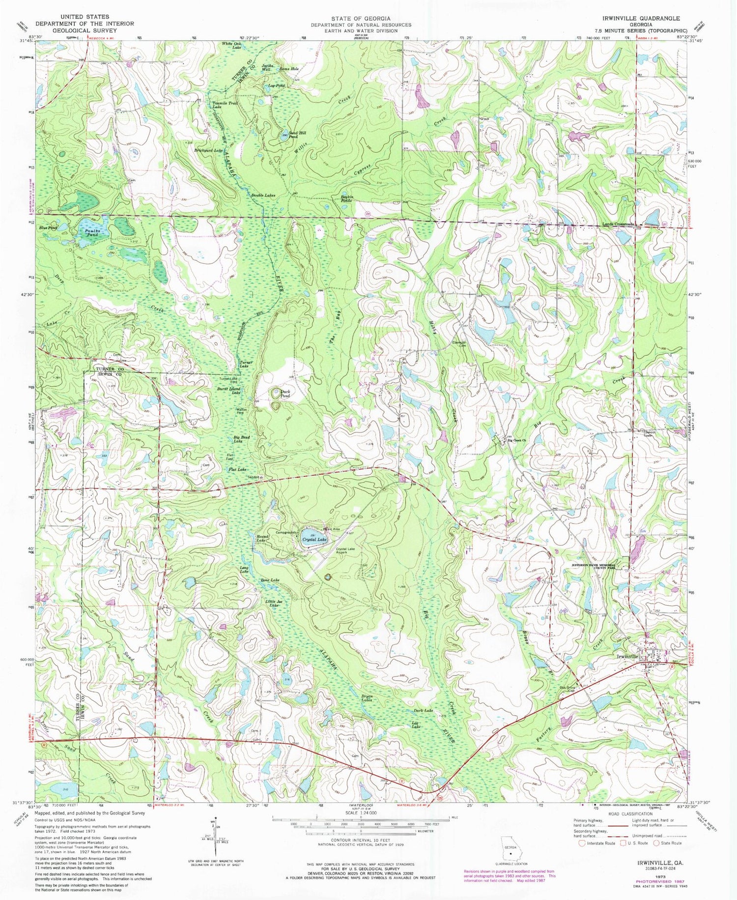
Classic USGS Irwinville Georgia 7.5'x7.5' Topo Map
Couldn't load pickup availability
Historical USGS topographic quad map of Irwinville in the state of Georgia. Map scale may vary for some years, but is generally around 1:24,000. Print size is approximately 24" x 27"
This quadrangle is in the following counties: Irwin, Turner.
The map contains contour lines, roads, rivers, towns, and lakes. Printed on high-quality waterproof paper with UV fade-resistant inks, and shipped rolled.
Contains the following named places: Avery Cemetery, Big Bend Lake, Big Creek, Big Creek Church, Big Creek Missionary Baptist Church Cemetery, Blue Pond, Boggy Branch, Bone Lake, Bowen Lake, Bowen Lake Dam, Boykin Ponds, Brickyard Lake, Brown Lake, Brown Lake Dam, Bryan Lakes, Burnt Island Lake, Clements Lake, Clements Lake Dam, Coleman Cemetery, Coleman Pond, Crystal Lake, Crystal Lake Airpark, Cypress Creek, Dark Lake, Deep Creek, Double Lakes, Duck Pond, Ebenezer Cemetery, Factory Creek, Flat Ford, Flat Lake, Fletcher Lake, Fletcher Lake Dam, Fuller Lake, Fuller Lake Dam, Hobby Creek, Irwinville, Irwinville Cemetery, Irwinville Division, Irwinville Post Office, Irwinville Volunteer Fire Department, Jacobs Well, Jefferson Davis Memorial State Park, Lake Creek, Land Lake, Land Lake Dam, Lands Crossroads, Little Joe Lake, Log Lake, Log Pond, Long Lake, McIntyre Lake, McIntyre Lake Dam, Oak Grove Cemetery, Oneal Wynn Lake, Oneal Wynn Lake Dam, Paulks Pond, Roberts Lake, Roberts Lake Dam, Ross Lake, Round Lake, Sams Hole, Sand Hill Pond, Stripling Lake, Stripling Lake Dam, Tenmile Trail Lake, The Bay, Turner Lake, Turner Lake Ford, United Pentecostal Church, Walker Ford, Walker Lake, Walker Lake Dam, White Oak Lake, Willis Creek


