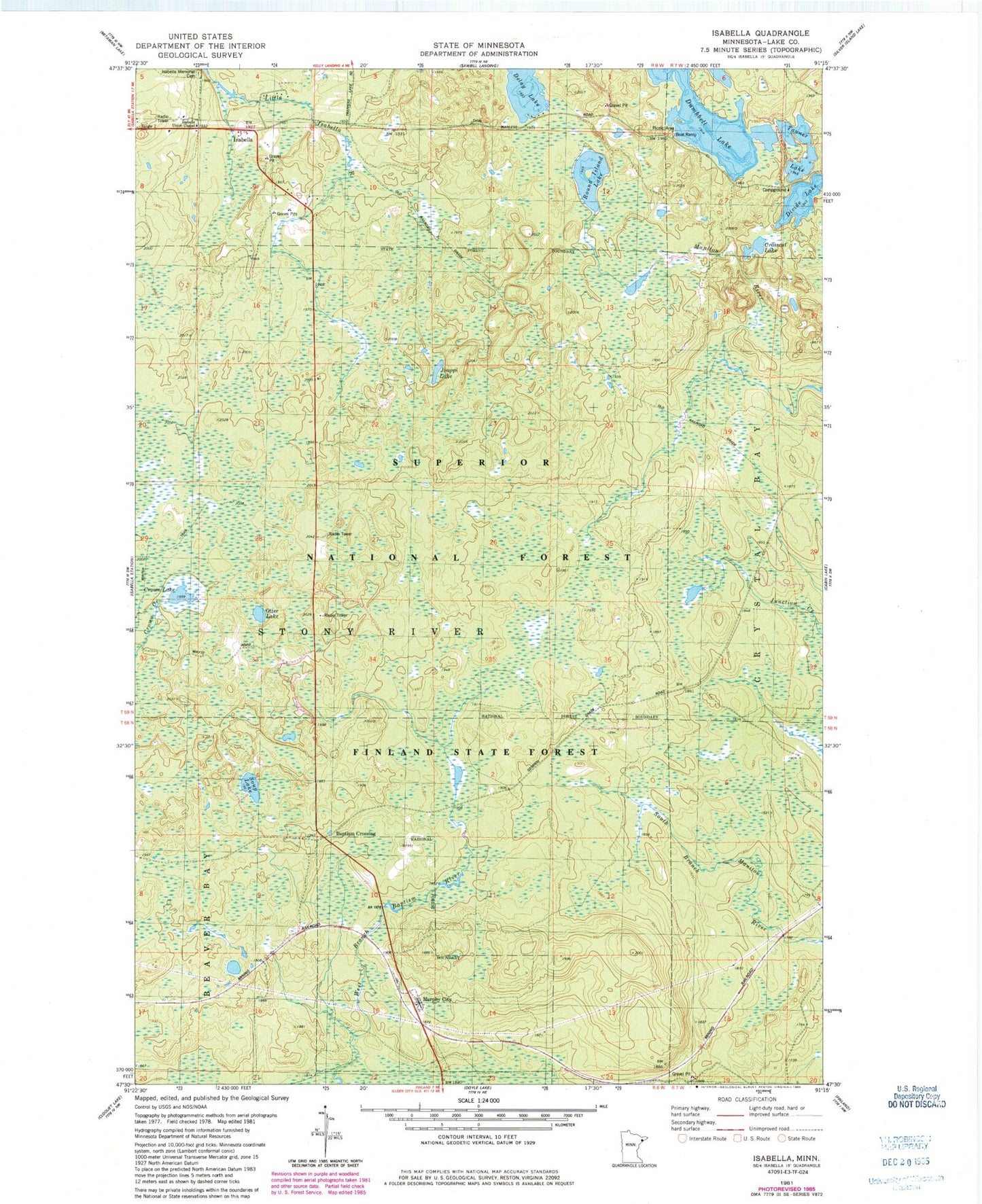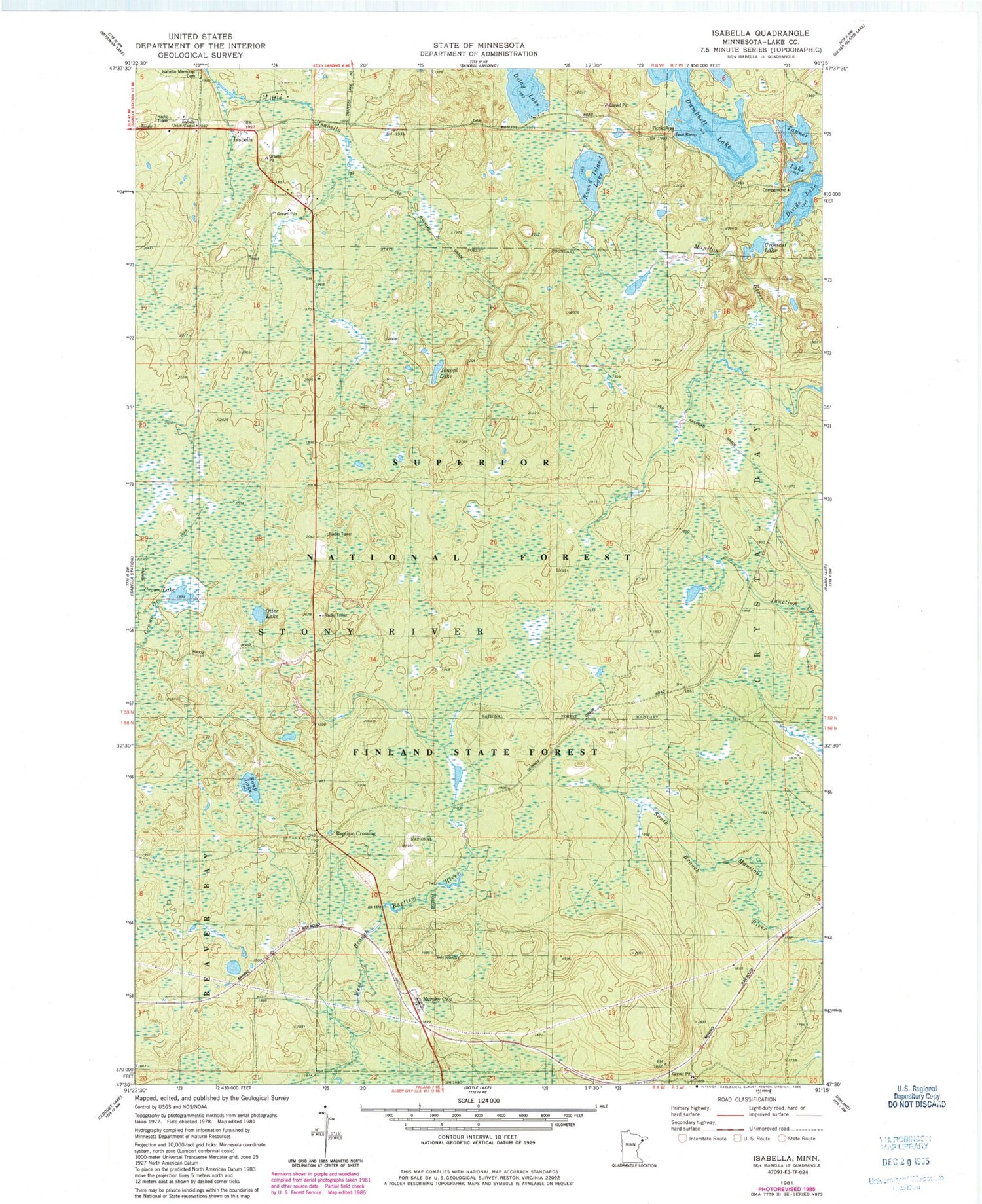
MyTopo
Classic USGS Isabella Minnesota 7.5'x7.5' Topo Map
Couldn't load pickup availability
Historical USGS topographic quad map of Isabella in the state of Minnesota. Map scale may vary for some years, but is generally around 1:24,000. Print size is approximately 24" x 27"
This quadrangle is in the following counties: Lake.
The map contains contour lines, roads, rivers, towns, and lakes. Printed on high-quality waterproof paper with UV fade-resistant inks, and shipped rolled.
Contains the following named places: Baptism Crossing, Crosscut Lake, Crown Lake, Delay Lake, Divide Lake, Divide Lake Campground, Dumbbell Lake, Dumbell Lake Picnic Area, Isabella, Isabella Memorial Cemetery, Isabella Post Office, Isabella School, Isabella Union Chapel, Jouppi Lake, Manitou Junction, Murphy City, Otter Lake, Round Island Lake, Soap Lake, Tanner Lake, ZIP Code: 55603