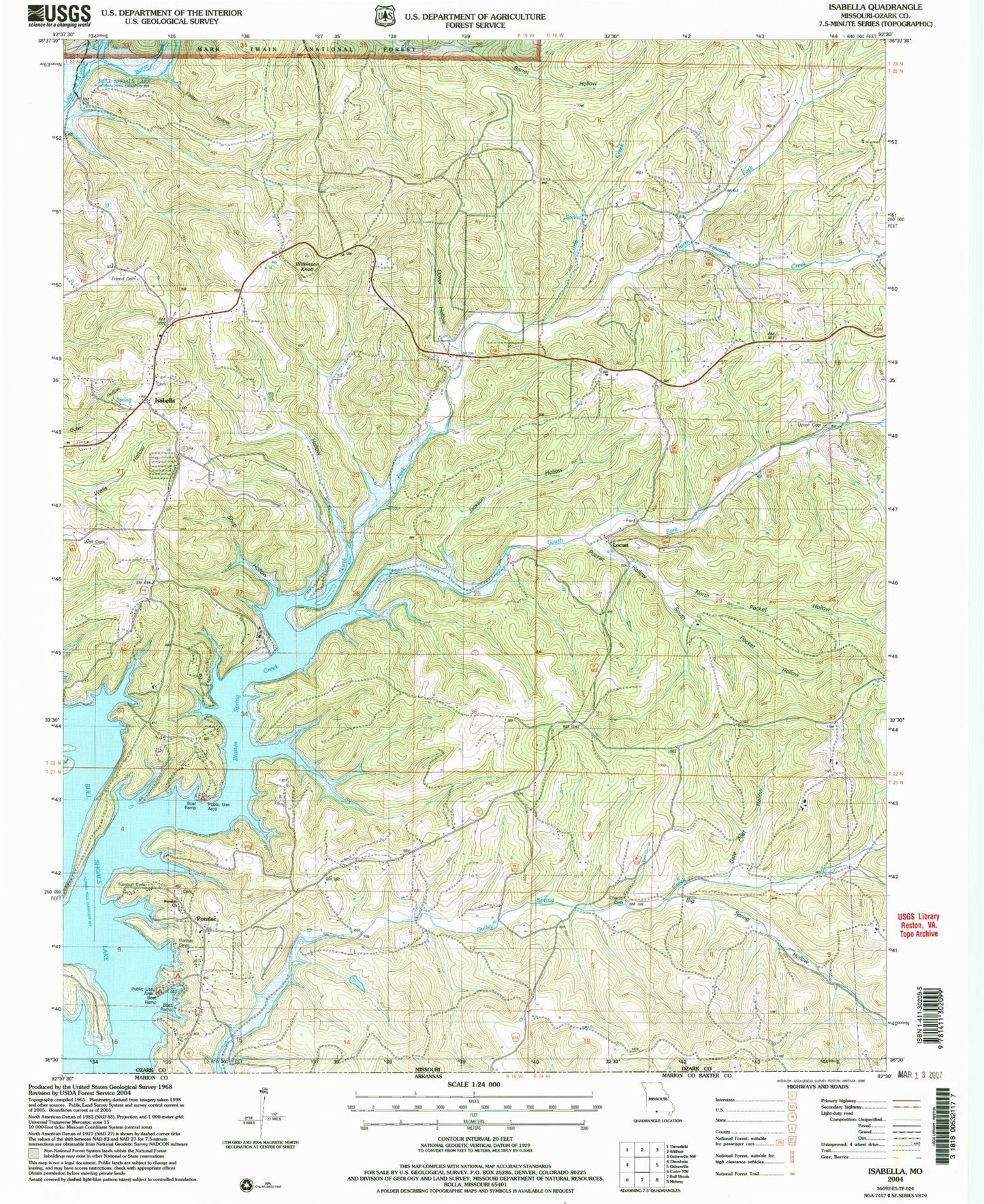
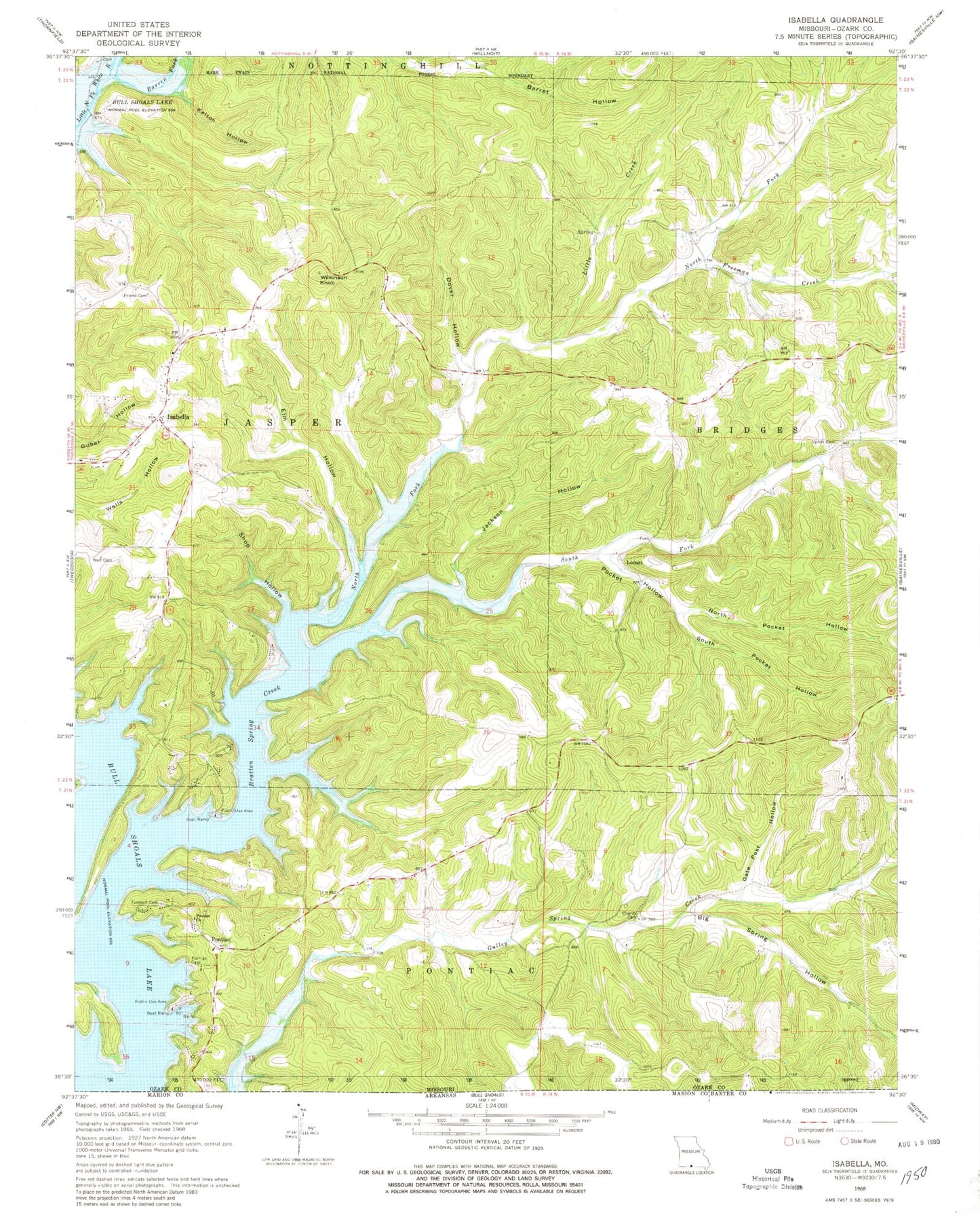
MyTopo
Classic USGS Isabella Missouri 7.5'x7.5' Topo Map
Couldn't load pickup availability
Historical USGS topographic quad map of Isabella in the state of Missouri. Map scale may vary for some years, but is generally around 1:24,000. Print size is approximately 24" x 27"
This quadrangle is in the following counties: Ozark.
The map contains contour lines, roads, rivers, towns, and lakes. Printed on high-quality waterproof paper with UV fade-resistant inks, and shipped rolled.
Contains the following named places: Barren Fork, Big Spring Hollow, Bratten Spring Creek, Burse Ford, Charity Cemetery, Charity School, Dillia, Dover Hollow, Elm Hollow, Freeman Creek, Friend Cemetery, Gate Post Hollow, Idumea School, Isabella, Isabella Cemetery, Isabella Post Office, Isabella Volunteer Fire Station, Jackson Hollow, Kelton Hollow, Little Creek, Locust, Locust School, Nave Ford, North Fork Bratten Spring Creek, North Pocket Hollow, Pleasant Grove School, Pocket Hollow, Pontiac, Pontiac - Price Place Volunteer Fire Department, Pontiac Census Designated Place, Pontiac Church, Pontiac Public Use Area, Shop Hollow, South Fork Bratten Spring Creek, South Pocket Hollow, Spring Creek Public Use Area, Timber Knob Volunteer Fire Department, Township of Jasper, Township of Pontiac, Turnbull Cemetery, Upton Cemetery, Wilkinson Knob, Wolf Cemetery, ZIP Codes: 65676, 65729