MyTopo
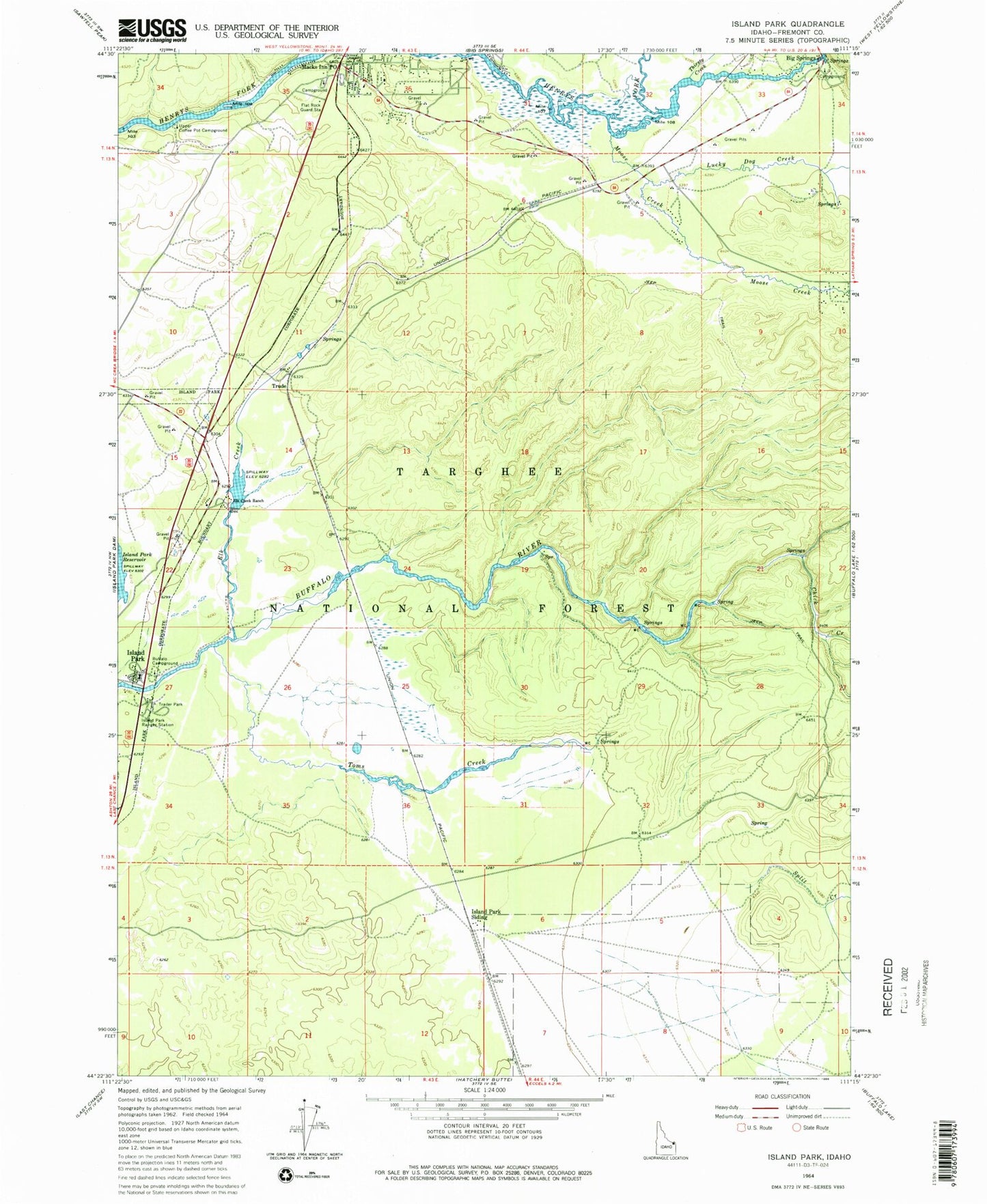
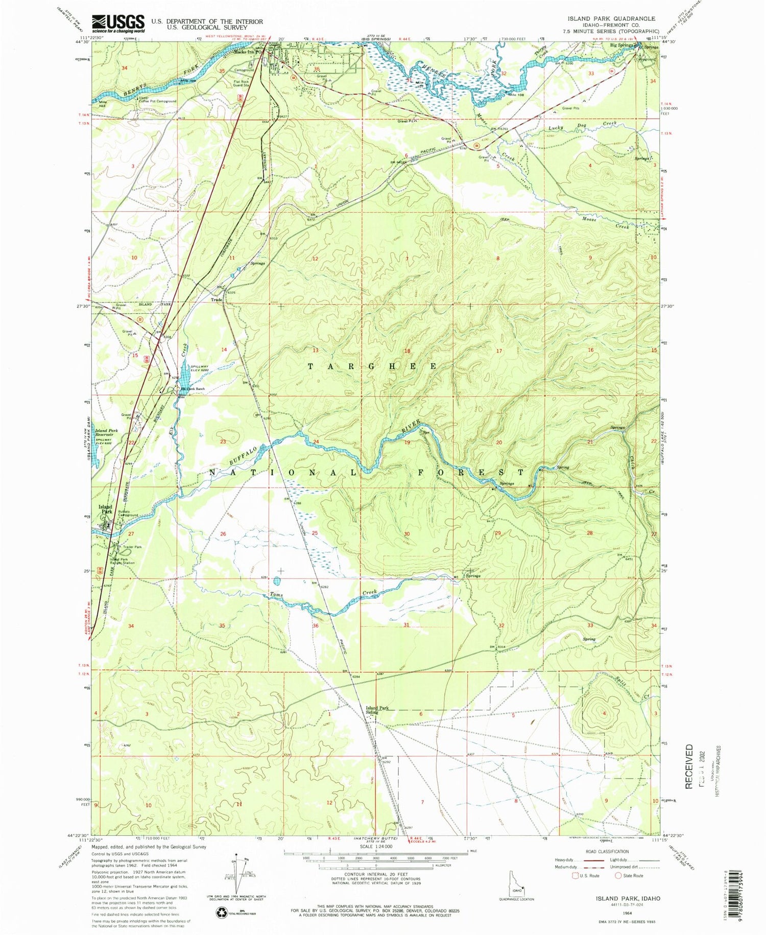
Classic USGS Island Park Idaho 7.5'x7.5' Topo Map
Couldn't load pickup availability
Historical USGS topographic quad map of Island Park in the state of Idaho. Map scale may vary for some years, but is generally around 1:24,000. Print size is approximately 24" x 27"
This quadrangle is in the following counties: Fremont.
The map contains contour lines, roads, rivers, towns, and lakes. Printed on high-quality waterproof paper with UV fade-resistant inks, and shipped rolled.
Contains the following named places: Big Springs, Big Springs Post Office, Buffalo Campground, Buffalo River Access Area, Chick Creek, City of Island Park, Elk Creek, Elk Creek Ranch, Flat Rock Guard Station, Henrys Lake Outlet, Island Park, Island Park Fire Department Station 1, Island Park Post Office, Island Park Ranger Station, Island Park Siding, Lucky Dog Creek, Macks Inn Post Office, Moose Creek, Split Creek, Thirsty Creek, Toms Creek, Trude, Trude Junction, Trude Post Office, Upper Coffee Pot Campground, ZIP Code: 83433