
MyTopo
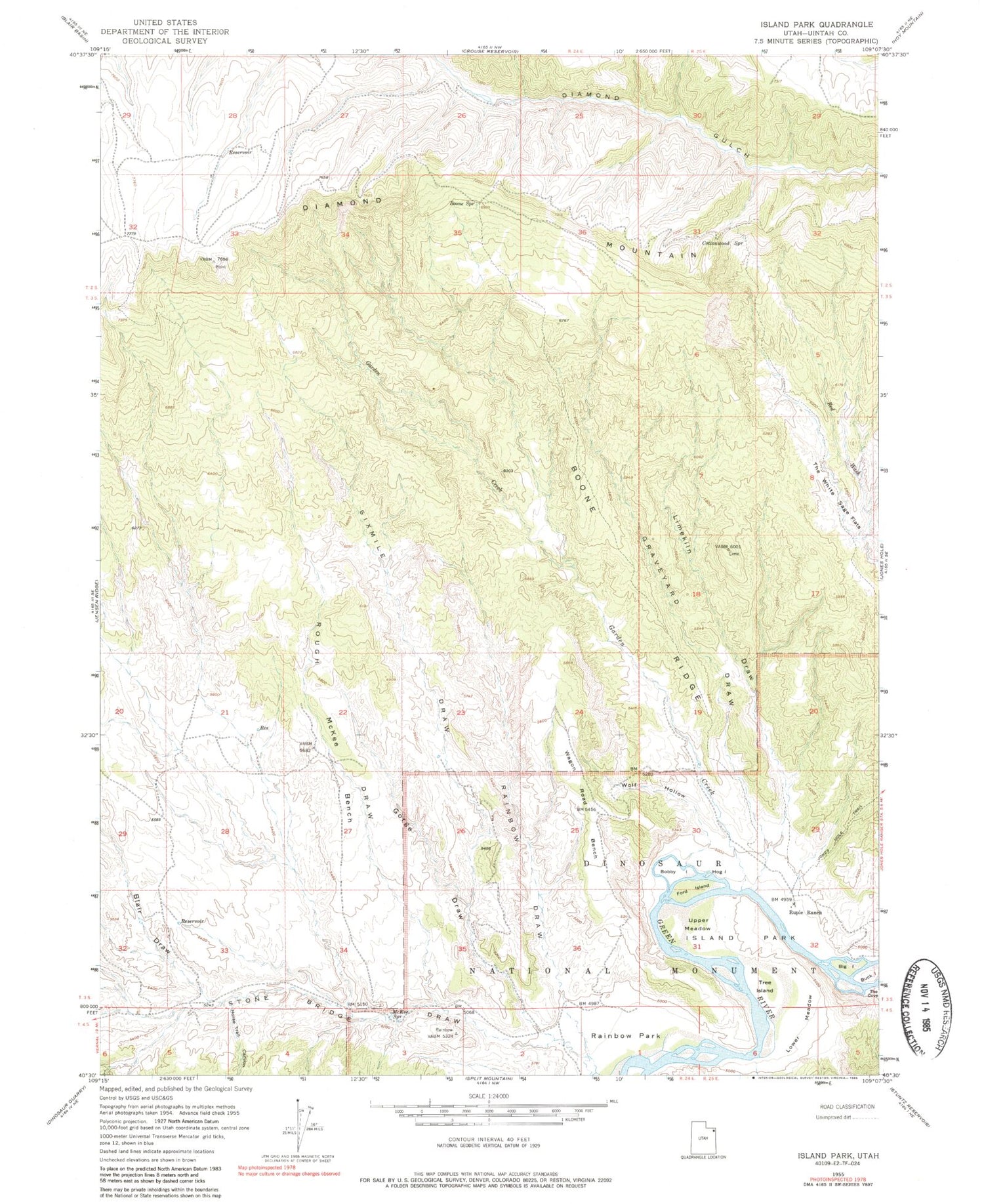
Classic USGS Island Park Utah 7.5'x7.5' Topo Map
Couldn't load pickup availability
Historical USGS topographic quad map of Island Park in the state of Utah. Map scale may vary for some years, but is generally around 1:24,000. Print size is approximately 24" x 27"
This quadrangle is in the following counties: Uintah.
The map contains contour lines, roads, rivers, towns, and lakes. Printed on high-quality waterproof paper with UV fade-resistant inks, and shipped rolled.
Contains the following named places: Big Island, Blair Draw, Bobby Island, Boone Ridge, Boone Spring, Buck Island, Cottonwood Spring, Diamond Mountain, Ford Island, Garden Creek, Gorge Draw, Graveyard Draw, Hog Island, Horse Trail Canyon, Island Park, Island Park Boat Launch Area, Limekiln Draw, Lower Meadow, McKee Bench, McKee Spring, Mount Hawkins, Rainbow Draw, Rainbow Park, Rough Draw, Ruple Ranch, Sixmile Draw, Stone Bridge Draw, Tree Island, Upper Meadow, Wagon Road Bench, Wolf Hollow


