MyTopo
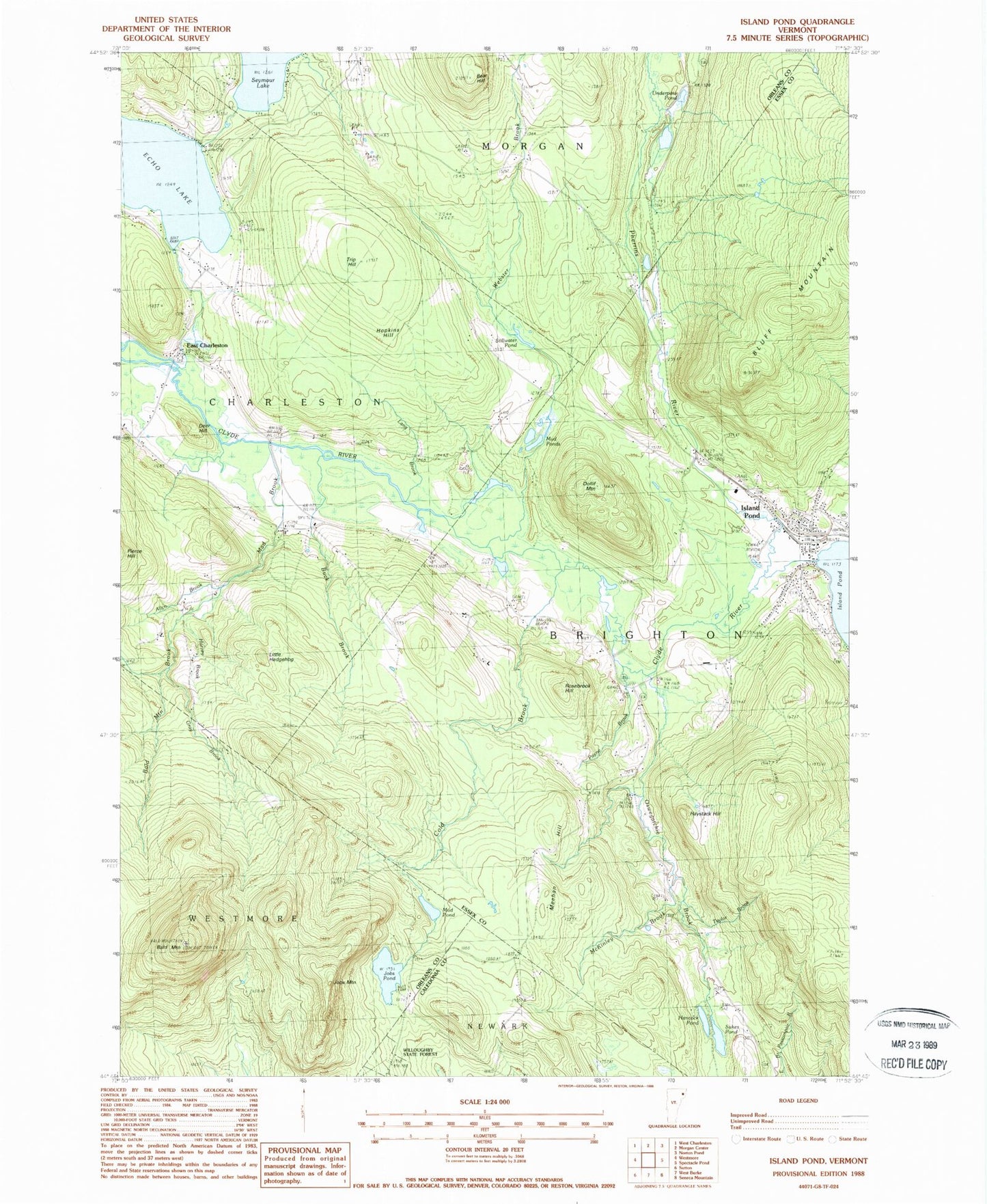
Classic USGS Island Pond Vermont 7.5'x7.5' Topo Map
Couldn't load pickup availability
Historical USGS topographic quad map of Island Pond in the state of Vermont. Typical map scale is 1:24,000, but may vary for certain years, if available. Print size: 24" x 27"
This quadrangle is in the following counties: Caledonia, Essex, Orleans.
The map contains contour lines, roads, rivers, towns, and lakes. Printed on high-quality waterproof paper with UV fade-resistant inks, and shipped rolled.
Contains the following named places: Allyn Brook, Bald Mountain, Bald Mountain Brook, Bear Hill, Buck Brook, Buck School, Cargill Cemetery, Cold Brook, Deer Hill, Dolif Mountain, East Charleston, Echo Lake, Gray Brook, Hancock Pond, Harvey Brook, Haystack Hill, Hopkins Hill, Island Pond, Job Mountain, Jobs Pond, Lang Brook, Little Hedgehog, Mad Brook, McKinley Brook, Meehan Hill, Mud Pond, Mud Ponds, Oswegatchie Brook, Payne Brook, Pherrins River, Rosebrook Hill, Stillwater Pond, Sukes Pond, Taylor Brook, Trip Hill, Underpass Pond, Webster Brook, Echo Lake Dam, Seymour Lake Dam, Brigton Baptist Church, Brighton Elementary School, Christ Episcopal Church, The Church of Jesus Christ of Latter Day Saints, Island Pond Fire Station, Island Pond Historic District, Island Pond Post Office, Lakeside Cemetery, New Catholic Cemetery, Old Catholic Cemetery, Old Protestant Cemetery, East Charleston Post Office, Frenchmans Lot, Hillside Cemetery, Morrill Cemetery, Old Buck School (historical), Buck Cemetery, Camp Winape, Charleston Volunteer Fire Department, Brighton Fire Department, Island Pond Census Designated Place, Derby Line Rescue Squad