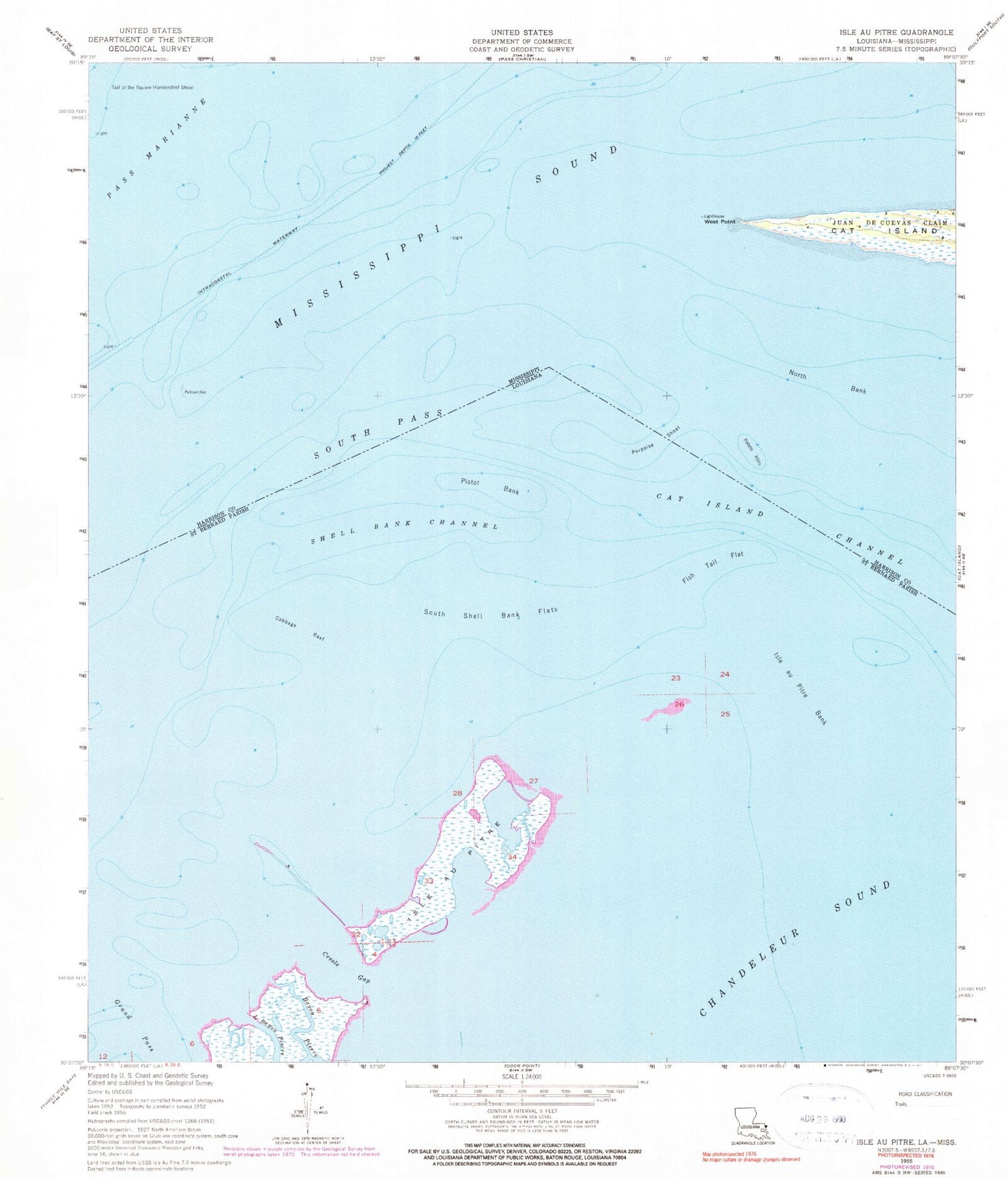
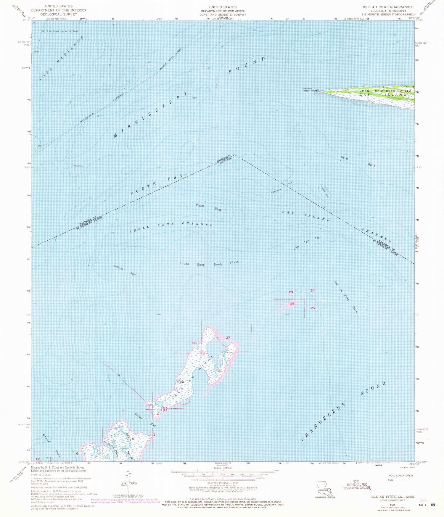
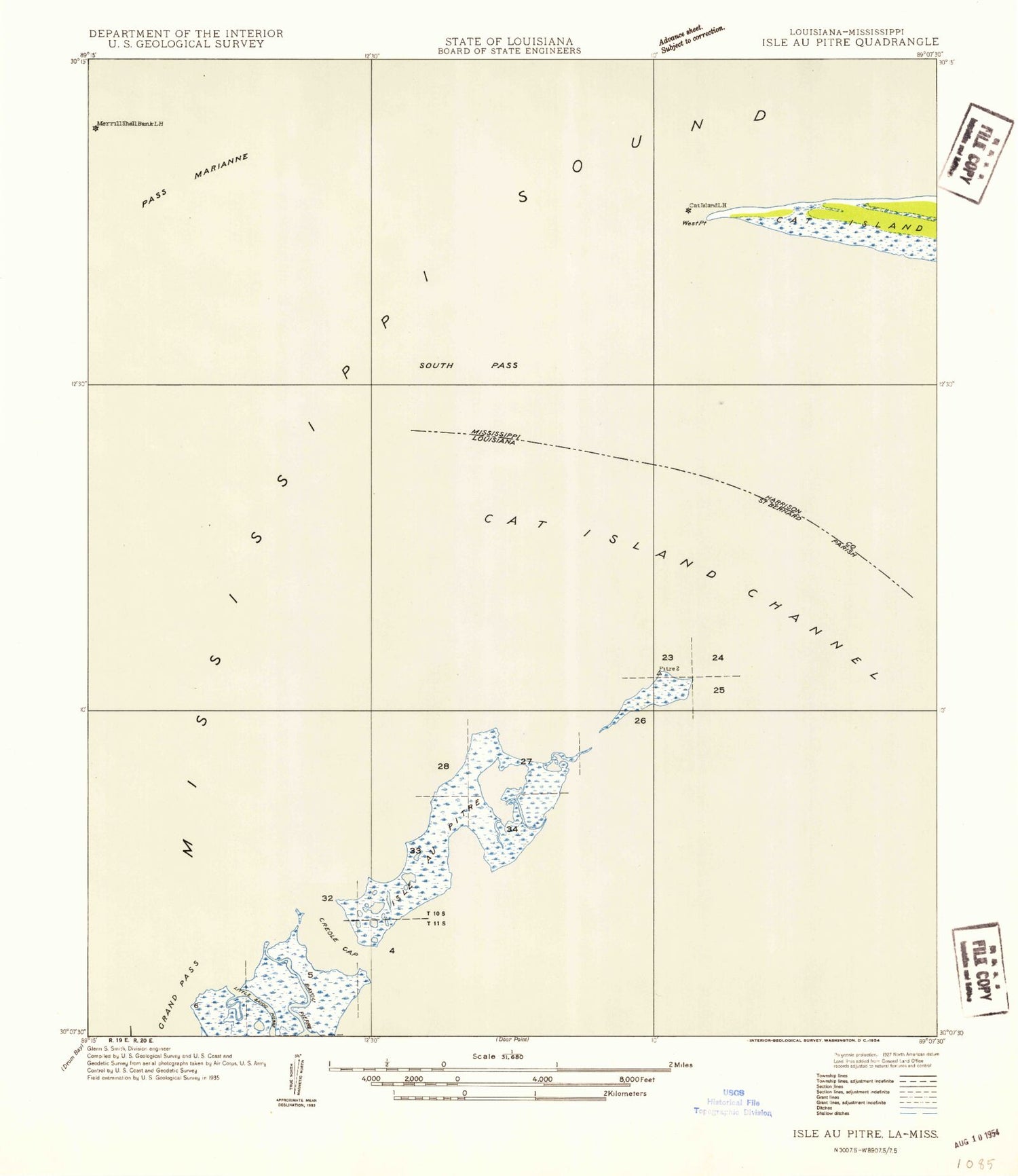
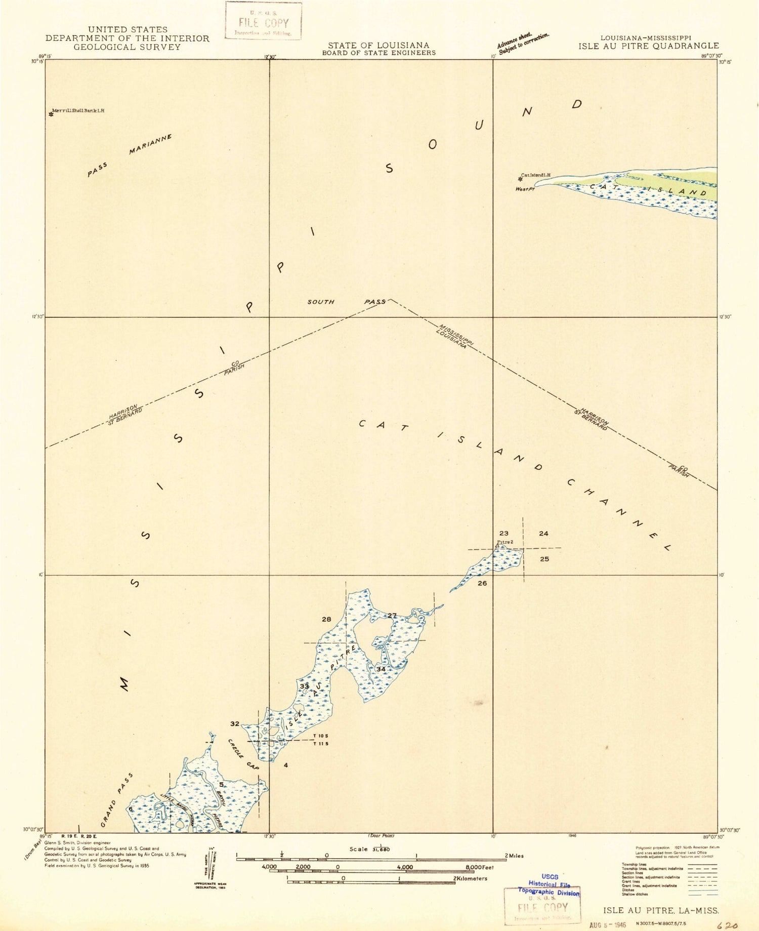
MyTopo
Classic USGS Isle au Pitre Louisiana 7.5'x7.5' Topo Map
Couldn't load pickup availability
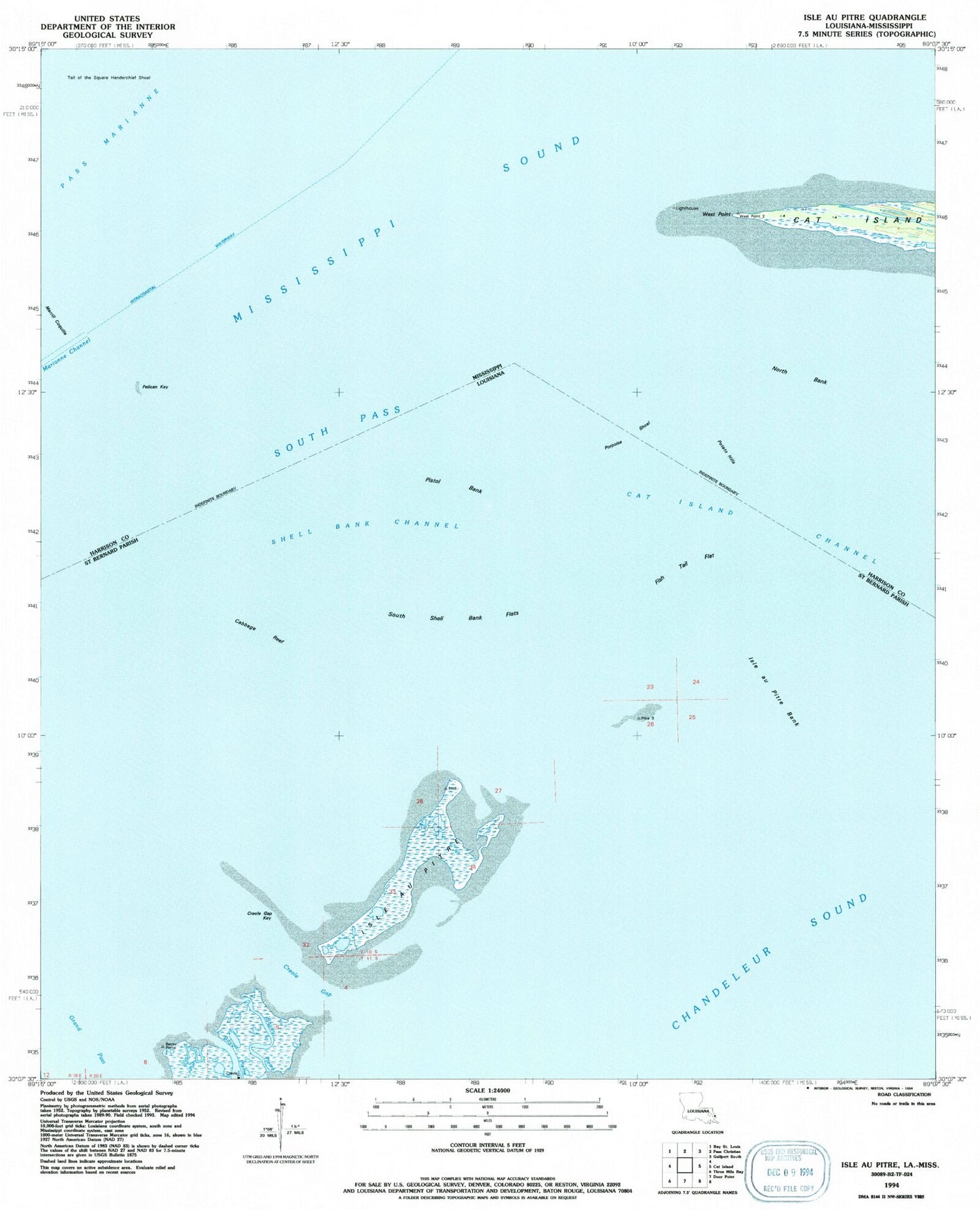
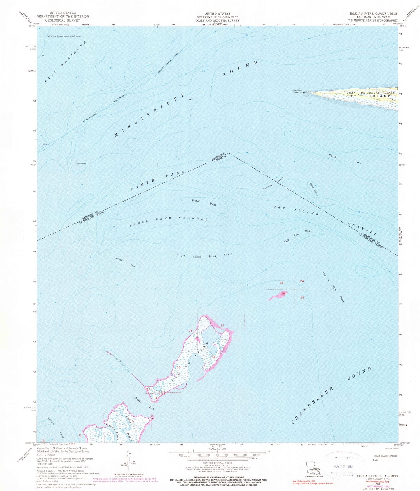
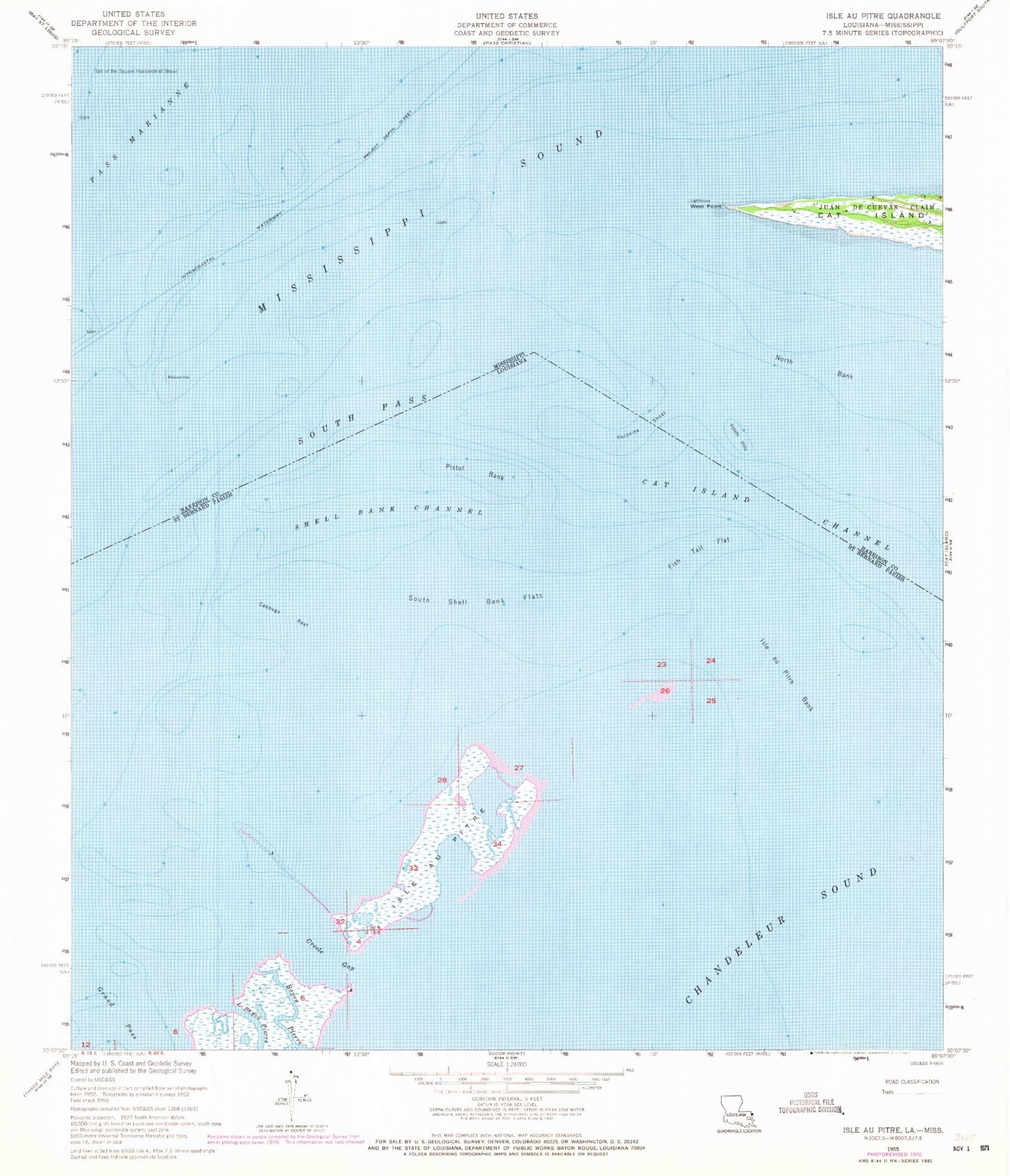
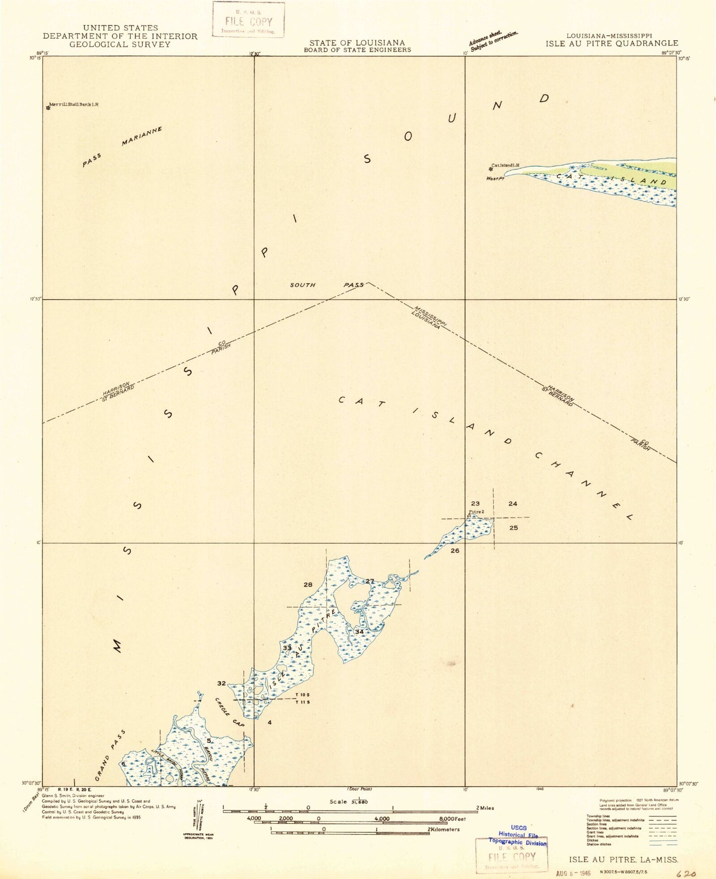
Historical USGS topographic quad map of Isle au Pitre in the states of Louisiana, Mississippi. Map scale may vary for some years, but is generally around 1:24,000. Print size is approximately 24" x 27"
This quadrangle is in the following counties: Harrison, St. Bernard.
The map contains contour lines, roads, rivers, towns, and lakes. Printed on high-quality waterproof paper with UV fade-resistant inks, and shipped rolled.
Contains the following named places: Bayou Pierre, Cabbage Reef, Cat Island Channel, Cat Island Lighthouse, Creole Gap, Creole Gap Key, Fish Tail Flat, Grand Pass, Isle au Pitre, Isle au Pitre Bank, Little Bayou Pierre, Marianne Channel, Merrill Coquille, Merrills Shell Bank Lighthouse, North Bank, Pass Marianne, Pelican Key, Pistol Bank, Porpoise Shoal, Potato Hills, Shell Bank Channel, South Pass, South Shell Bank Flats, Tail of the Square Handkerchief Shoal, West Point