MyTopo
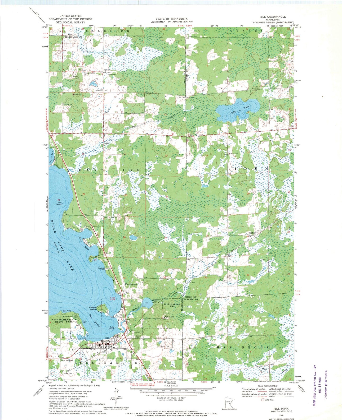
Classic USGS Isle Minnesota 7.5'x7.5' Topo Map
Couldn't load pickup availability
Historical USGS topographic quad map of Isle in the state of Minnesota. Map scale may vary for some years, but is generally around 1:24,000. Print size is approximately 24" x 27"
This quadrangle is in the following counties: Aitkin, Kanabec, Mille Lacs.
The map contains contour lines, roads, rivers, towns, and lakes. Printed on high-quality waterproof paper with UV fade-resistant inks, and shipped rolled.
Contains the following named places: Anderson Lake, Cedar Creek, Cedar Lake, City of Isle, Faith Lutheran Cemetery, Father Hennepin State Park, Holden Cemetery, Holden Church, Isle, Isle Airport, Isle Cemetery, Isle Fire and Rescue Department, Isle Harbor, Isle Police Department, Isle Post Office, Malone Creek, Malone Island, Mille Lacs School, Opstead, Opstead Church, Pete Island, Pine Island, Redtop, Redtop Cemetery, Redtop Post Office, Sacred Heart Cemetery, Township of East Side, Twin Bays