MyTopo
Classic USGS Isney Alabama 7.5'x7.5' Topo Map
Couldn't load pickup availability
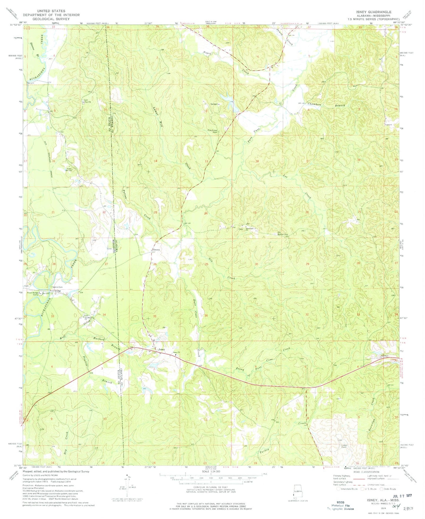
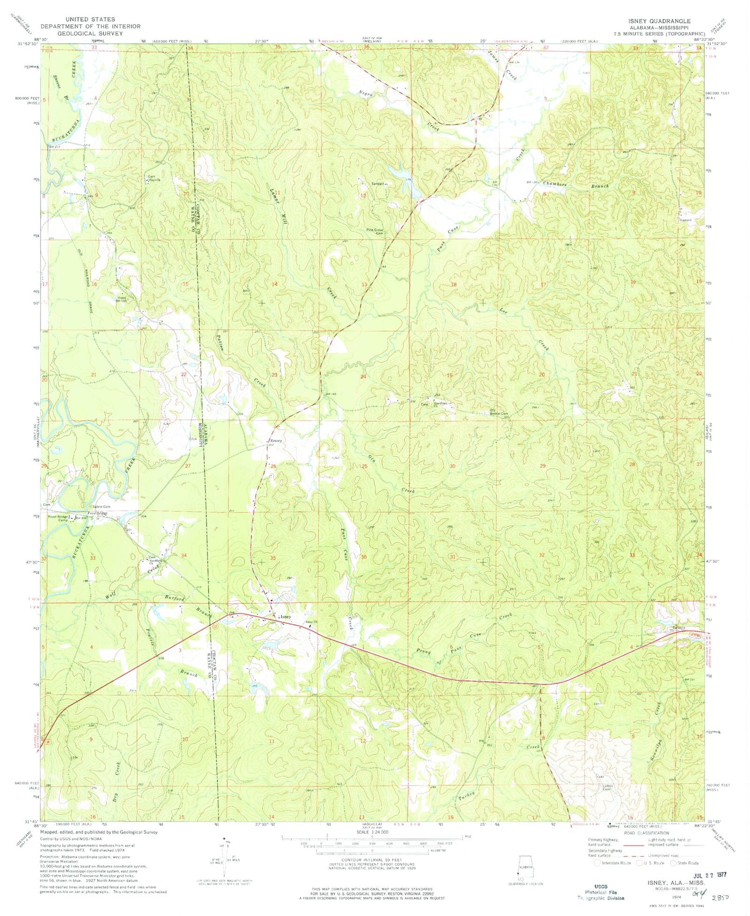
Historical USGS topographic quad map of Isney in the states of Alabama, Mississippi. Map scale may vary for some years, but is generally around 1:24,000. Print size is approximately 24" x 27"
This quadrangle is in the following counties: Choctaw, Wayne.
The map contains contour lines, roads, rivers, towns, and lakes. Printed on high-quality waterproof paper with UV fade-resistant inks, and shipped rolled.
Contains the following named places: Burford Branch, Carroll School, Chambers Branch, Coyt Church, Emory, Frost Bridge, Frost Bridge Camp, Gin Branch, Gin Creek, Gin Creek Baptist Church, Gin Creek Oil Field, Isney, Isney Baptist Church, James Creek, John Green Dam, John Green Pond, Lamar Mill Creek, Lee Creek, Loften Cemetery, Negro Creek, Old Bethel Cemetery, Old Shady Grove Cemetery, Patton Creek, Pine Grove Cemetery, Prairie Branch, Prong Puss Cuss Creek, Puss Cuss Creek Oil Field, Salem Cemetery, Sanderson Pond Dam, Sandfield Church, Silas Oil Field, Souwilpa Creek Gas Field, Stevens Branch, Tabernacle Church, Wayne County Volunteer Fire Department Coyt Station, West Point Church, ZIP Code: 36908