MyTopo
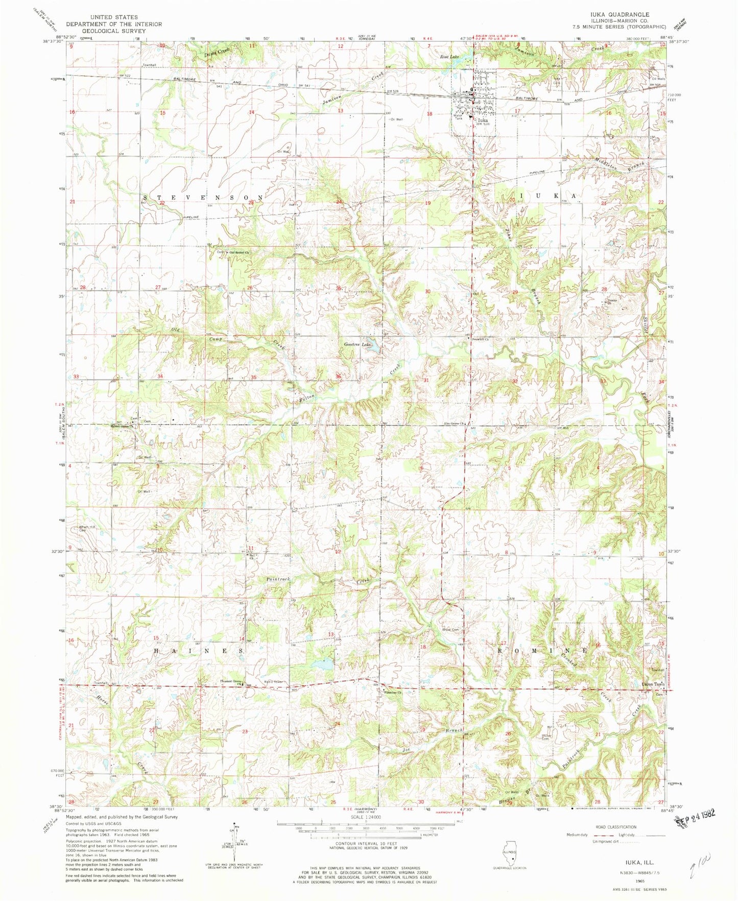
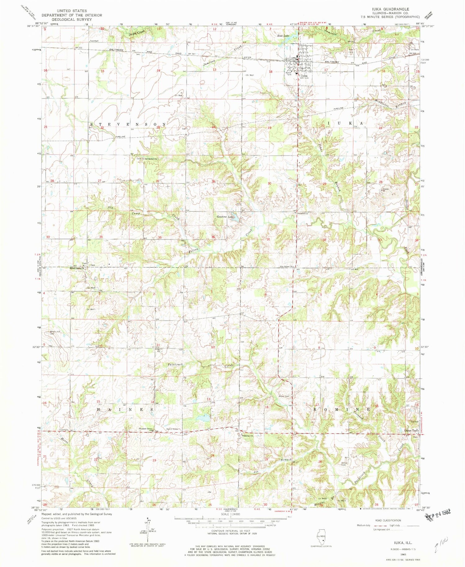
Classic USGS Iuka Illinois 7.5'x7.5' Topo Map
Couldn't load pickup availability
Historical USGS topographic quad map of Iuka in the state of Illinois. Map scale may vary for some years, but is generally around 1:24,000. Print size is approximately 24" x 27"
This quadrangle is in the following counties: Marion.
The map contains contour lines, roads, rivers, towns, and lakes. Printed on high-quality waterproof paper with UV fade-resistant inks, and shipped rolled.
Contains the following named places: Apple Ridge School, Bannister, Bannister Switch, Barrall Cemetery, Bell Cemetery, Bell Church, Bell School, Brewer Branch, Cherry Ridge School, Crooked Creek, Dalton School, Elm Grove Church, Fulton Creek, Goostree Lake, Green Church, Haines Townhall, Iuka, Iuka Cemetery, Iuka Elementary School, Iuka Fire Protection District, Iuka Post Office, Joe Branch, Johns Branch, Kell Cemetery, Lester Lake, Lester Lake Dam, Liberty School, Metcalf School, New Home School, Old Bethel Cemetery, Old Bethel Church, Old Camp Creek, Palestine Cemetery, Palestine Church, Palestine School, Panhandle School, Pleasant Grove Church, Prairie Grove School, Rabbit Grove Cemetery, Rabbit Grove Church, Romine Townhall, Rose Lake, Rose Lake Dam, Snow Hill Cemetery, Snowhill Church, Snowhill School, Stevenson Townhall, Stuber Cemetery, Township of Haines, Township of Iuka, Township of Romine, Township of Stevenson, Trinity Church, Trinity Lutheran Cemetery, Trinity School, Union Cemetery, Union Grove Cemetery, Union Town, Village of Iuka, Wham Hill Cemetery, ZIP Code: 62849