MyTopo
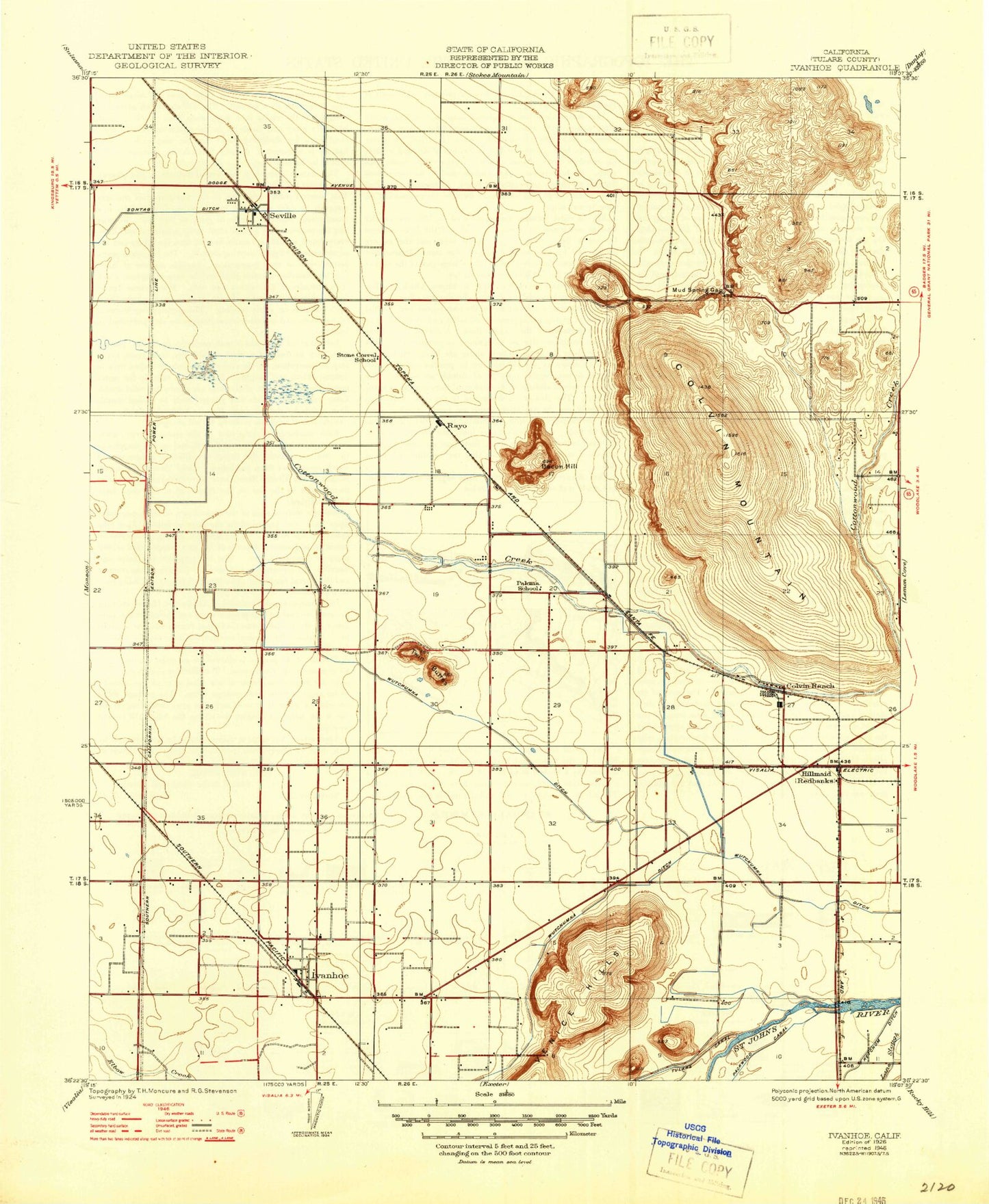
Classic USGS Ivanhoe California 7.5'x7.5' Topo Map
Couldn't load pickup availability
Historical USGS topographic quad map of Ivanhoe in the state of California. Map scale may vary for some years, but is generally around 1:24,000. Print size is approximately 24" x 27"
This quadrangle is in the following counties: Tulare.
The map contains contour lines, roads, rivers, towns, and lakes. Printed on high-quality waterproof paper with UV fade-resistant inks, and shipped rolled.
Contains the following named places: Bacon Hill, Cairns, Colvin Mountain, Colvin Ranch, Cottonwood Ditch, Hillmaid, Ivanhoe, Ivanhoe Census Designated Place, Ivanhoe Division, Ivanhoe Elementary School, Ivanhoe Post Office, Lone Oak Cemetery, Mountain View Dairy, Mud Spring Gap, Paloma School, Rayo, Redbanks, Seville, Seville Census Designated Place, Sontag Ditch, Stone Corral Elementary School, Stone Corral School, Tulare County Fire Department Battalion 1 Ivanhoe Fire Station 8, Tulare Irrigation District Canal, Twin Buttes, Venice Hills, Wutchumna Ditch, ZIP Codes: 93235, 93292