MyTopo
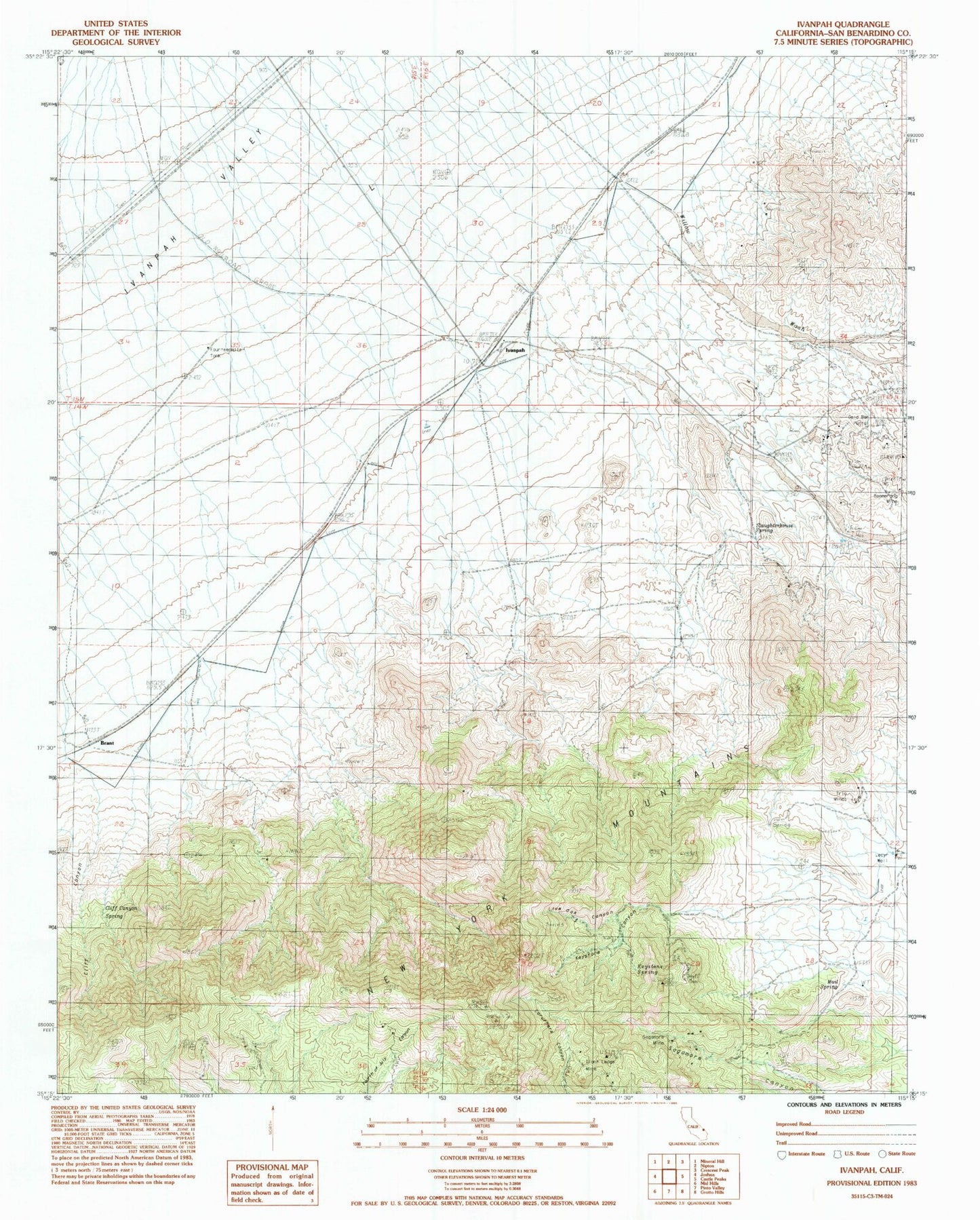
Classic USGS Ivanpah California 7.5'x7.5' Topo Map
Regular price
$16.95
Regular price
Sale price
$16.95
Unit price
per
Couldn't load pickup availability
Historical USGS topographic quad map of Ivanpah in the state of California. Map scale may vary for some years, but is generally around 1:24,000. Print size is approximately 24" x 27"
This quadrangle is in the following counties: San Bernardino.
The map contains contour lines, roads, rivers, towns, and lakes. Printed on high-quality waterproof paper with UV fade-resistant inks, and shipped rolled.
Contains the following named places: Boomerang Mine, Brant, Cliff Canyon, Cliff Canyon Spring, Fourteenmile Tank, Giant Ledge Mine, Gold Bar Portal, Ivanpah, Keystone Canyon, Keystone Spring, Lecyr Well, Live Oak Canyon, Mail Spring, Sagamore Mine, Slaughterhouse Spring, Trio Mines, Vanderbilt