MyTopo
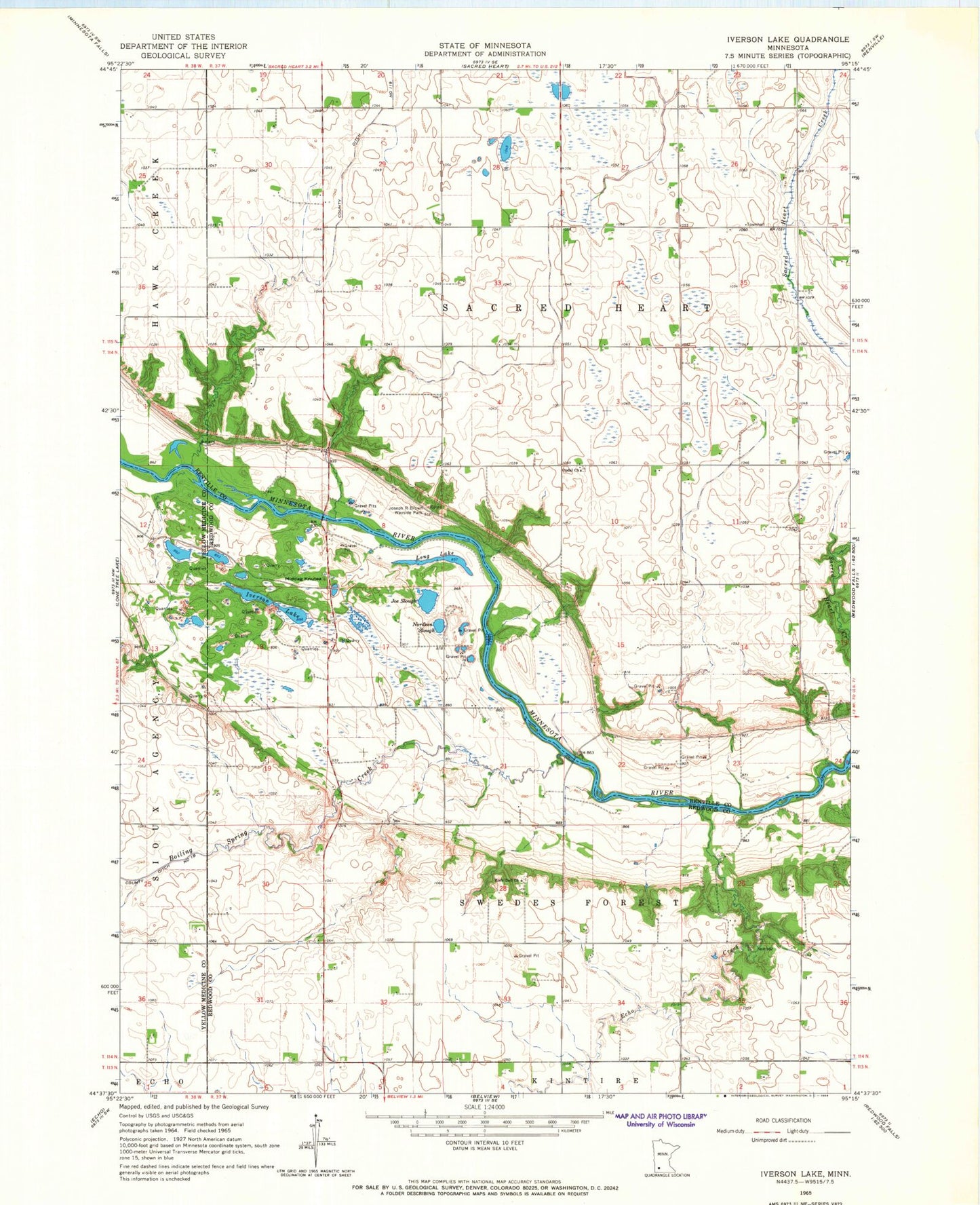
Classic USGS Iverson Lake Minnesota 7.5'x7.5' Topo Map
Couldn't load pickup availability
Historical USGS topographic quad map of Iverson Lake in the state of Minnesota. Map scale may vary for some years, but is generally around 1:24,000. Print size is approximately 24" x 27"
This quadrangle is in the following counties: Redwood, Renville, Yellow Medicine.
The map contains contour lines, roads, rivers, towns, and lakes. Printed on high-quality waterproof paper with UV fade-resistant inks, and shipped rolled.
Contains the following named places: Boiling Spring Creek, Donner Airport, Echo Creek, Farther and Gay Castle Historical Marker, Iverson Lake, Joe Slough, Joseph R Brown Wayside Park, Koldorn Family Cemetery, Long Lake, Middag Knutea, Nordeen Slough, Opdahl Cemetery, Opdal Church, Rock Dell Cemetery, Rock Dell Church, Sandager Cemetery, Swedes Forest Township Cemetery, Township of Sacred Heart, Township of Swedes Forest