MyTopo
Classic USGS Ivory New York 7.5'x7.5' Topo Map
Regular price
$16.95
Regular price
Sale price
$16.95
Unit price
per
Couldn't load pickup availability
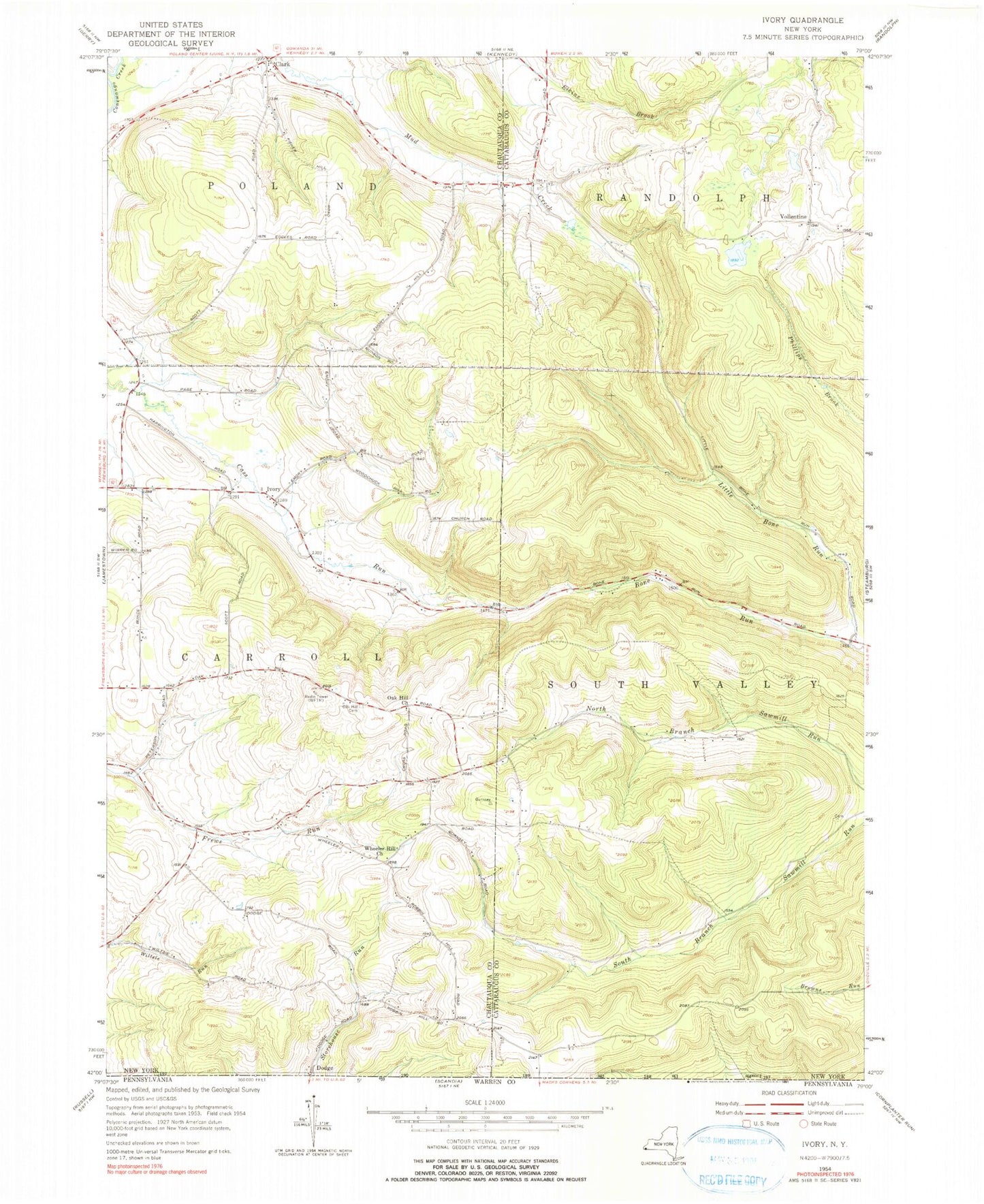
Historical USGS topographic quad map of Ivory in the state of New York. Typical map scale is 1:24,000, but may vary for certain years, if available. Print size: 24" x 27"
This quadrangle is in the following counties: Cattaraugus, Chautauqua.
The map contains contour lines, roads, rivers, towns, and lakes. Printed on high-quality waterproof paper with UV fade-resistant inks, and shipped rolled.
Contains the following named places: Clark, Dry Brook, Ivory, Little Bone Run, Oak Hill Cemetery, Oak Hill Church, Wheeler Hill Church, Dodge, Vollentine, Town of Carroll, Kennedy Airfield, Kost Family Apiary, Ivory Cemetery, Clarks Corners Community Church, Ivory Baptist Church, J - High Acres