MyTopo
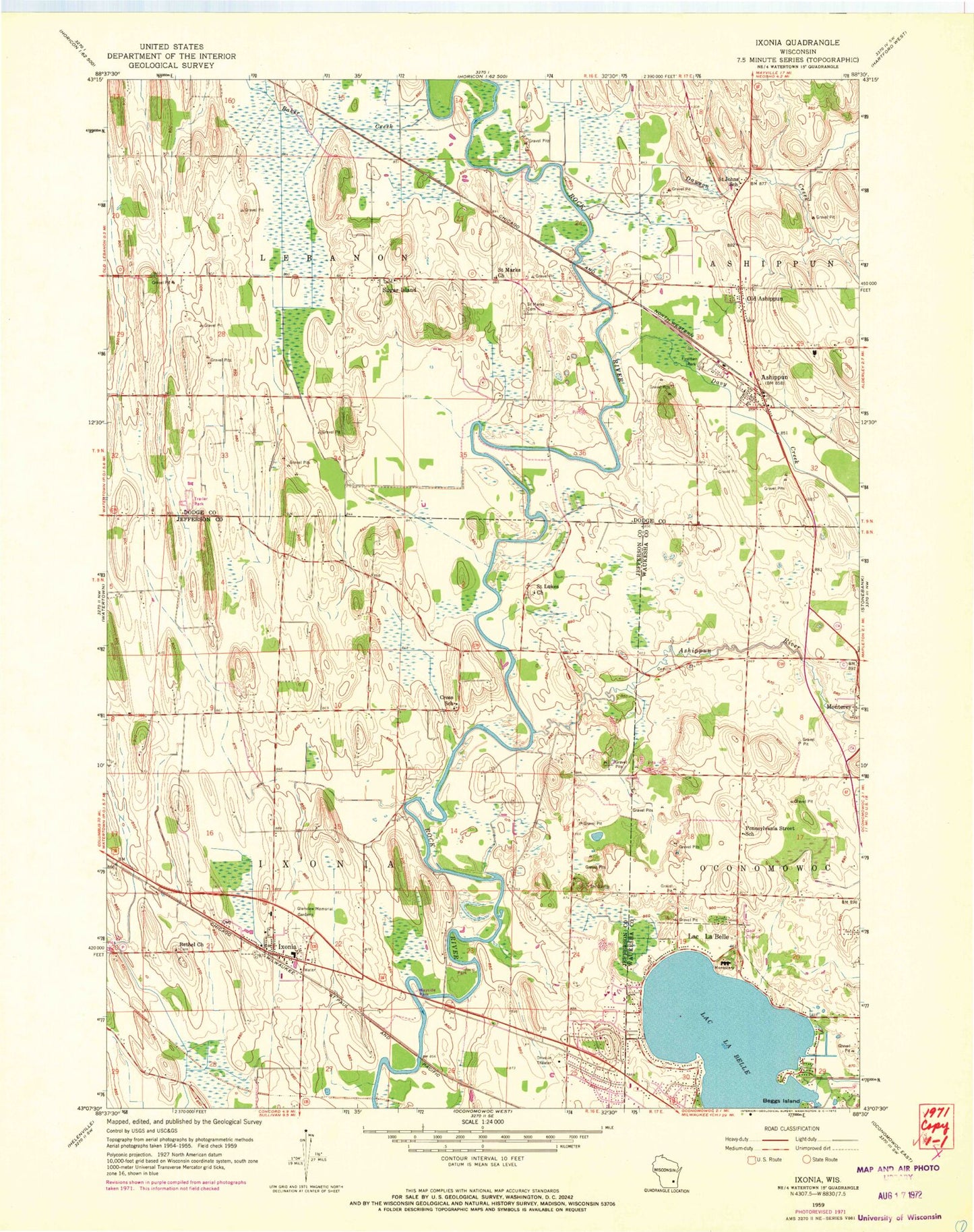
Classic USGS Ixonia Wisconsin 7.5'x7.5' Topo Map
Couldn't load pickup availability
Historical USGS topographic quad map of Ixonia in the state of Wisconsin. Map scale may vary for some years, but is generally around 1:24,000. Print size is approximately 24" x 27"
This quadrangle is in the following counties: Dodge, Jefferson, Waukesha.
The map contains contour lines, roads, rivers, towns, and lakes. Printed on high-quality waterproof paper with UV fade-resistant inks, and shipped rolled.
Contains the following named places: Ashippun, Ashippun Census Designated Place, Ashippun Elementary School, Ashippun Post Office, Ashippun River, Ashippun Volunteer Fire Department Station 1, Baker Creek, Bara Farms, Beggs Island, Bethel Cemetery, Bethel Church, Buzzard Point, C and L Hereford Farm, Crescentmead Farm, Cross Lutheran Cemetery, Cross Lutheran Church, Cross School, Davy Creek, Dawson Creek, Fireman Park, Glacier Rock Farms, Glenview Memorial Gardens, Ixonia, Ixonia Census Designated Place, Ixonia Elementary School, Ixonia Fire Department, Ixonia Post Office, Lac La Belle, Lac La Belle Police Department, Lake Lac La Belle, Monterey Methodist Cemetery, Monterey Village Cemetery, Old Ashippun, Old Ashippun Census Designated Place, Pennsylvania Street School, Redemptionist Fathers Catholic Seminary Cemetery, Rosenow Creek, Saint John Evangelical Lutheran Church, Saint Johns School, Saint Lukes Church, Saint Marks Cemetery, Saint Marks Church, Sugar Island, Tag Lane Dairy Farm, Town of Ixonia, Town of Lebanon, Village of Lac La Belle, Zion Lutheran Church, ZIP Codes: 53003, 53036