MyTopo
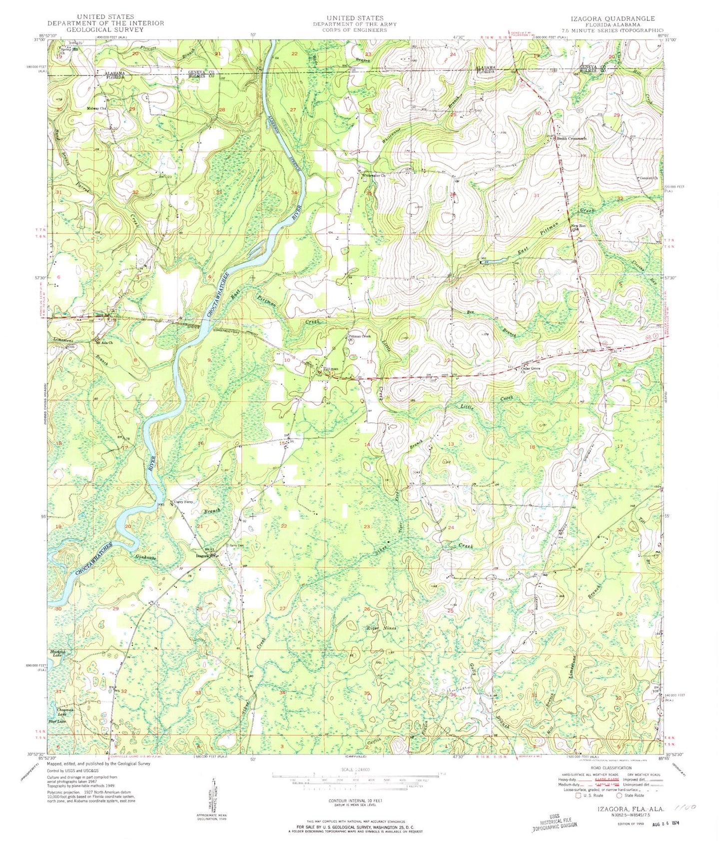
Classic USGS Izagora Florida 7.5'x7.5' Topo Map
Couldn't load pickup availability
Historical USGS topographic quad map of Izagora in the states of Florida, Alabama. Map scale may vary for some years, but is generally around 1:24,000. Print size is approximately 24" x 27"
This quadrangle is in the following counties: Geneva, Holmes.
The map contains contour lines, roads, rivers, towns, and lakes. Printed on high-quality waterproof paper with UV fade-resistant inks, and shipped rolled.
Contains the following named places: Alberson Stretch, Bee Branch, Blackfish Lake, Blackshire Creek, Cedar Grove Church, Chapman Lake, Clovin Bay, Concord Church, Curry Cemetery, Curry Ferry, East Pittman Creek, Emmius School, Ginhouse Branch, Hand Branch, Izagora, James Riley 'Jim Paul' Bridge, Limestone Branch, Little Creek, Midway Church, Mount Ida Church, New Zion Church, Parrot Creek, Pittman, Pittman Creek Church, River Nines, Smith Crossroads, Spring Hill Church, Tiger Ford Branch, Whitewater Baptist Church, Whitewater Branch, Whitewater Cemetery