MyTopo
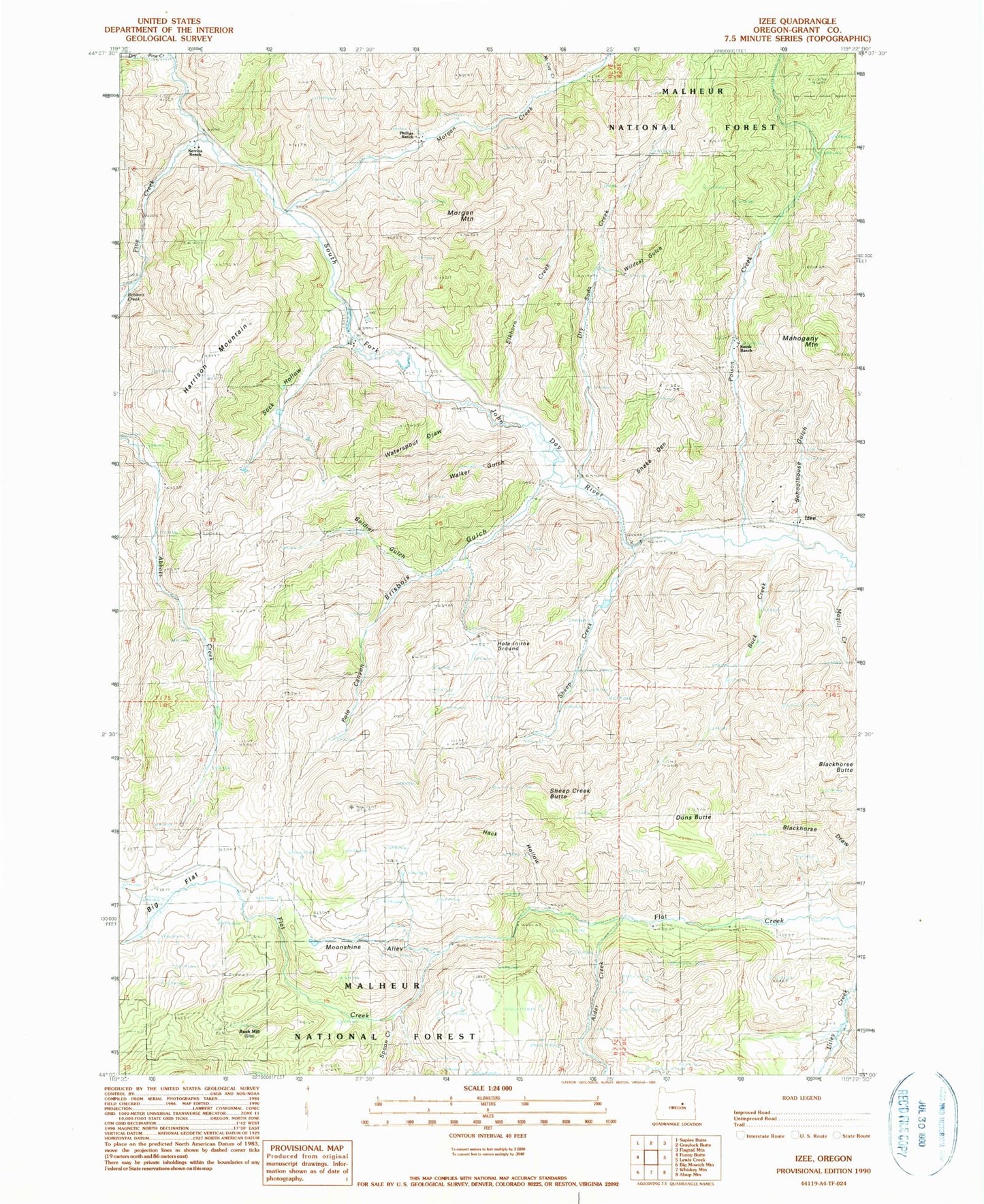
Classic USGS Izee Oregon 7.5'x7.5' Topo Map
Couldn't load pickup availability
Historical USGS topographic quad map of Izee in the state of Oregon. Map scale may vary for some years, but is generally around 1:24,000. Print size is approximately 24" x 27"
This quadrangle is in the following counties: Grant.
The map contains contour lines, roads, rivers, towns, and lakes. Printed on high-quality waterproof paper with UV fade-resistant inks, and shipped rolled.
Contains the following named places: Alder Creek, Big Flat, Brisbois Creek, Brisbois Gulch, Brisbois Ranch, Buck Creek, Bush Mill, Davis Ranch, Dons Butte, Dry Soda Creek, Elkhorn Creek, Hack Hollow, Harrison Mountain, Hole-in-the Ground, Izee, Izee Cemetery, Izee Post Office, Keerins Ranch, Magill Creek, Mahogany Mountain, McCoy Creek, Moonshine Alley, Morgan Creek, Morgan Mountain, Phillips Ranch, Phillips Spring, Pine Creek, Poison Creek, Pole Canyon, Rosebud Creek, Schoolhouse Gulch, Sheep Creek, Sheep Creek Butte, Smith Ranch, Snake Den, Sock Hollow, Soldier Gulch, Spoon Creek, Walker Gulch, Waterspout Draw, Wildcat Gulch, ZIP Code: 97820