MyTopo
Classic USGS Jachin Alabama 7.5'x7.5' Topo Map
Couldn't load pickup availability
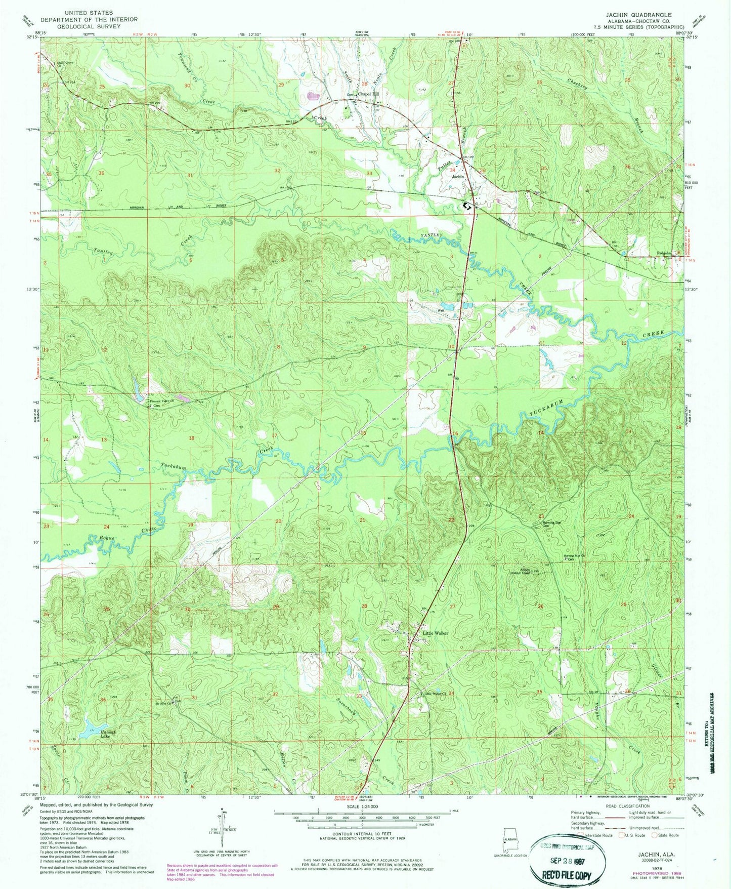
Historical USGS topographic quad map of Jachin in the state of Alabama. Map scale may vary for some years, but is generally around 1:24,000. Print size is approximately 24" x 27"
This quadrangle is in the following counties: Choctaw.
The map contains contour lines, roads, rivers, towns, and lakes. Printed on high-quality waterproof paper with UV fade-resistant inks, and shipped rolled.
Contains the following named places: Allison Lookout Tower, Bogue Chitto, Chapel Hill, Christ Temple Church, Christopher Chapel Cemetery, Christopher Chapel United Methodist Church, Clear Creek, Clear Creek Baptist Church, D T Hannah Lake Dam, Donald Hesselman Lake, Donald Hesselman Lake Dam, Fuller Branch, Hannah Lake, Jachin, Keahey Hunting Club, Lisman Division, Little Walker, Little Walker Christian Methodist Episcopal Church, Morning Star Baptist Church, Morning Star Cemetery, Morning Star Church, Mount Olive Baptist Church, Mount Olive Cemetery, Neals Creek, Pleasant Valley Baptist Church, Robjohn, Shady Grove Christian Methodist Episcopal Church, Smith Branch, Sunshine School, Tanyard Creek, Townsend Branch, Townsend Creek, Williams Crossroads, Yantley Creek, ZIP Code: 36910