MyTopo
Classic USGS Jacinto Mesa New Mexico 7.5'x7.5' Topo Map
Couldn't load pickup availability
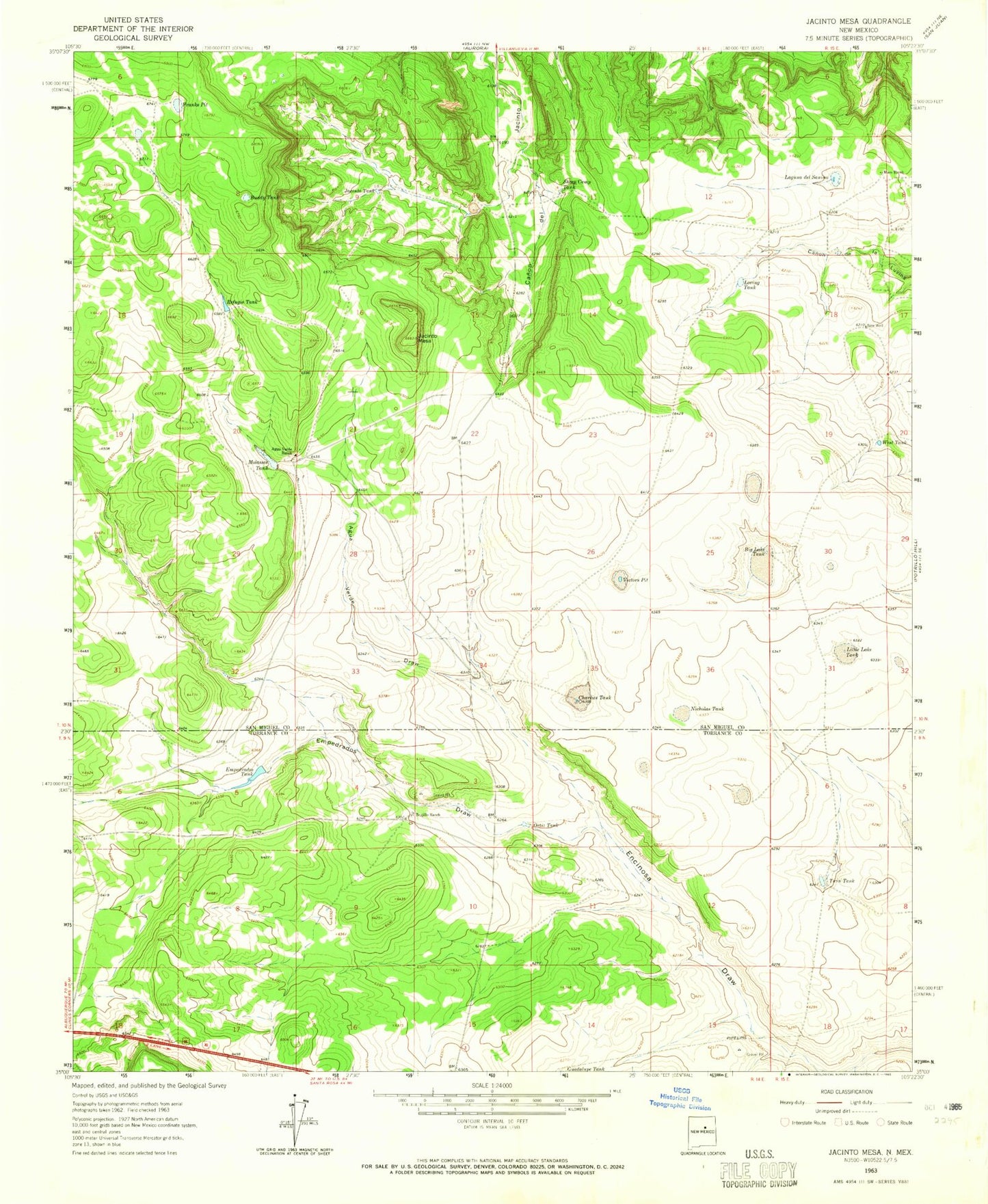
Historical USGS topographic quad map of Jacinto Mesa in the state of New Mexico. Map scale may vary for some years, but is generally around 1:24,000. Print size is approximately 24" x 27"
This quadrangle is in the following counties: San Miguel, Torrance.
The map contains contour lines, roads, rivers, towns, and lakes. Printed on high-quality waterproof paper with UV fade-resistant inks, and shipped rolled.
Contains the following named places: Agua Verde Draw, Agua Verde Ranch, Big Lake Tank, Buddy Tank, Charlies Tank, Empedrados Draw, Empedrados Tank, Encinoso Draw, Franks Pit, Jacinto Mesa, Laguna del Sauino, Little Lake Tank, Loving Tank, Mesita Tank, Molasses Tank, New Well, Nicholas Tank, Ortiz Tank, Refugio Tank, Sheep Camp Tank, Trujillo Ranch, Twin Tank, Victors Pit, West Tank