MyTopo
Classic USGS Jack Creek Reservoir Wyoming 7.5'x7.5' Topo Map
Couldn't load pickup availability
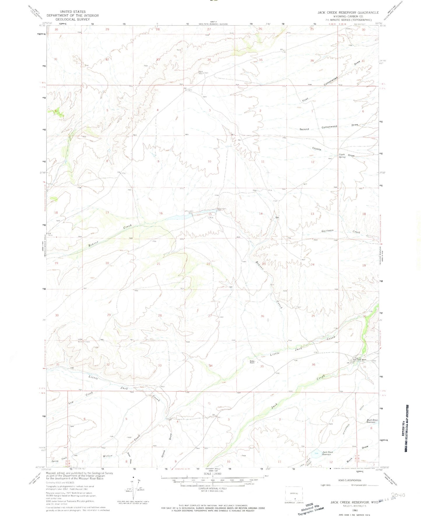
Historical USGS topographic quad map of Jack Creek Reservoir in the state of Wyoming. Map scale may vary for some years, but is generally around 1:24,000. Print size is approximately 24" x 27"
This quadrangle is in the following counties: Carbon.
The map contains contour lines, roads, rivers, towns, and lakes. Printed on high-quality waterproof paper with UV fade-resistant inks, and shipped rolled.
Contains the following named places: Beaver Creek, Boden Ranch, Coyote Spring, Good Number 1 Dam, Good Number 1 Reservoir, Grove Draw, Jack Creek Dam, Jack Creek Reservoir, Lazy C J Jack Creek Ranch, Little Jack Creek, Long Pond Dam, Long Pond Reservoir, Low Creek, Seaverson Ditch, Snow Draw, Spring Creek, Willow Creek