MyTopo
Classic USGS Jack Henry Knoll Utah 7.5'x7.5' Topo Map
Regular price
$16.95
Regular price
Sale price
$16.95
Unit price
per
Couldn't load pickup availability
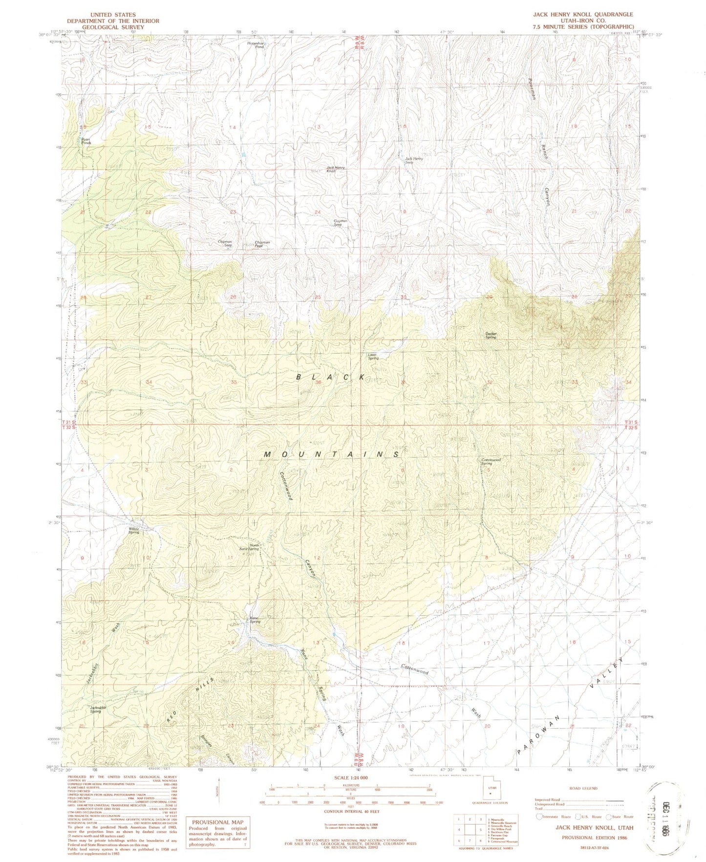
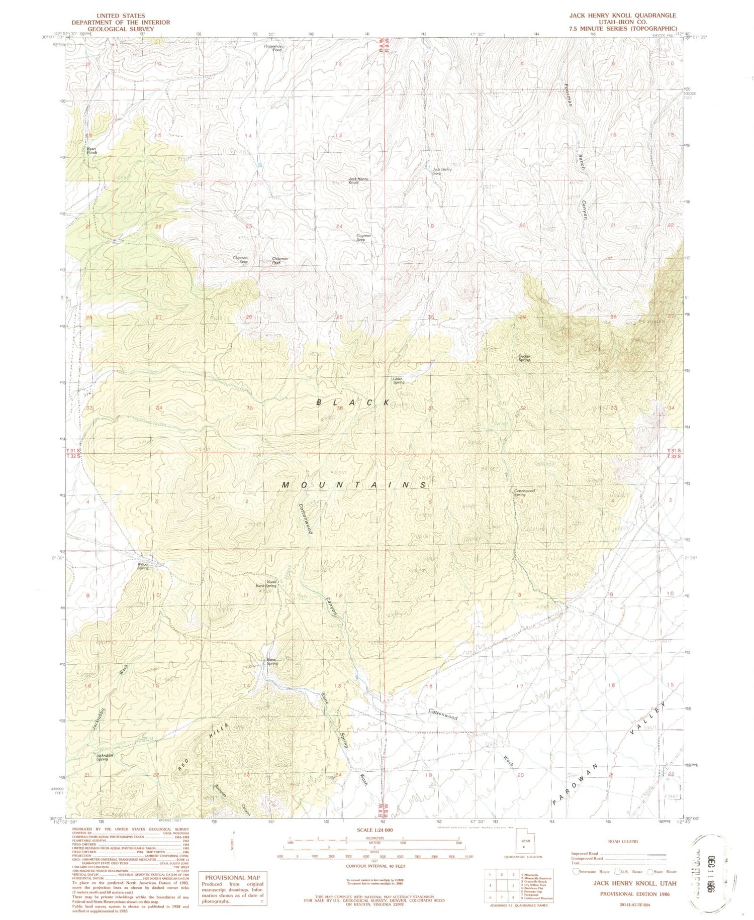
Historical USGS topographic quad map of Jack Henry Knoll in the state of Utah. Map scale may vary for some years, but is generally around 1:24,000. Print size is approximately 24" x 27"
This quadrangle is in the following counties: Iron.
The map contains contour lines, roads, rivers, towns, and lakes. Printed on high-quality waterproof paper with UV fade-resistant inks, and shipped rolled.
Contains the following named places: Chipman Peak, Chipman Seep, Cottonwood Canyon, Cottonwood Spring, Decker Spring, Guyman Seep, Horseshoe Pond, Jack Henry Knoll, Jack Henry Seep, Jackrabbit Spring, Kane Spring, Lister Spring, North Kane Spring, Red Hills, Ryan Ponds, Ryan Spring, Willow Spring