MyTopo
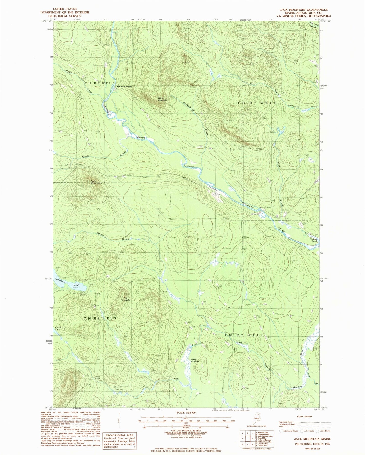
Classic USGS Jack Mountain Maine 7.5'x7.5' Topo Map
Regular price
$16.95
Regular price
Sale price
$16.95
Unit price
per
Couldn't load pickup availability
Historical USGS topographic quad map of Jack Mountain in the state of Maine. Map scale may vary for some years, but is generally around 1:24,000. Print size is approximately 24" x 27"
This quadrangle is in the following counties: Aroostook.
The map contains contour lines, roads, rivers, towns, and lakes. Printed on high-quality waterproof paper with UV fade-resistant inks, and shipped rolled.
Contains the following named places: Dead Brook, Donkey Deadwater, Foster-Rand Brook, Horse Mountain, Jack Mountain, McKeen Crossing, North Branch Camp, Rand Landing, Round Trail, Rowe Brook, Spectacle Brook, Spectacle Pond, T10 R7 WELS, T11 R7 WELS, The Owls Roost, The Pinnacle, Trafton Pond, Weeks Brook