MyTopo
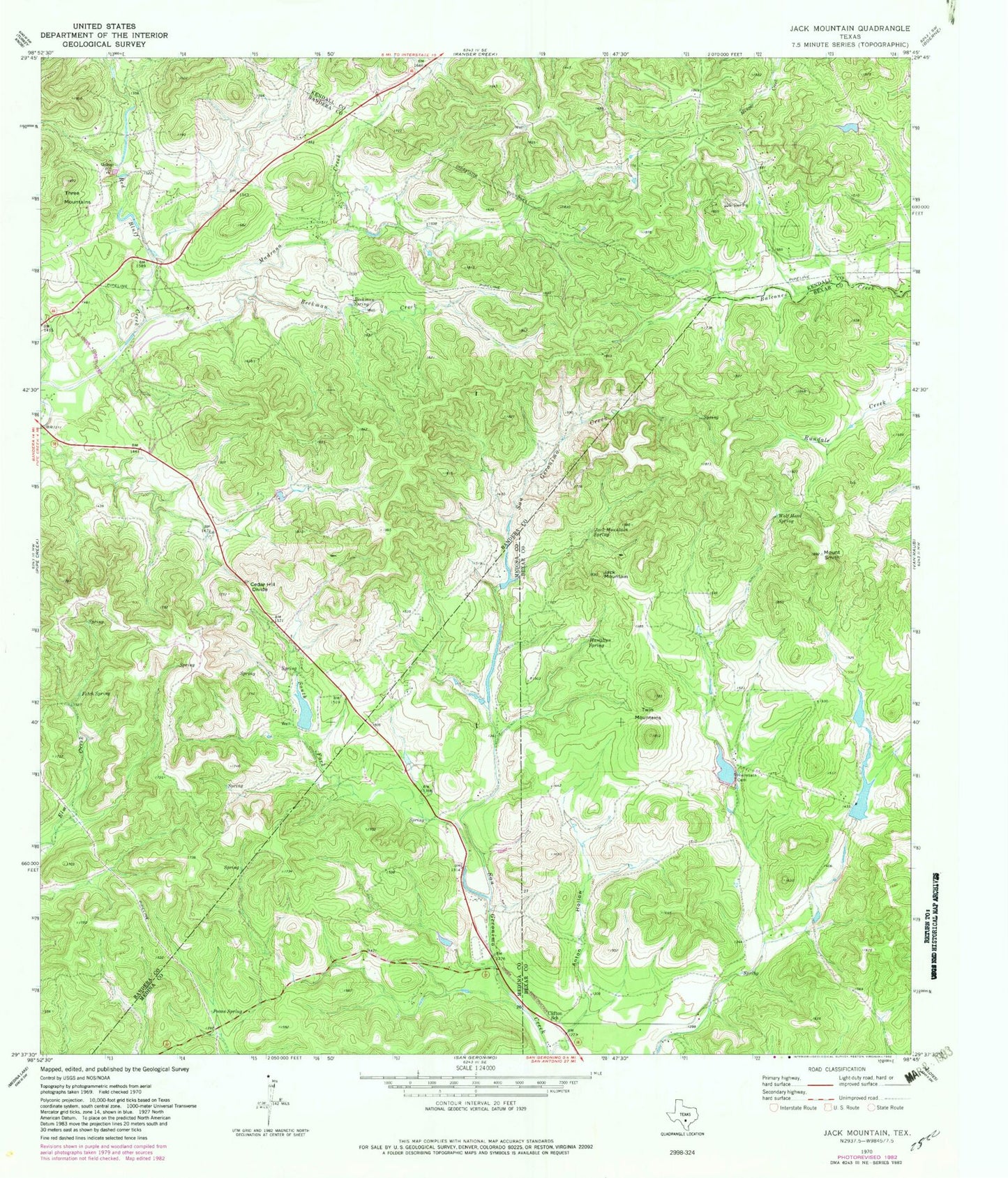
Classic USGS Jack Mountain Texas 7.5'x7.5' Topo Map
Couldn't load pickup availability
Historical USGS topographic quad map of Jack Mountain in the state of Texas. Map scale may vary for some years, but is generally around 1:24,000. Print size is approximately 24" x 27"
This quadrangle is in the following counties: Bandera, Bexar, Kendall, Medina.
The map contains contour lines, roads, rivers, towns, and lakes. Printed on high-quality waterproof paper with UV fade-resistant inks, and shipped rolled.
Contains the following named places: Anton Hollow, Beekman Creek, Beekman Spring, Cedar Hill Divide, Clifton School, Fitch Spring, Freedom Springs Ranch Airport, Hamilton Spring, Heimsath Cemetery, Heimsath Cemetery Lake, Heimsath Cemetery Lake Dam, Hill Country Chapel, Jack Mountain, Jack Mountain Spring, Madrona Creek, Medina Lake Volunteer Fire Department Station 2, Mount Smith, Pecan Spring, South Fork Sangeronimo Creek, Three Mountains, Twin Mountains, Walton Lake, Walton Lake Dam, White Lake, White Lake Dam, White Ranch Lake, White Ranch Lake Dam, Wolf Head Spring