MyTopo
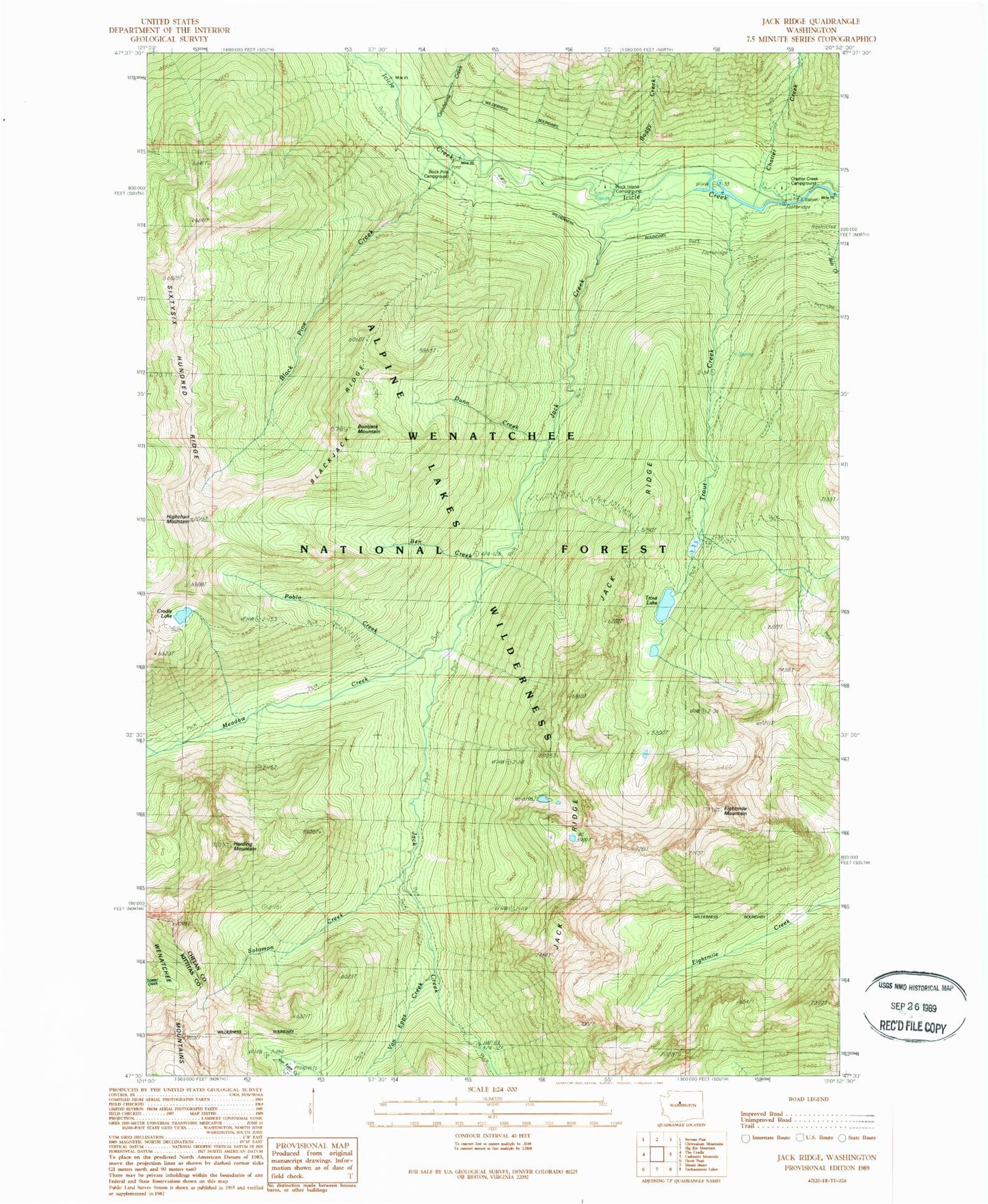
Classic USGS Jack Ridge Washington 7.5'x7.5' Topo Map
Couldn't load pickup availability
Historical USGS topographic quad map of Jack Ridge in the state of Washington. Typical map scale is 1:24,000, but may vary for certain years, if available. Print size: 24" x 27"
This quadrangle is in the following counties: Chelan, Kittitas.
The map contains contour lines, roads, rivers, towns, and lakes. Printed on high-quality waterproof paper with UV fade-resistant inks, and shipped rolled.
Contains the following named places: Ben Creek, Black Pine Creek, Blackjack Ridge, Boggy Creek, Bootjack Mountain, Chatter Creek, Chatter Creek Campground, Cradle Lake, Dunn Creek, Eightmile Mountain, Grindstone Creek, Harding Mountain, Highchair Mountain, Jack Creek, Meadow Creek, Pablo Creek, Rock Island Campground, Sixtysix Hundred Ridge, Solomon Creek, Trout Creek, Trout Lake, Van Epps Mine, Trout Lake Campground, Meadow Camp, Black Pine Campground, Chatter Guard Station