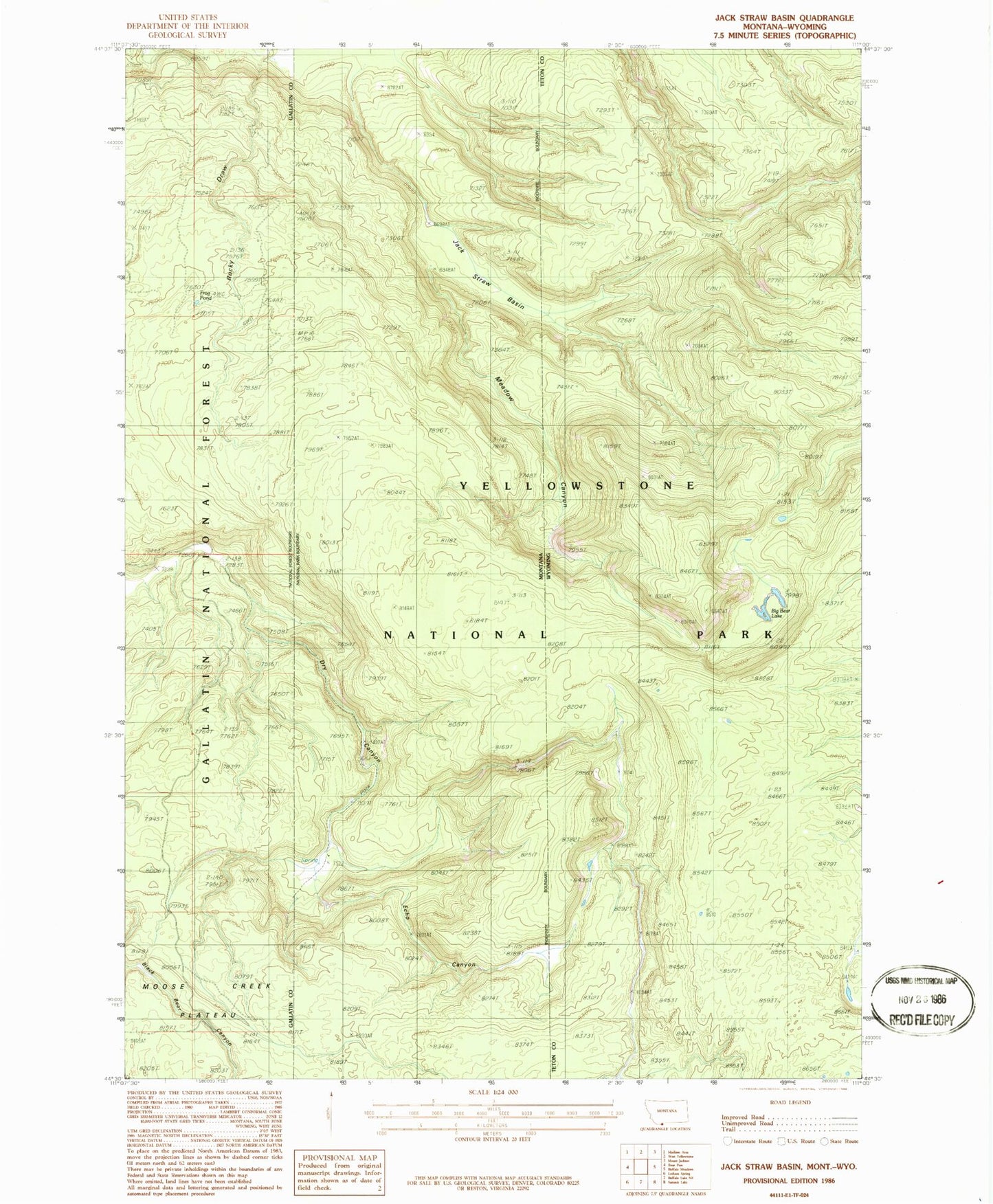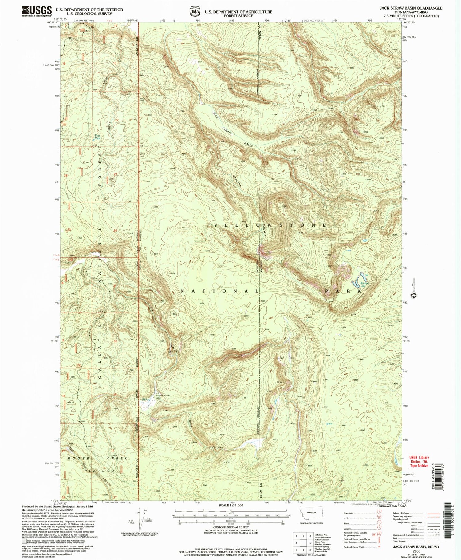

MyTopo
Classic USGS Jack Straw Basin Montana 7.5'x7.5' Topo Map
Regular price
$16.95
Regular price
Sale price
$16.95
Unit price
per
Couldn't load pickup availability
Historical USGS topographic quad map of Jack Straw Basin in the states of Montana, Wyoming. Map scale may vary for some years, but is generally around 1:24,000. Print size is approximately 24" x 27"
This quadrangle is in the following counties: Gallatin, Teton.
The map contains contour lines, roads, rivers, towns, and lakes. Printed on high-quality waterproof paper with UV fade-resistant inks, and shipped rolled.
Contains the following named places: Big Bear Lake, Echo Canyon, Frog Pond, Jack Straw Basin, Madison Plateau, Meadow Canyon, Rocky Draw, South Riverside Cabin