MyTopo
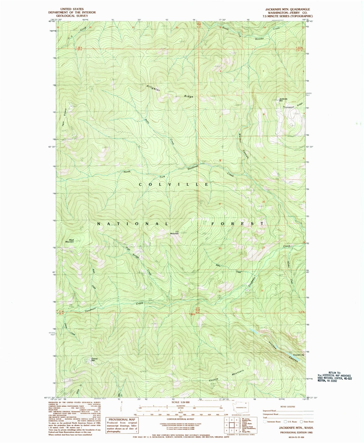
Classic USGS Jackknife Mountain Washington 7.5'x7.5' Topo Map
Couldn't load pickup availability
Historical USGS topographic quad map of Jackknife Mountain in the state of Washington. Typical map scale is 1:24,000, but may vary for certain years, if available. Print size: 24" x 27"
This quadrangle is in the following counties: Ferry.
The map contains contour lines, roads, rivers, towns, and lakes. Printed on high-quality waterproof paper with UV fade-resistant inks, and shipped rolled.
Contains the following named places: Bailey Creek, Betty Creek, C C Mountain, Coyote Mountain, Emerald Lake, Graves Creek, Graves Mountain, High Bridge Creek, Hoodoo Canyon, Hoodoo Creek, Jackknife Mountain, Lilly Lake, M J B Creek, Mack Mountain, Merkel Canyon, Twin Sisters, Wash Creek, Alligator Ridge, Jackknife Mountain Lookout, East Ferry Division