MyTopo
Classic USGS Jacks Peak Nevada 7.5'x7.5' Topo Map
Regular price
$16.95
Regular price
Sale price
$16.95
Unit price
per
Couldn't load pickup availability
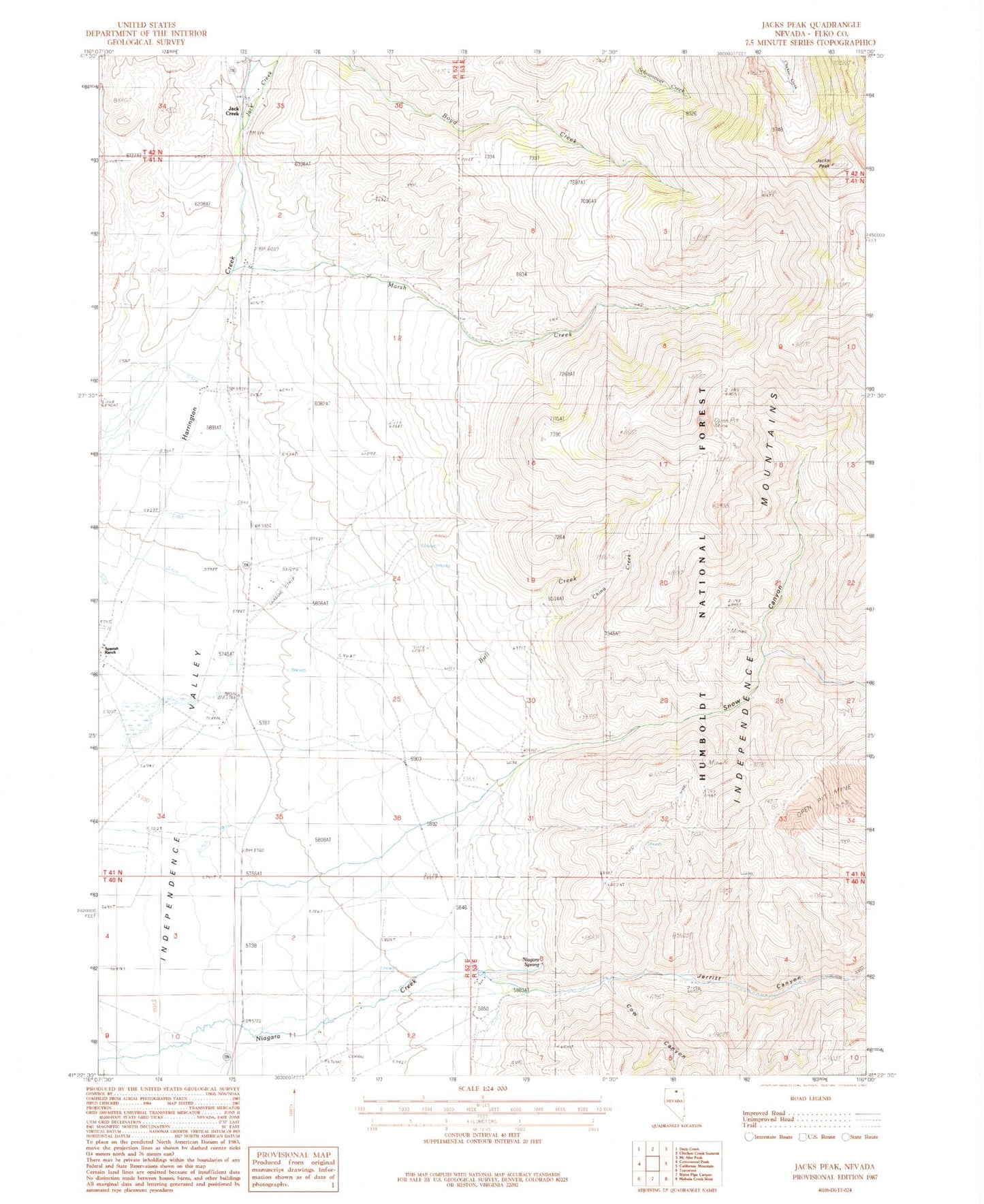
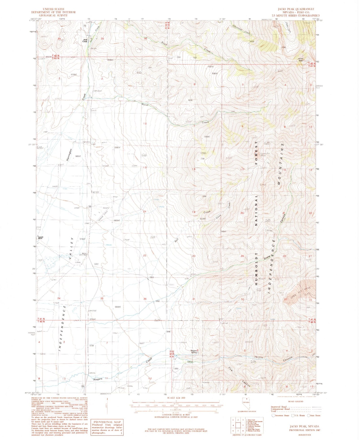
Historical USGS topographic quad map of Jacks Peak in the state of Nevada. Typical map scale is 1:24,000, but may vary for certain years, if available. Print size: 24" x 27"
This quadrangle is in the following counties: Elko.
The map contains contour lines, roads, rivers, towns, and lakes. Printed on high-quality waterproof paper with UV fade-resistant inks, and shipped rolled.
Contains the following named places: Jack Creek Ranch Landing Strip (historical), China Creek, Cow Canyon, Harrington Creek, Jack Creek, Jacks Peak, Jerritt Canyon, Marsh Creek, Snow Canyon, Jack Creek, Niagara Spring, Andrae Ranch, Anderson (historical), Jerret Creek, Snow Creek, Anderson Post Office (historical)