MyTopo
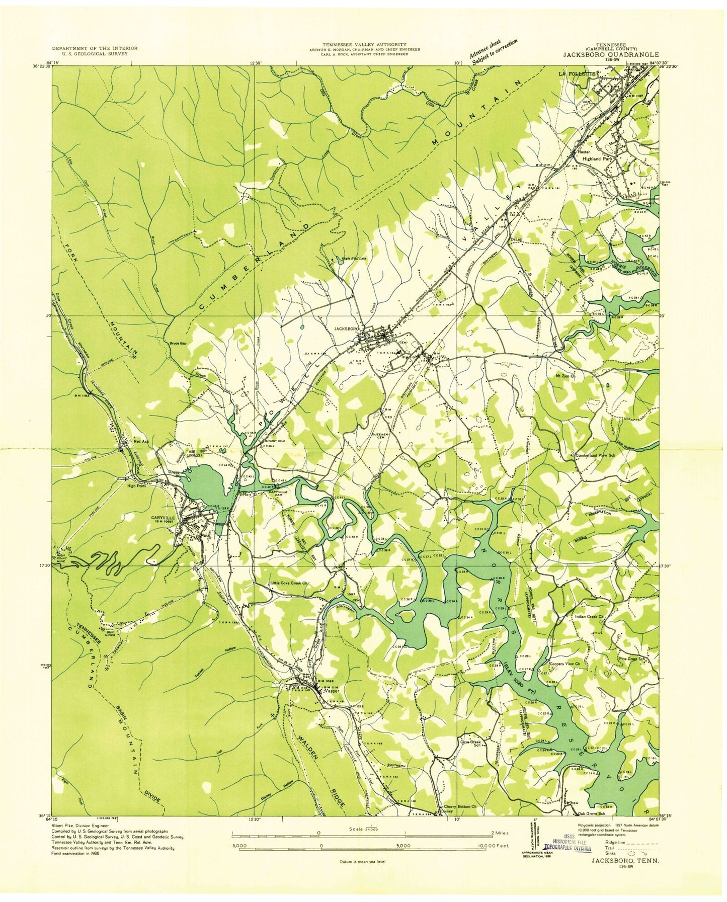
Classic USGS Jacksboro Tennessee 7.5'x7.5' Topo Map
Couldn't load pickup availability
Historical USGS topographic quad map of Jacksboro in the state of Tennessee. Typical map scale is 1:24,000, but may vary for certain years, if available. Print size: 24" x 27"
This quadrangle is in the following counties: Campbell.
The map contains contour lines, roads, rivers, towns, and lakes. Printed on high-quality waterproof paper with UV fade-resistant inks, and shipped rolled.
Contains the following named places: Fork Mountain, Powell Valley, Shown Hollow, Shown Springs, Spicewood Hollow, Stokes Hollow, Su-Dennie Dock, Thompson Creek, Tidwell Hollow, Tunnel Hollow, Twin Cove, Vasper, Vasper Cemetery, Vasper Hollow, Vinsant Cemetery, Wheeler Cemetery, Willoughby Cemetery, Woodlawn Cemetery, Woods Cemetery, Yellow Branch, Adkins Branch, Asher Branch, Bearwallow Church, Bearwallow Hollow, Bethel Church, Brown Hollow, Bruce Creek, Bruce Gap, Brush Creek, Campbell County Memorial Gardens, Campbell County Park, Carey Cemetery, Carroll Cemetery, Caryville, Cave Spring, Cherry Bottom Church, College Hill Church, Coopers View Cemetery, Cove Lake Estates, Cove Lake State, Cuckle Creek, Dabney Cemetery, David Cemetery, Davis Cemetery, Disney Hollow, Dog Creek, Duncan Branch, Eagle Bluff, Eagle Bluff Lake, Elkins Cemetery, Falls Creek, Flat Woods, Gross Cemetery, Harness Cemetery, Hatfield Cemetery, High Point, High Point Hollow, Highland Park, Hunter, Hunter Branch, Indian Creek Baptist Church, Indian Gap, Indian Grave Tunnel, Indian River Dock, Ivy Grove Baptist Church, Jacksboro, Johnson Branch, Johnson Cemetery, Johnson Spring, La Follette Reservoir, Lake View Baptist Church, Laurel Branch, Lindsay Mill Dock, Little Cove Creek, Little Cove Creek Baptist Church, Lovely Cemetery, Lovely Spring, Madison Cemetery, Marlow Cemetery, Mattie Randolph Hollow, McGhee Cemetery, McGhee Gap, Midway Baptist Church, Mount Paran Baptist Church, Mount Zion United Methodist Church, Nelson Cemetery, Pickle Cemetery, Pine Crest, Poor Farm Cemetery, Queener Cemetery, Queener Cemetery, Queener Cemetery, Queener Hollow, Rains Cemetery, Rains Cemetery, Rains Grove Cemetery, Ridge View Church, Ridgewood, Rogers Cemetery, Rogers Gap, Saltpeter Ridge, Sharp Cemetery, Campbell County Airport, Caryville Lake Dam, Eblen-Powell Number Two Dam, Smith Cemetery, Tiller - Ford Cemetery, Caryville Dam, Cedar Hill Baptist Church, Clotfelter Cemetery, Cove Lake, Cumberland View Baptist Church, De Lap, DeLap Cemetery, Eagle Bluff Springs, Left Fork Little Cove Creek, Silica, Lindsay Mill, Oak Grove, Red Ash, Rocky Ford, Blankenbickler Cemetery, Burris Cemetery, Caryville Elementary School, Cove Creek Boat Ramp, Cove Creek View School (historical), Coopers View Baptist Church (historical), Cumberland View Cemetery, Cumberland View School (historical), Disney Cemetery, Dugtown Cemetery, East Jacksboro Baptist Church, High Point Mine, Indian Creek Cemetery, Jacksboro City Cemetery, Jacksboro Elementary School, Jacksboro Middle School, Miller Cemetery, Montgomery Cemetery, Mount Paran Cemetery, Mount Zion Cemetery, Oak Grove Baptist Church, Oak Grove School (historical), Pine Crest School (historical), Powder Spring Church (historical), Ridgewood Elementary School, Sun Mines, Twin Cove Boat Dock, Vasper Baptist Church, Vasper Cemetery, Vasper School (historical), Zeaks Cemetery, Oak Grove Cemetery, Woodsons Mall Shopping Center, WWGR-AM (La Follette), Cove Creek, Cumberland View, Indian Creek, College Hill Elementary School, Caryville Division (historical), Anthras Slope Mine, Caryville Post Office, Jacksboro Post Office, Sun Pewee Mine, Central Baptist Church, First Baptist Church, First Baptist Church, Hollingsworth Industrial Park, West Walden Church of God, City of La Follette, Town of Jacksboro, Town of Caryville, Commissioner District 3, Campbell County Highway Department Quarry, Jacksboro Fire Department, Caryville Volunteer Fire Department, Pinecrest Volunteer Fire Department Station 2, Ridgewood Volunteer Fire Department, Pinecrest Volunteer Fire Department Station 1, Campbell County Sheriff's Department, Caryville Police Department, Fork Mountain, Powell Valley, Shown Hollow, Shown Springs, Spicewood Hollow, Stokes Hollow, Su-Dennie Dock, Thompson Creek, Tidwell Hollow, Tunnel Hollow, Twin Cove, Vasper, Vasper Cemetery, Vasper Hollow, Vinsant Cemetery, Wheeler Cemetery, Willoughby Cemetery, Woodlawn Cemetery, Woods Cemetery, Yellow Branch, Adkins Branch, Asher Branch, Bearwallow Church, Bearwallow Hollow, Bethel Church, Brown Hollow, Bruce Creek, Bruce Gap, Brush Creek, Campbell County Memorial Gardens, Campbell County Park, Carey Cemetery, Carroll Cemetery, Caryville, Cave Spring, Cherry Bottom Church, College Hill Church, Coopers View Cemetery, Cove Lake Estates, Cove Lake State, Cuckle Creek, Dabney Cemetery, David Cemetery, Davis Cemetery, Disney Hollow, Dog Creek, Duncan Branch, Eagle Bluff, Eagle Bluff Lake, Elkins Cemetery, Falls Creek, Flat Woods, Gross Cemetery, Harness Cemetery, Hatfield Cemetery


