MyTopo
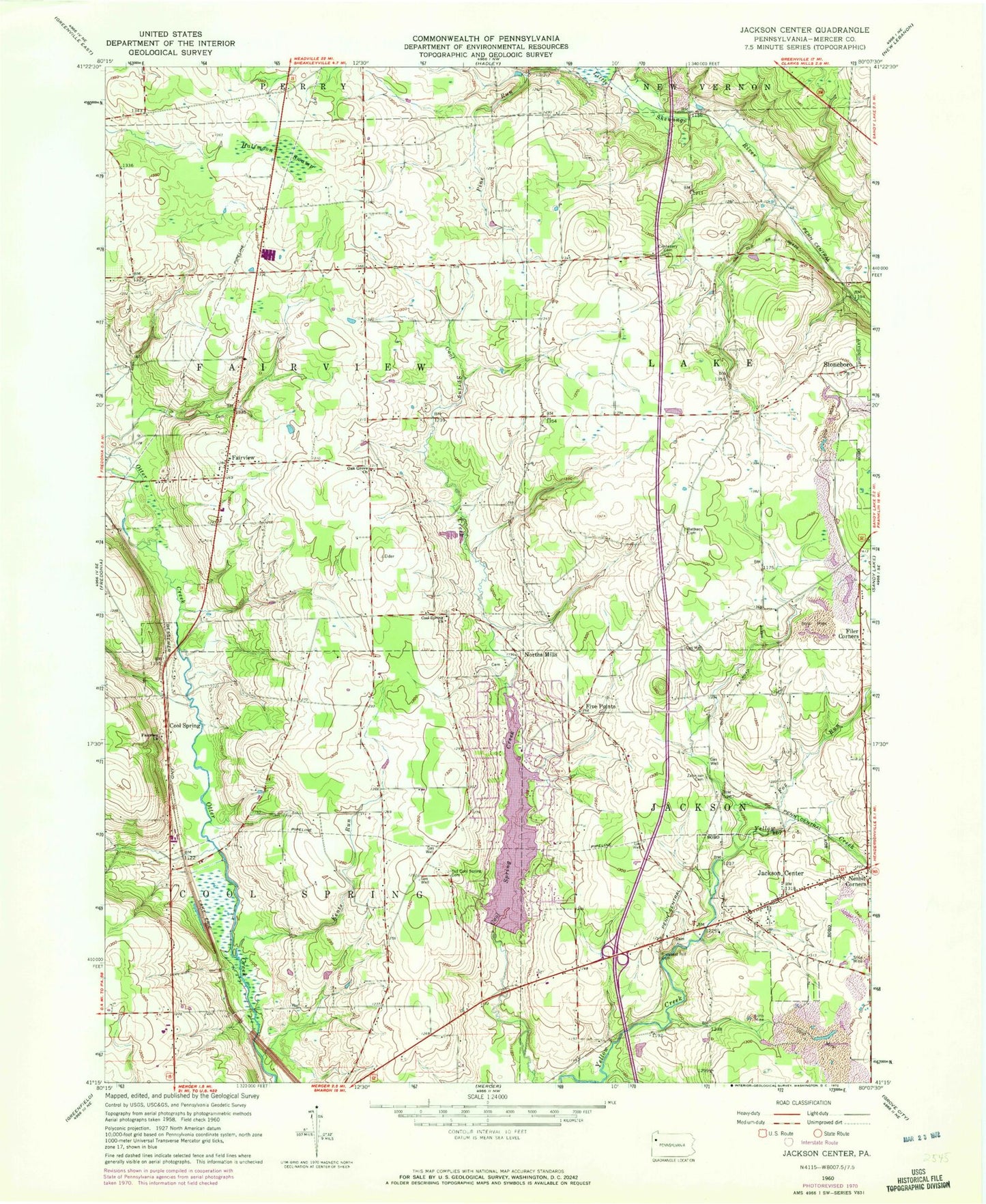
Classic USGS Jackson Center Pennsylvania 7.5'x7.5' Topo Map
Couldn't load pickup availability
Historical USGS topographic quad map of Jackson Center in the state of Pennsylvania. Map scale may vary for some years, but is generally around 1:24,000. Print size is approximately 24" x 27"
This quadrangle is in the following counties: Mercer.
The map contains contour lines, roads, rivers, towns, and lakes. Printed on high-quality waterproof paper with UV fade-resistant inks, and shipped rolled.
Contains the following named places: Amish Cemetery, Bethany Cemetery, Borough of Jackson Center, Cape Horn School, Cass School, Centenary Cemetery, Center School, Cool Spring, Cool Spring Church, Coolspring Cemetery, Fairview, Fairview Church, Ferrell Field, Filer Corners, Five Points, Fox Run, Godfrey School, Halfmoon Swamp, Jackson Center, Jackson Center Post Office, Jackson Center Presbyterian Cemetery, Jackson Center Station, Jackson Center Volunteer Fire Department Station 92, Kents Run, Lake Latonka, Lake Latonka Census Designated Place, Lake Latonka Dam, Maple Shade School, Mill Run, Nesbit Corners, North Mills, Oak Grove Cemetery, Oak Grove Church, Oak Hill School, Old Cool Spring Cemetery, Orr School, Paoli School, Pennsylvania State Police Troop D Mercer Station, Pleasant Hill Cemetery, Slater School, State Game Lands Number 294, Still Meadow Farm Airport, Township of Coolspring, Township of Fairview, Township of Jackson, Township of Lake, White School, Zahniser Cemetery, Zahniser School