MyTopo
Classic USGS Jackson South Tennessee 7.5'x7.5' Topo Map
Couldn't load pickup availability
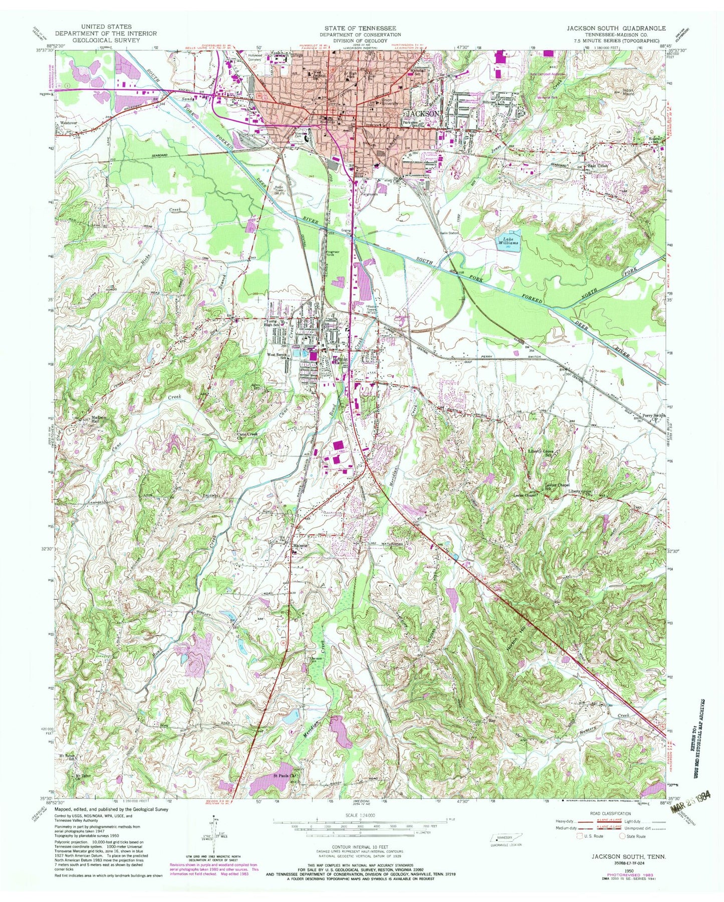
Historical USGS topographic quad map of Jackson South in the state of Tennessee. Map scale may vary for some years, but is generally around 1:24,000. Print size is approximately 24" x 27"
This quadrangle is in the following counties: Madison.
The map contains contour lines, roads, rivers, towns, and lakes. Printed on high-quality waterproof paper with UV fade-resistant inks, and shipped rolled.
Contains the following named places: Academy of Our Lady of Mercy, Allenton Heights, Anderson Branch, Bemis, Bemis Cemetery, Bemis Chapel Missionary Baptist Church, Bemis Post Office, Bemis Square Shopping Center, Bemis United Methodist Church, Berean Baptist Church, Bond Creek, Bonwood Industrial Park, Calvary Baptist Church, Cane Creek, Cane Creek Church, Carney-Johnston Hall, Central Church of Christ, Church of Christ, Church of God, City of Jackson Fire Department Training Center, Commissioner District 1, Concordia Lutheran Church, Cumberland Episcopal Church, Cumberland Missionary Baptist Church, Cumberland Street Baptist Church, Cypress Grove Park, Dry Branch, E W Sprague Hall, East Chester Street Baptist Church, East Jackson Baptist Church, East Main Street Historic District, East Union, East Union Baptist Church, Ebenezer Cemetery, Ebenezer Methodist Church, First Baptist Church, First Baptist Church of Bemis, First Christian Church, First Church of the Nazarene, First Cumberland Presbyterian Church, First Pentecostal Church, First United Methodist Church, Frogmoor Yards, George Ellis Spangler Hall, Hamilton Performing Arts Center, Hays Avenue Methodist Church, Hicks Creek, Hillcrest Church, Hollywood Cemetery, Home Baptist Church, Iselin Station, Jackson, Jackson City Hall, Jackson Civic Center, Jackson Fire Department Station 1, Jackson Fire Department Station 4, Jackson Junior High School, Jackson Police Department, Jackson Post Office, Jackson-Madison County Library, Johnson Memorial Presbyterian Church, Jones Creek, Joseph Reeves Hyde Science Hall, Kate Campbell Anderson Memorial Park, Knee Temple Church of God in Christ, Lake Williams, Lambuth Memorial United Methodist Church, Lambuth University, Lester Chapel, Lester Chapel School, Liberty Grove Church, Liberty Grove School, Liberty Street Christian Methodist Episcopal Church, Lovelace Hall, Luther L Gobbel Library, Madison Baptist Church, Madison County, Madison County Courthouse, Madison County Fire Department Station 1, Madison County Fire Department Station 2, Madison County Sheriff's Office, Madison Hall, Madison South Shopping Plaza, Malesus, Malesus Baptist Church, Malesus Elementary School, Malesus United Methodist Church, Mary Girven Harris Hall, Meridian Creek, Meridian Creek Dam One, Meridian Creek Dam Two, Meridian Creek Lake One, Meridian Creek Lake Two, Merry High School, Mitchell Airport, Mount Tabor Church, Mount Tabor School, Mount Zion Baptist Church, New Christ Temple Church of Christ, New Hope Baptist Church, North Fork Forked Deer River, Norton Hill, Parkview Baptist Church, Parkview Elementary School, Perry Switch Church, Pinson Division, R E Womack Memorial Chapel, Riveside Cemetery, Robbins Street Primitive Baptist Church, Rosehill School, Rothrock Field, Roy, Saint James Baptist Church, Saint Josephs Church, Saint Josephs School, Saint Lukes Episcopal Church, Saint Marys Roman Catholic Church, Saint Pauls Church, Sandy Creek, South Royal Baptist Mission, South Side High School, South Side Junior High School, Tennessee Sheriffs Youthtown Dam, Tennessee Sheriffs Youthtown Lake, Trinity United Methodist Church, Union Station, Union University, Varnell-Jones Hall, Warren F Jones Hall, Washington Douglass Elementary School, Webb-Williamson Hospital, Wesley Chapel United Methodist Church, West Bemis School, West Jackson Baptist Church, West Jackson Elementary School, West Tennessee Fairgrounds, Whitehall Elementary School, Wilder Student Union, WJHR-FM (Jackson), WUAA-TV (Jackson), Young High School, ZIP Code: 38301


