MyTopo
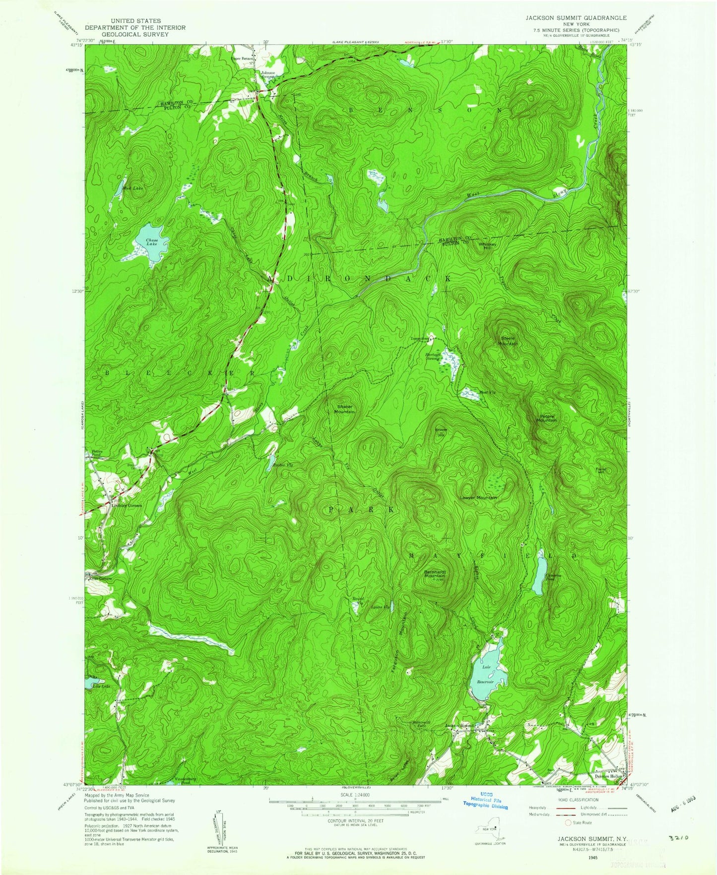
Classic USGS Jackson Summit New York 7.5'x7.5' Topo Map
Couldn't load pickup availability
Historical USGS topographic quad map of Jackson Summit in the state of New York. Typical map scale is 1:24,000, but may vary for certain years, if available. Print size: 24" x 27"
This quadrangle is in the following counties: Fulton, Hamilton.
The map contains contour lines, roads, rivers, towns, and lakes. Printed on high-quality waterproof paper with UV fade-resistant inks, and shipped rolled.
Contains the following named places: Bellan Ledge, Bernhardt Mountain, Bowlers Corners, Brower Hill, Buttermilk Falls, Cameron Reservoir, Chase Lake, Chase Lake Outlet, Dennies Hollow, Elphee Creek, Ferguson Mountain, Hartwell Swamp, Hatch Brook, Holmes Lake Outlet, Jackson Summit, Jackson Summit Reservoir, Johnson Swamp, Lawyer Mountain, Lily Lake, Lindsley Corners, Lynus Vly, Lynus Vly Outlet, Moat Vly, Mud Lake, Peters Mountain, Pinnacle, Racker Vly, Round Vly, Shaker Mountain, Steele Mountain, Trypoli Creek, Tyrrell Hill, Whiskey Hill, North Branch West Stony Creek, Tomantown, Upper Benson, Bleecker Cemetery, Berry Cemetery, Bellan Ledge, Bernhardt Mountain, Bowlers Corners, Brower Hill, Buttermilk Falls, Cameron Reservoir, Chase Lake, Chase Lake Outlet, Dennies Hollow, Elphee Creek, Ferguson Mountain, Hartwell Swamp, Hatch Brook, Holmes Lake Outlet, Jackson Summit, Jackson Summit Reservoir, Johnson Swamp, Lawyer Mountain, Lily Lake, Lindsley Corners, Lynus Vly, Lynus Vly Outlet, Moat Vly, Mud Lake, Peters Mountain, Pinnacle, Racker Vly, Round Vly, Shaker Mountain, Steele Mountain, Trypoli Creek, Tyrrell Hill, Whiskey Hill, North Branch West Stony Creek, Tomantown, Upper Benson, Bleecker Cemetery, Berry Cemetery