MyTopo
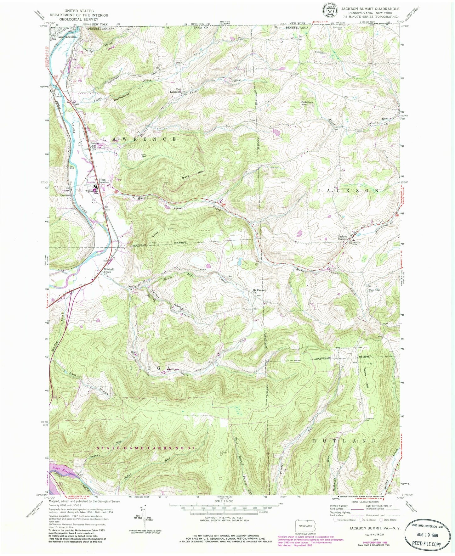
Classic USGS Jackson Summit Pennsylvania 7.5'x7.5' Topo Map
Couldn't load pickup availability
Historical USGS topographic quad map of Jackson Summit in the state of Pennsylvania. Typical map scale is 1:24,000, but may vary for certain years, if available. Print size: 24" x 27"
This quadrangle is in the following counties: Steuben, Tioga.
The map contains contour lines, roads, rivers, towns, and lakes. Printed on high-quality waterproof paper with UV fade-resistant inks, and shipped rolled.
Contains the following named places: Barber Hollow, Bentley Creek, Buck Hill, Daily Creek, Dark Hollow, Dickenson Cemetery, Gobblers Knob, Harts Creek, Jackson Summit, Maple Ridge Cemetery, Middaugh Cemetery, Mitchell Creek, Morrell Cemetery, Mount Pleasant Church, Mutton Lane Creek, Phoenix Run, Rowe Hill, Shanty Creek, Steam Mill Creek, Tower Hill, Tower Hill Cemetery, Williamson Senior High School, Buckwheat Hollow, Smith Creek, Tioga Dam, Rising, Tioga Reservoir, Beeman, C V Junction, East Lawrence, Mitchell Creek, Somers Lane, Tioga Junction, Township of Tioga, Lawrenceville Fire Department, Lawrence Township Police Department