MyTopo
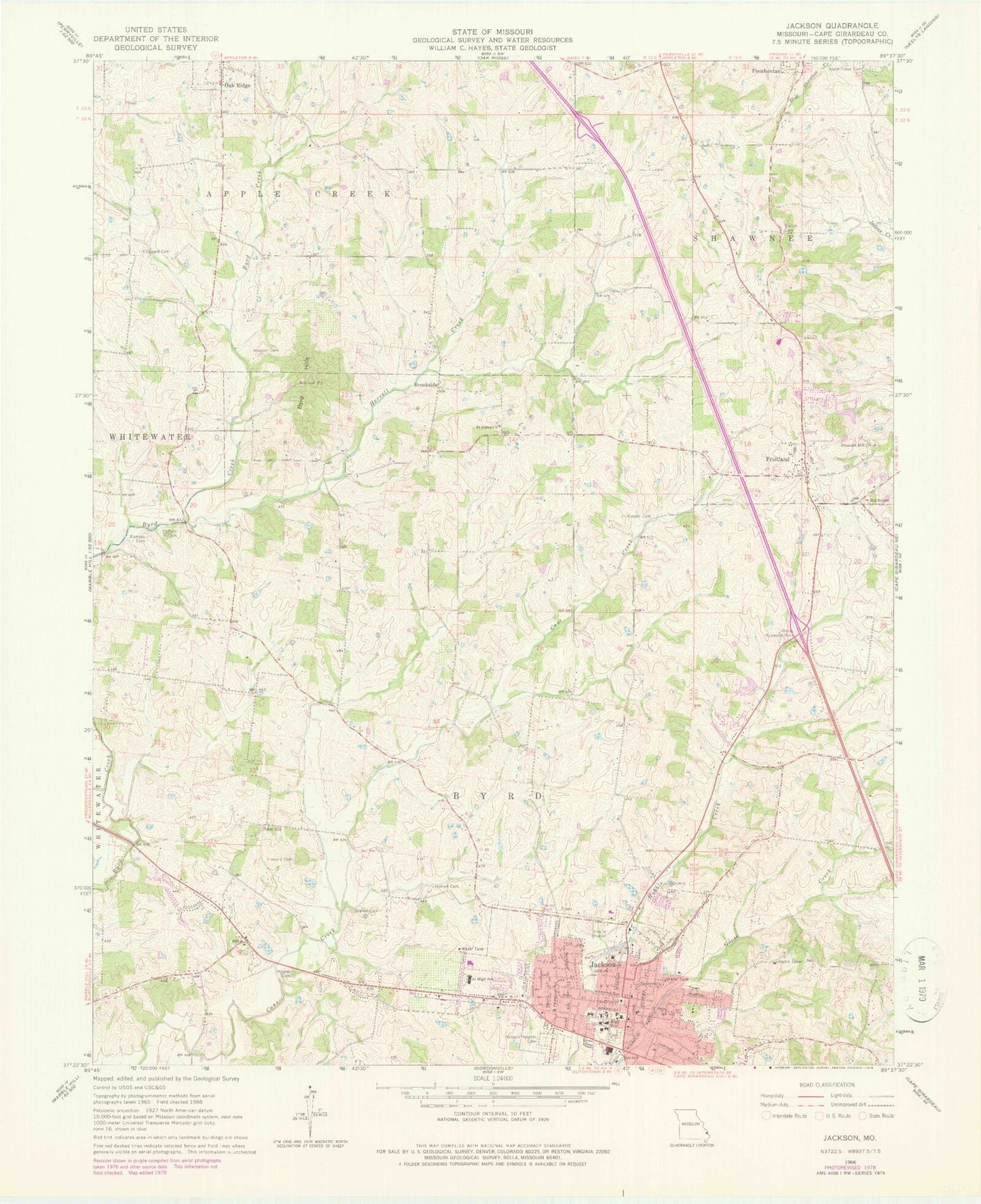
Classic USGS Jackson Missouri 7.5'x7.5' Topo Map
Couldn't load pickup availability
Historical USGS topographic quad map of Jackson in the state of Missouri. Map scale may vary for some years, but is generally around 1:24,000. Print size is approximately 24" x 27"
This quadrangle is in the following counties: Cape Girardeau.
The map contains contour lines, roads, rivers, towns, and lakes. Printed on high-quality waterproof paper with UV fade-resistant inks, and shipped rolled.
Contains the following named places: Apple Creek Cemetery, Brookside, Byrd - Delph - Roberts Cemetery, Byrd Hills, Cane Creek School, Cape Girardeau County, Cape Girardeau County Sheriff's Office, City of Jackson, Clifford School, Clippard Cemetery, Clover Hills School, Dogwood School, Franke Lake, Franke Lake Dam, Fruitland, Fruitland Area Fire Protection District Station 1, Horrell Cemetery, Horrell Creek, Horrell School, Howard Cemetery, Jackson, Jackson Cemetery, Jackson Fire and Rescue Department, Jackson Police Department, Jackson Post Office, KUGT-AM (Jackson), McFerron School, Millersville Rural Fire Protection District Station 2, Mogler Cemetery, North Cape Girardeau County Fire District Station, Pleasant Hill Church, Pocahontas Station, R-2 School, Ramsey Cemetery, Roberts School, Russell Cemetery, Russell Heights Cemetery, Saint Johns Church, Sawyer, Sawyers School, Schoenebeck School, Shiloh Camp, Spring Lake, Spring Lake Dam, Town of Oak Ridge, Township of Byrd, Walker Cemetery, Weiss Roadside Park, Wheeler Cemetery, ZIP Code: 63755