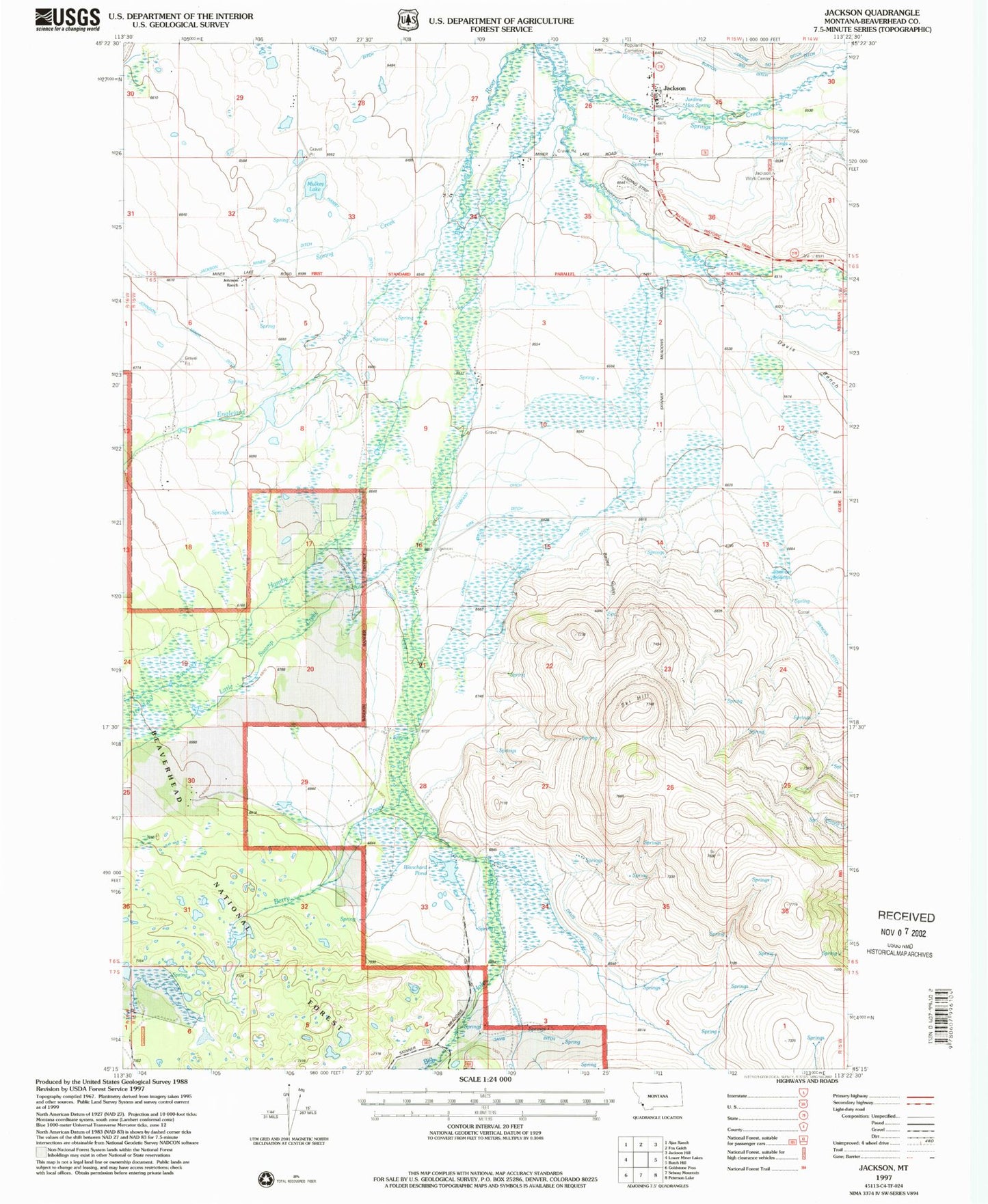
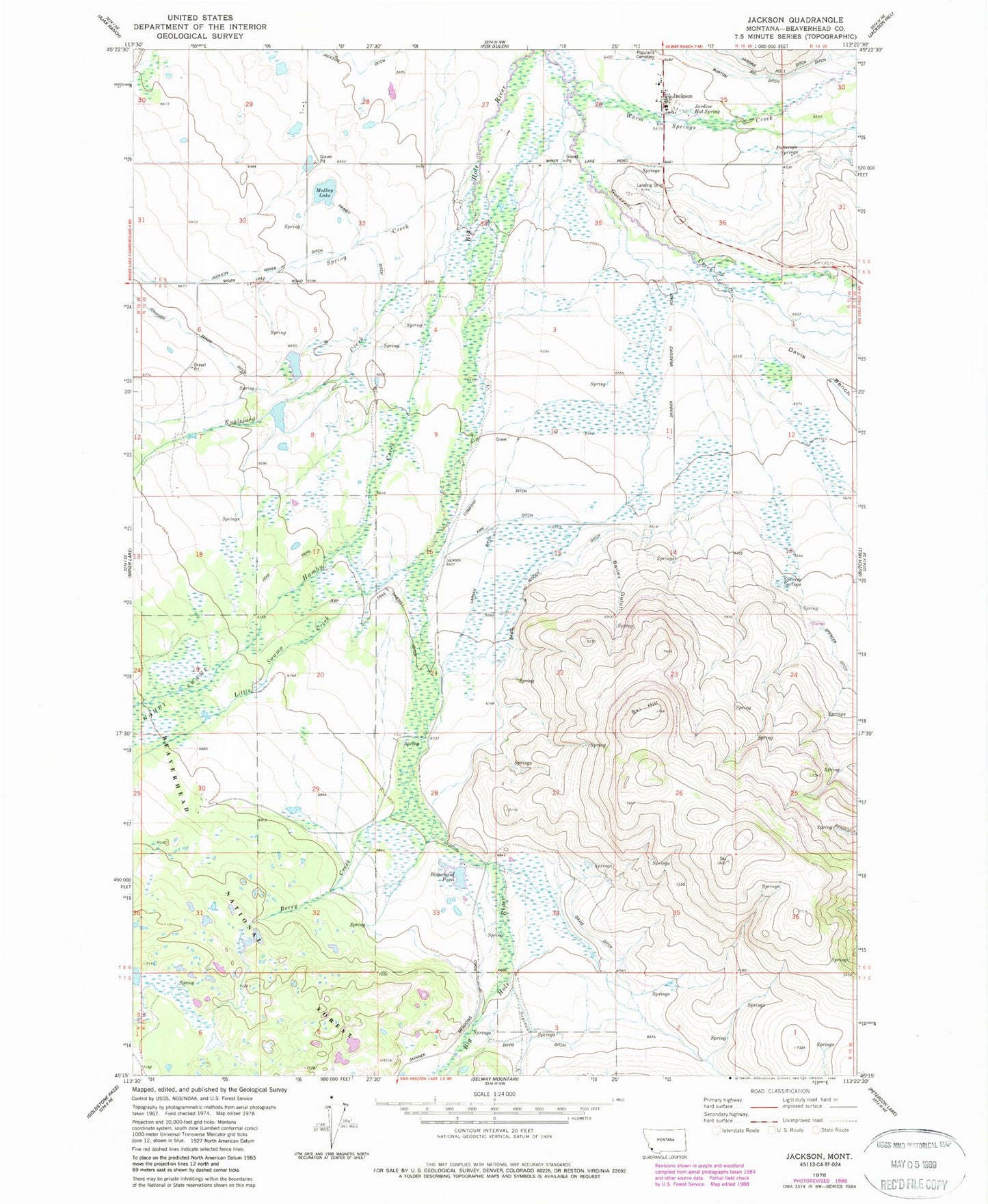
MyTopo
Classic USGS Jackson Montana 7.5'x7.5' Topo Map
Couldn't load pickup availability
Historical USGS topographic quad map of Jackson in the state of Montana. Map scale may vary for some years, but is generally around 1:24,000. Print size is approximately 24" x 27"
This quadrangle is in the following counties: Beaverhead.
The map contains contour lines, roads, rivers, towns, and lakes. Printed on high-quality waterproof paper with UV fade-resistant inks, and shipped rolled.
Contains the following named places: 05S14W31BCAC01 Well, 05S14W31BCBB01 Well, 05S15W25BCCB01 Well, 05S15W25CBAA01 Spring, 05S15W26ADAD01 Well, 05S15W29ADAD01 Well, 05S15W36CABD01 Well, 06S15W02ADAD01 Well, 06S15W09AADA01 Well, 06S15W28BBAB01 Well, 06S15W30DBBC01 Well, 06S15W33CDDA01 Well, Alamo Post Office, Bailey Gulch, Berry Creek, Blanchard Pond, Blanchard Pond Dam, Burton Ditch, Company Ditch, Davis Ditch, Davis Woody Ditch, Englejard Creek, Governor Creek, Hamby Creek, Hamby Ditch, Hamby Swamp, Humperdinck Number 1 Dam, Humperdinck Number 2 Dam, Jackson, Jackson Census Designated Place, Jackson Ditch, Jackson Fire Department, Jackson Hot Springs, Jackson Hot Springs Lodge, Jackson Miner Ditch, Jackson Post Office, Jackson School, Jackson Work Center, Johnson, Johnson Miner Ditch, Kirk Ditch, Laphan Ditch, Laphan Mountain, Little Swamp Creek, Mulkey Lake, Patterson Springs, Saginaw Creek, Sawmill Ditch, Ski Hill, Spencer Springs, Spring Creek