MyTopo
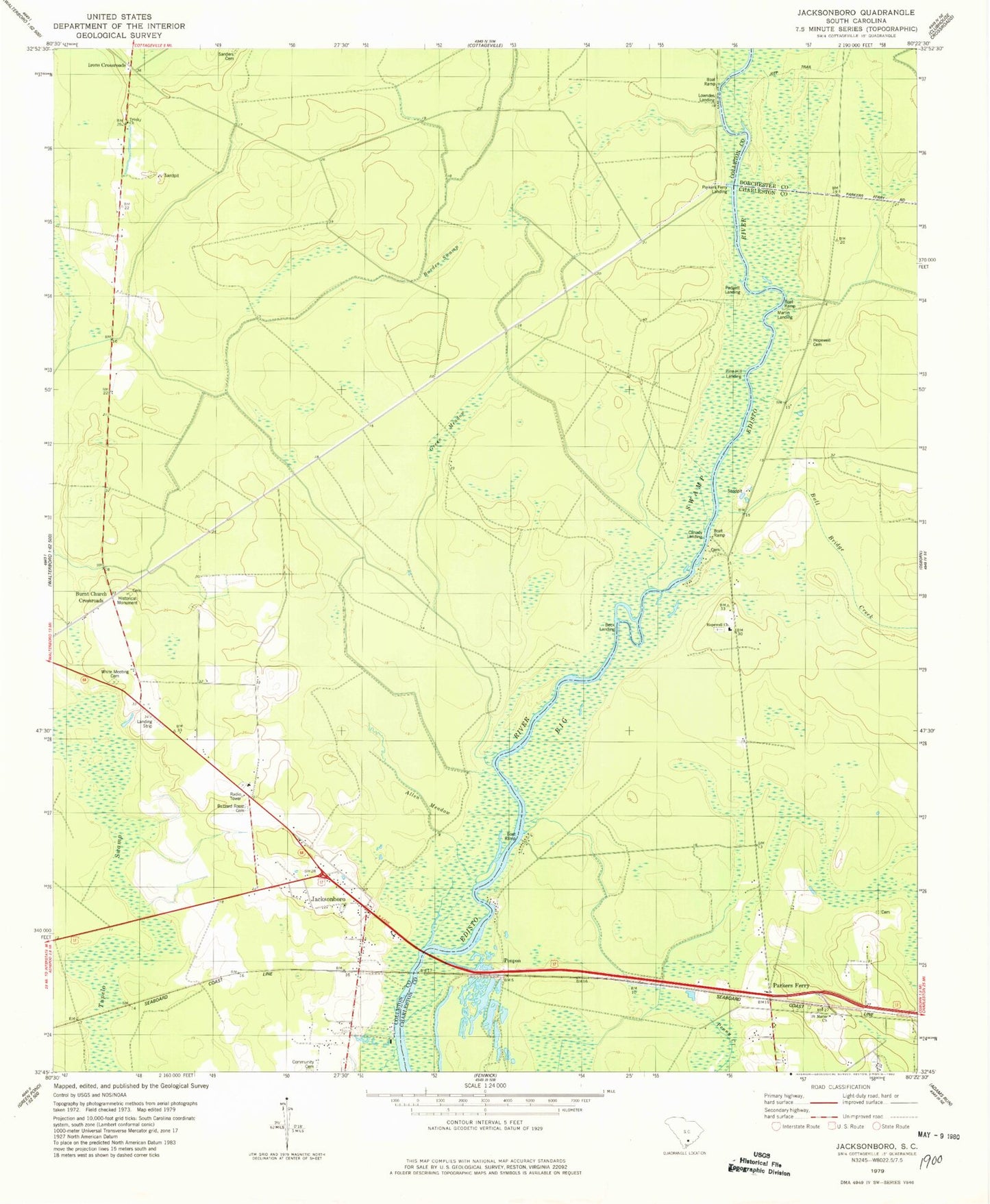
Classic USGS Jacksonboro South Carolina 7.5'x7.5' Topo Map
Couldn't load pickup availability
Historical USGS topographic quad map of Jacksonboro in the state of South Carolina. Map scale may vary for some years, but is generally around 1:24,000. Print size is approximately 24" x 27"
This quadrangle is in the following counties: Charleston, Colleton, Dorchester.
The map contains contour lines, roads, rivers, towns, and lakes. Printed on high-quality waterproof paper with UV fade-resistant inks, and shipped rolled.
Contains the following named places: Allen Meadow, Baptist Church Branch, Beck Landing, Bluefield Hunting Club, Bull Bridge Creek, Burden Swamp, Burnt Church Crossroads, Buzzard Roost Cemetery, Canady Landing, Cedar Grove School, Church of God, Colleton Fire Department Station 2, Community Cemetery, Edisto Sand Pit, Elliot Swamp, Eureka School, Fishburn Landing, Green Meadow, Haynes Cemetery, Henry James Swamp, Hopewell Cemetery, Hopewell Church, Iron Crossroads, Irons Cross Roads School, Isaac Hayne Tomb, Jacksonboro, Jacksonboro Census Designated Place, Jacksonboro Church, Jacksonboro Post Office, Jacksonboro School, Jenkins Swamp, Lowndes Landing, Martins Landing, Oak Grove School, Padgett Landing, Parkers Ferry, Parkers Ferry Landing, Parkers Ferry School, Pine Hill Landing, Pine Hill School, Ponpon, Saint Johns Swamp, Saint Marks Church, Sanders Cemetery, Trinity Church, Trinity School, White Meeting Cemetery