MyTopo
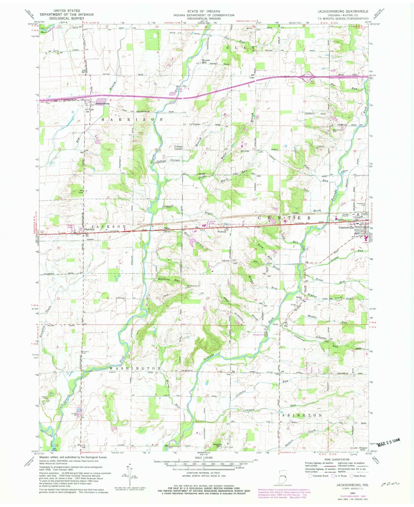
Classic USGS Jacksonburg Indiana 7.5'x7.5' Topo Map
Couldn't load pickup availability
Historical USGS topographic quad map of Jacksonburg in the state of Indiana. Map scale may vary for some years, but is generally around 1:24,000. Print size is approximately 24" x 27"
This quadrangle is in the following counties: Wayne.
The map contains contour lines, roads, rivers, towns, and lakes. Printed on high-quality waterproof paper with UV fade-resistant inks, and shipped rolled.
Contains the following named places: Black Run, Black Water Branch, Brethren Run, Bryant Church, Bryant Creek, Center Run, Centeral Run, Centrum Run, Cold Run, College Corner, College Corner Branch, Common Run, Cool Brook, Crown Creek, Doddridge Chapel, Far Run, Franklin Cemetery, Franklin Creek, Free Run, Greens Fork, Hiser, Hiser Drain, Hoover Mill, Jacksonburg, Middle Run, Our Run, Pennville, Pinhook, Pinhook Drain, Point Run, Sleet Brook, Snow Run Brook, Township of Harrison, Township of Washington, United Brethren Church Cemetery, Warm Run, Wayne County, West Grove, West Grove Cemetery, Winter Run, ZIP Code: 47330