MyTopo
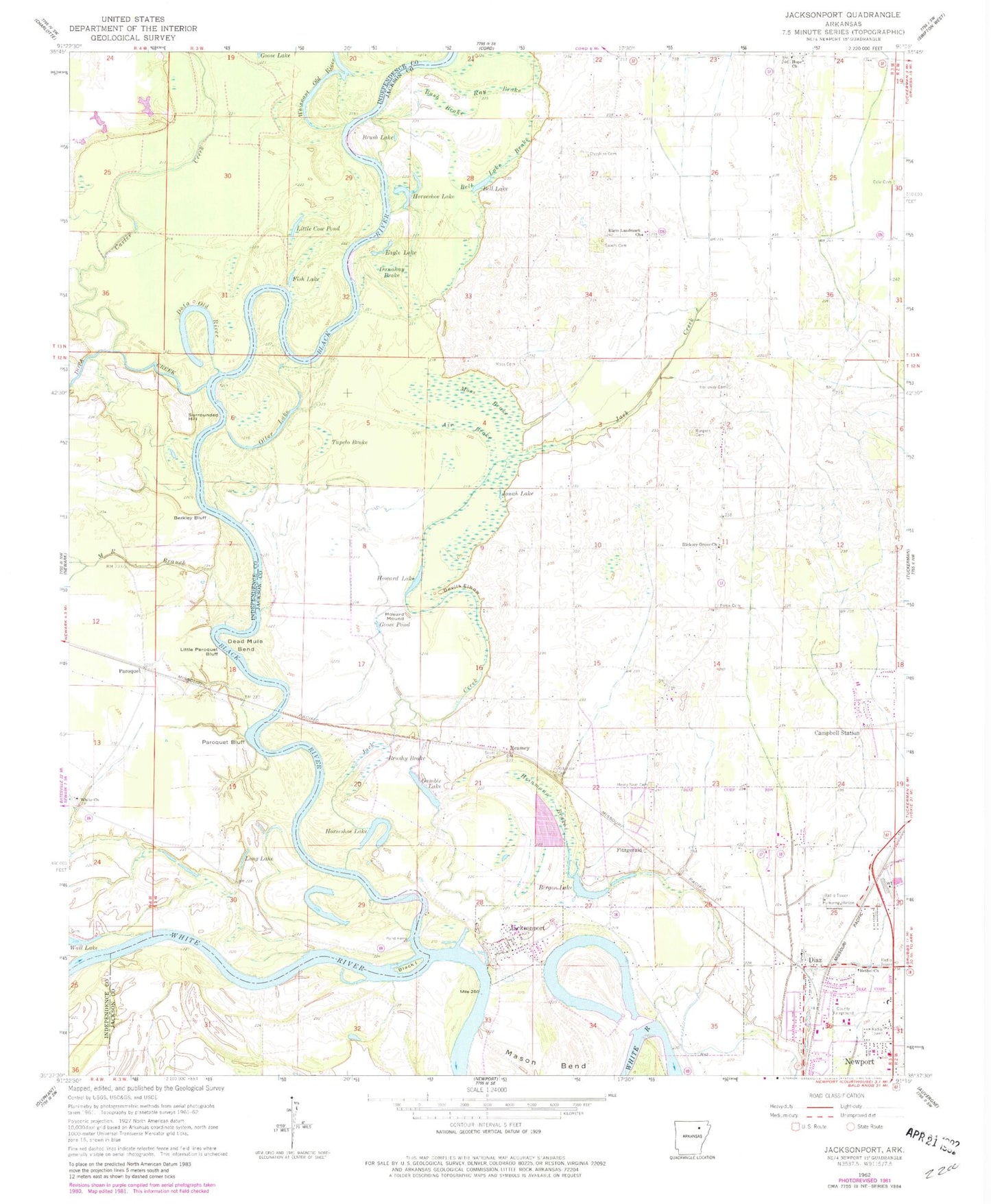
Classic USGS Jacksonport Arkansas 7.5'x7.5' Topo Map
Couldn't load pickup availability
Historical USGS topographic quad map of Jacksonport in the state of Arkansas. Map scale may vary for some years, but is generally around 1:24,000. Print size is approximately 24" x 27"
This quadrangle is in the following counties: Independence, Jackson.
The map contains contour lines, roads, rivers, towns, and lakes. Printed on high-quality waterproof paper with UV fade-resistant inks, and shipped rolled.
Contains the following named places: Air Brake, Arkansas State Police Highway Patrol Troop B, Bell Lake, Bell Lake Brake, Bergen Lake, Berkley Bluff, Bethel Church, Black Island, Black River, Brush Lake, Brushy Brake, Burgess Cemetery, Bush Brake, Carter Creek, Cheshire Cemetery, City of Campbell Station, City of Diaz, Cole Cemetery, Dead Mule Bend, Devils Elbow, Diaz, Diaz Baptist Church, Diaz City Hall, Diaz Police Department, Diaz Post Office, Diaz Volunteer Fire Department, Dota Creek, Dota Old River, Dunahay Brake, Eagle Lake, Elgin Landmark Church, Fish Lake, Fitzgerald, Gamble Lake, Goose Pond, Heinmann Brake, Hickory Grove Cemetery, Hickory Grove Church, Hickory Grove School, Holloway Cemetery, Hope Church, Horseshoe Lake, Hout Ditch, Howard Lake, Howard Mound, Jack Creek, Jacksonport, Jacksonport Post Office, Jacksonport State Park, Jacksonport Volunteer Fire Station, Jonah Lake, Little Cow Pond, Little Paroquet Bluff, Long Lake, M R Branch, Mason Bend, Mercy Seat Cemetery, Moss Brake, Moss Cemetery, Otter Lake, Paroquet, Paroquet Bluff, Point Ferry, Pullum Bend, Ray Brake, Reamey, Roberts - Penix Cemetery, Robinson Cemetery, Salem Cemetery, Scott Cemetery, Shiloh Cemetery, Surrounded Hill, Town of Jacksonport, Township of Jefferson, Township of Logan, Tupelo Brake, Whisnant Old River, White Church