MyTopo
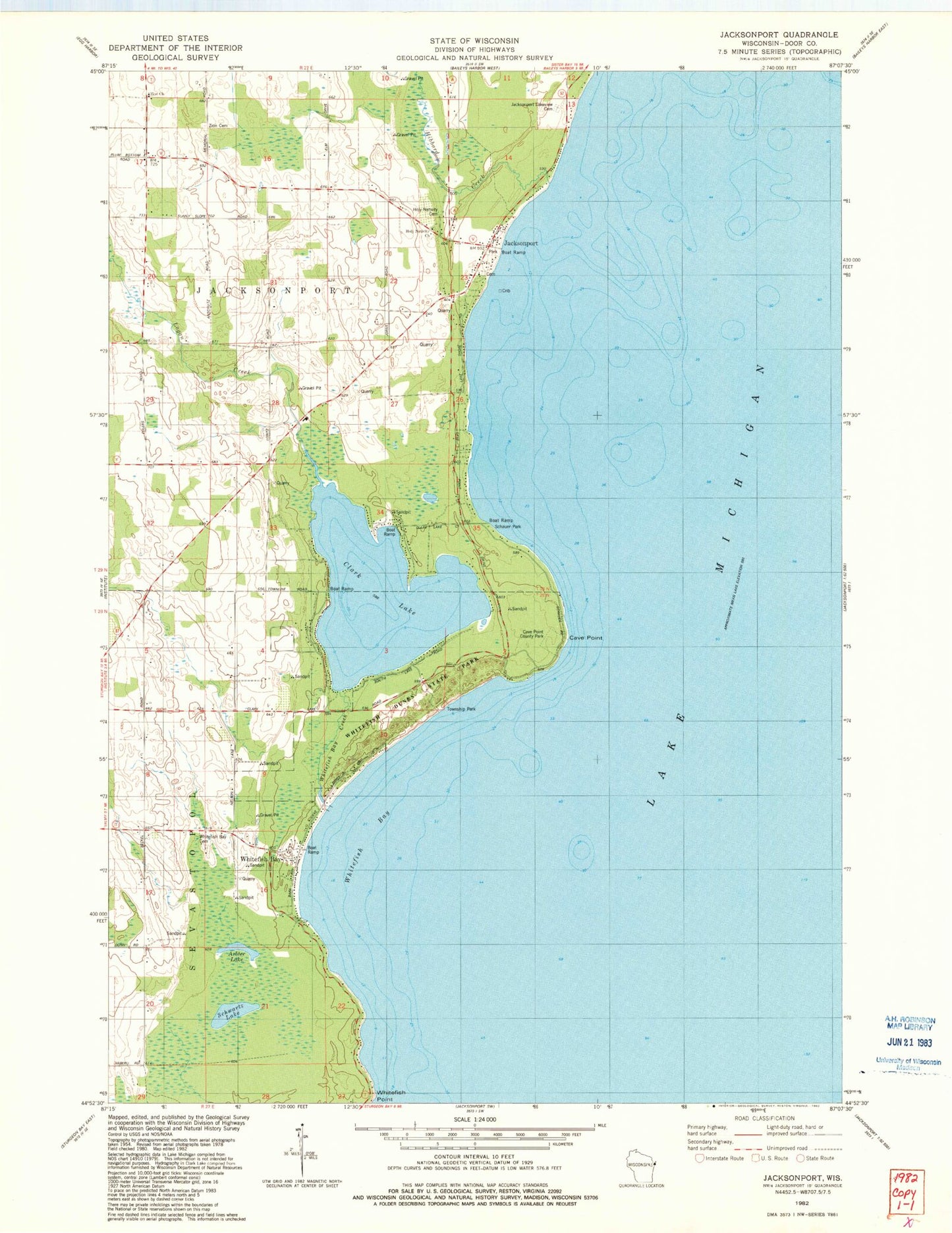
Classic USGS Jacksonport Wisconsin 7.5'x7.5' Topo Map
Couldn't load pickup availability
Historical USGS topographic quad map of Jacksonport in the state of Wisconsin. Map scale may vary for some years, but is generally around 1:24,000. Print size is approximately 24" x 27"
This quadrangle is in the following counties: Door.
The map contains contour lines, roads, rivers, towns, and lakes. Printed on high-quality waterproof paper with UV fade-resistant inks, and shipped rolled.
Contains the following named places: Arbter Lake, Butler Pond, Cave Point, Cave Point County Park, Clark Lake, Farview School, Hibbard Creek, Holy Nativity Cemetery, Holy Nativity Church, Jacksonport, Jacksonport Fire Department, Lakeview Cemetery, Logan Creek, Quiteside Acres, Schauer Park, Schwartz Lake, Sevastopol Township Park, Whitefish Bay, Whitefish Bay Cemetery, Whitefish Bay Creek, Whitefish Bay Farm, Whitefish Dunes State Natural Area, Whitefish Point, Zion Church, Zion Lutheran Cemetery, Zion Lutheran School