MyTopo
Classic USGS Jacksons Gap Alabama 7.5'x7.5' Topo Map
Couldn't load pickup availability
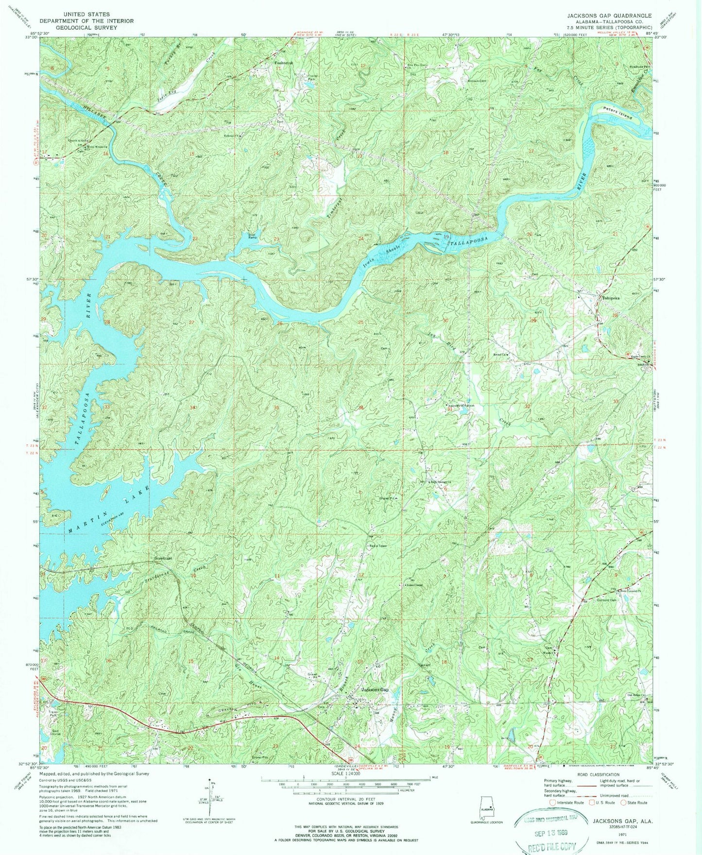
Historical USGS topographic quad map of Jacksons Gap in the state of Alabama. Map scale may vary for some years, but is generally around 1:24,000. Print size is approximately 24" x 27"
This quadrangle is in the following counties: Tallapoosa.
The map contains contour lines, roads, rivers, towns, and lakes. Printed on high-quality waterproof paper with UV fade-resistant inks, and shipped rolled.
Contains the following named places: Antioch Cemetery, Assembly of Yahweh, Bethel Church, Camp Assca, Church of God, Concord Cemetery, Eagle Creek, Eagle Creek Baptist Church, Eagle Creek Cemetery, Eagle Creek Volunteer Fire Department, Emuckfaw Creek, Ephesus Cemetery, Ephesus Primitive Baptist Church, Fosheeton, Fox Creek, Gin House Branch, Hams Cut, Hillabee Creek, Irwin Shoals, Jackson Field Cemetery, Jacksons Gap, Jackson's Gap Fire Department, Jackson's Gap Police Department, Jacksons Gap Post Office, Jacksons Gap School, Jay Bird Creek, Jones Chapel, Josie Leg Creek, Midway, Midway Golf Club, Mount Olive Church, New Concord Church, New Pine Grove Baptist Church, Oak Ridge Church, Peters Island, Rock Springs Church, Rocky Mount Baptist Church, Stow Ferry, Sturdivant, Sturdivant Creek, Timbergut Creek, Tohopeka, Town of Jacksons' Gap, Turkey Branch, Welch Ferry, Whaley Ferry, Woods Cemetery, Woods Presbyterian Church, ZIP Code: 36861