MyTopo
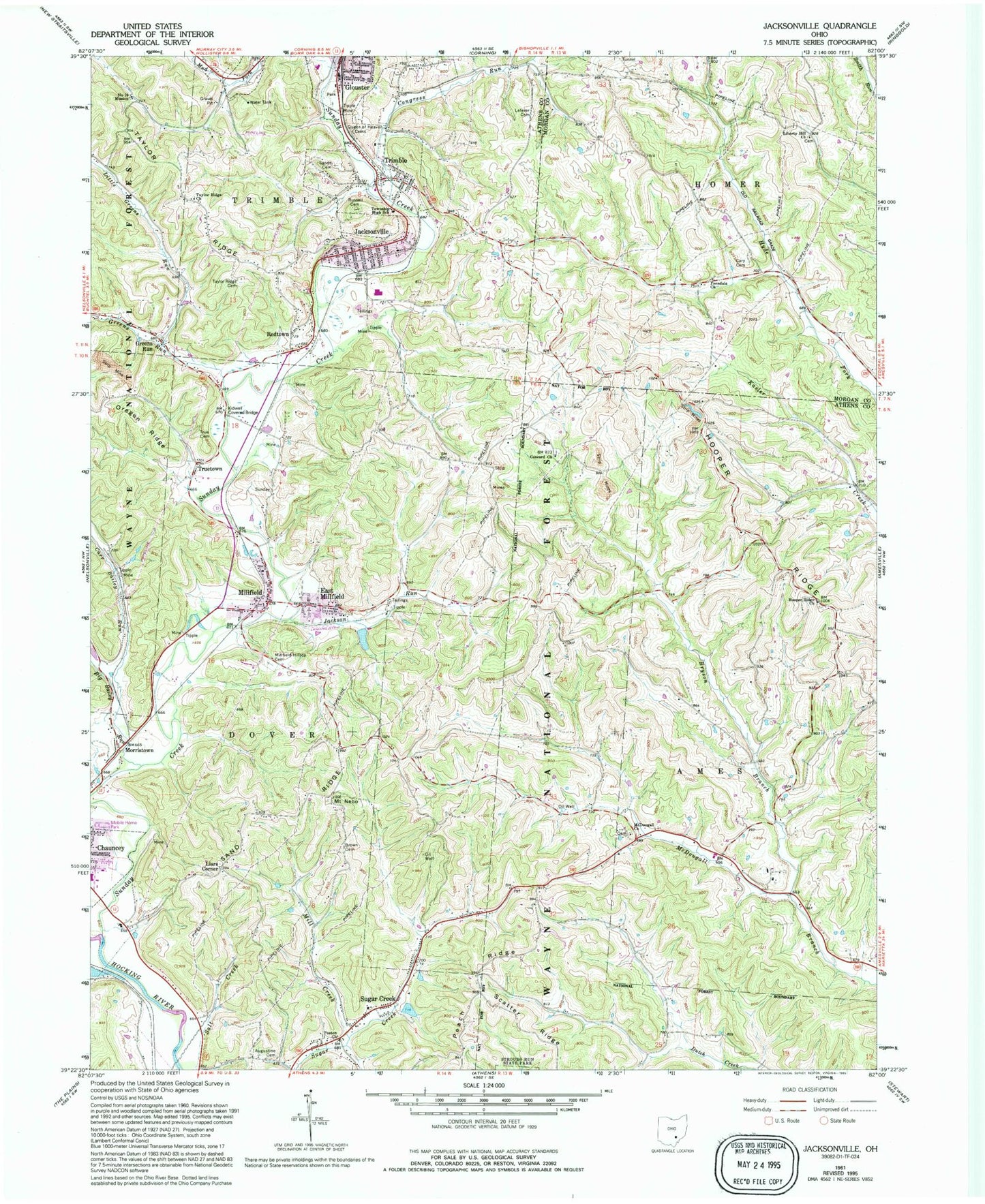
Classic USGS Jacksonville Ohio 7.5'x7.5' Topo Map
Couldn't load pickup availability
Historical USGS topographic quad map of Jacksonville in the state of Ohio. Map scale may vary for some years, but is generally around 1:24,000. Print size is approximately 24" x 27"
This quadrangle is in the following counties: Athens, Morgan.
The map contains contour lines, roads, rivers, towns, and lakes. Printed on high-quality waterproof paper with UV fade-resistant inks, and shipped rolled.
Contains the following named places: Athens City Schools Early Learning Center, Augustine Cemetery, Big Bailey Run, Brown Cemetery, Bryson Branch, Carr Bailey Run, Cary Cemetery, Concord Cemetery, Concord Church, Congress Run, Derthick, East Millfield, Ferndale Methodist Church, Greens Run, Hooper Ridge, Hooper Ridge Cemetery, Hooper Ridge Church, Jackson Run, Jacksonville, Jacksonville Fire and Rescue, Jacksonville Post Office, Kidwell Bridge, Kidwell Covered Bridge, Lefever Cemetery, Lewis, Lewis Post Office, Liars Corner, Liberty Hill Cemetery, Liberty Hill Methodist Church, Linscott, Little Greens Run, McDougall Cemetery, McDougall Church, Mill Creek, Millfield, Millfield - Hilltop Cemetery, Millfield Census Designated Place, Millfield Post Office, Morristown, Mount Nebo, Number Ten Mission, Olbers, Olbers Post Office, Poston, Poston Church, Poston Post Office, Queen of Heaven Cemetery, Redtown, Russell Cemetery, Salt Creek, Sand Ridge, Sands Cemetery, Sugar Creek, Sunday Creek, Taylor Ridge Cemetery, Taylor Ridge Church, Township of Ames, Township of Dover, Trimble, Trimble High School, Trimble Post Office, Trimble Township High School, True Cemetery, Truetown, Village of Jacksonville, Village of Trimble, ZIP Codes: 45740, 45761, 45782