MyTopo
Classic USGS Jacobs Reservoir Oregon 7.5'x7.5' Topo Map
Couldn't load pickup availability
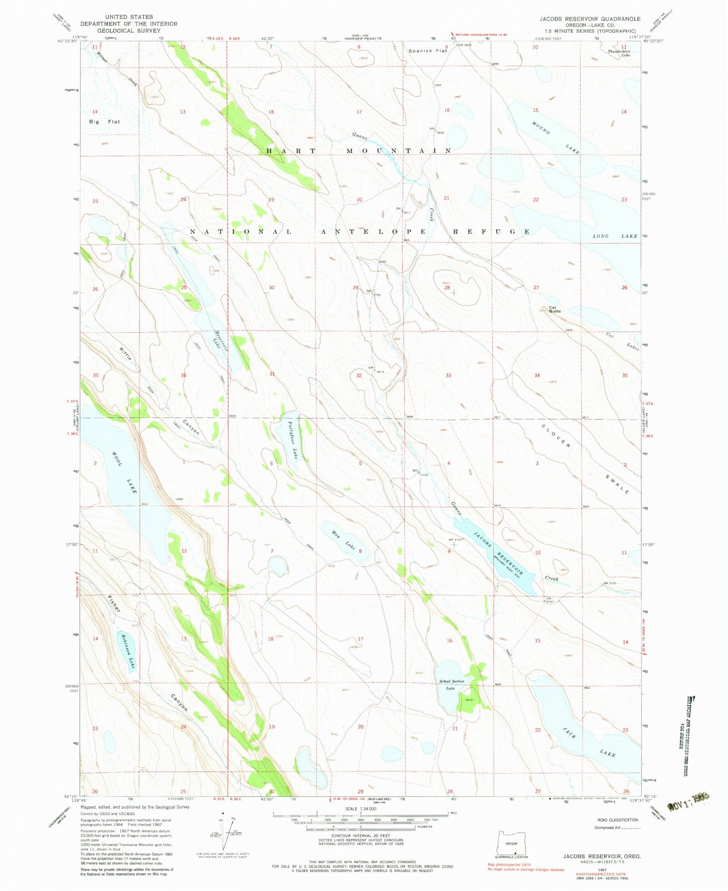
Historical USGS topographic quad map of Jacobs Reservoir in the state of Oregon. Map scale may vary for some years, but is generally around 1:24,000. Print size is approximately 24" x 27"
This quadrangle is in the following counties: Lake.
The map contains contour lines, roads, rivers, towns, and lakes. Printed on high-quality waterproof paper with UV fade-resistant inks, and shipped rolled.
Contains the following named places: Cat Butte, Fortyfour Lake, Handle Reservoir, Jacobs Reservoir, June Reservoir, Long Lake, May Lake, Mound Lake, O'Keefe Reservoir, Reservoir Lake, Robinson Dam, Robinson Lake, School Section Lake, Squib Waterhole, Thunderbird Lake, Wagner Waterhole, Warner Creek, Wildlife Lake, Wire Corral Flat, Wool Lake