MyTopo
Classic USGS Jacobs Reservoir Utah 7.5'x7.5' Topo Map
Couldn't load pickup availability
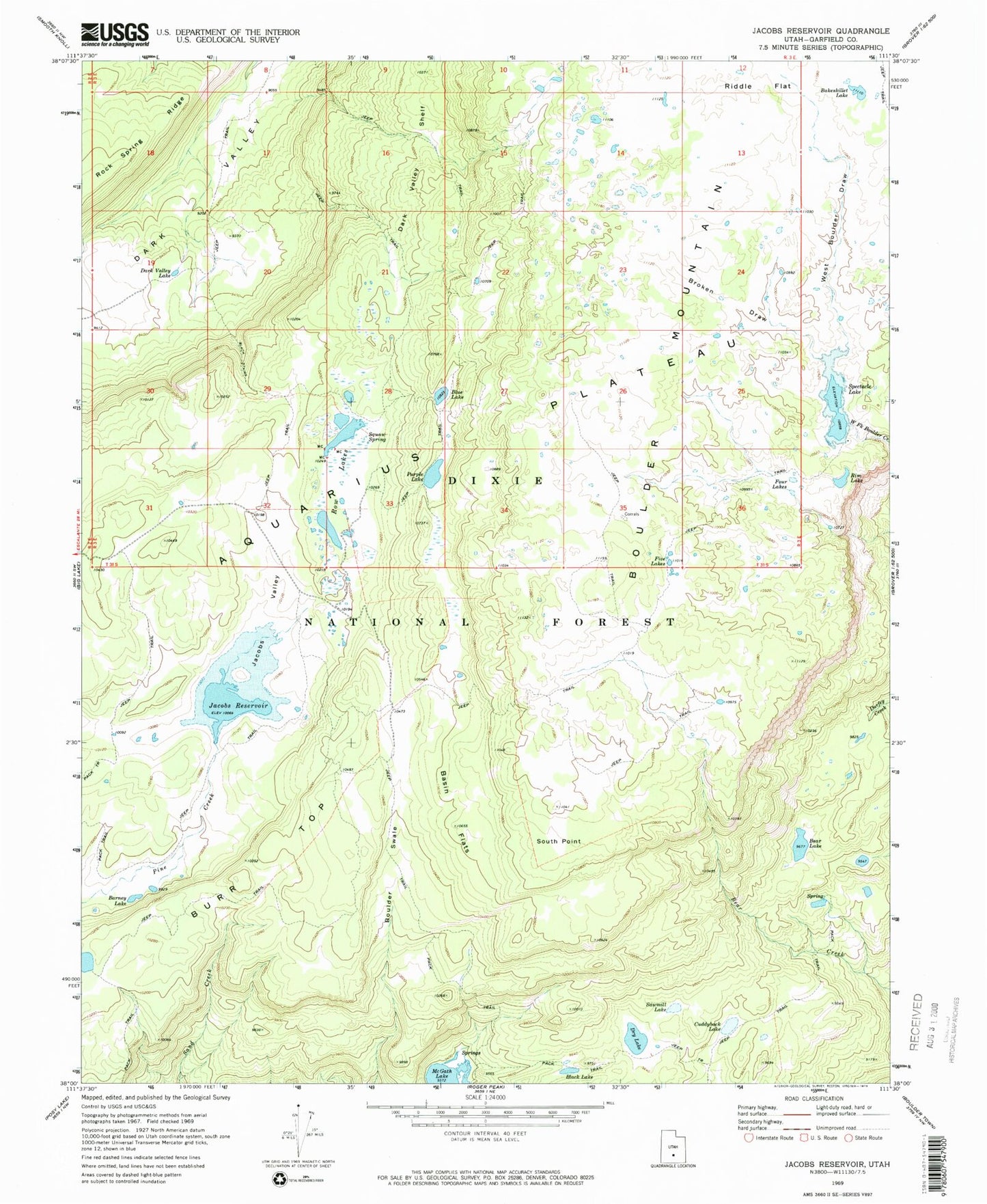
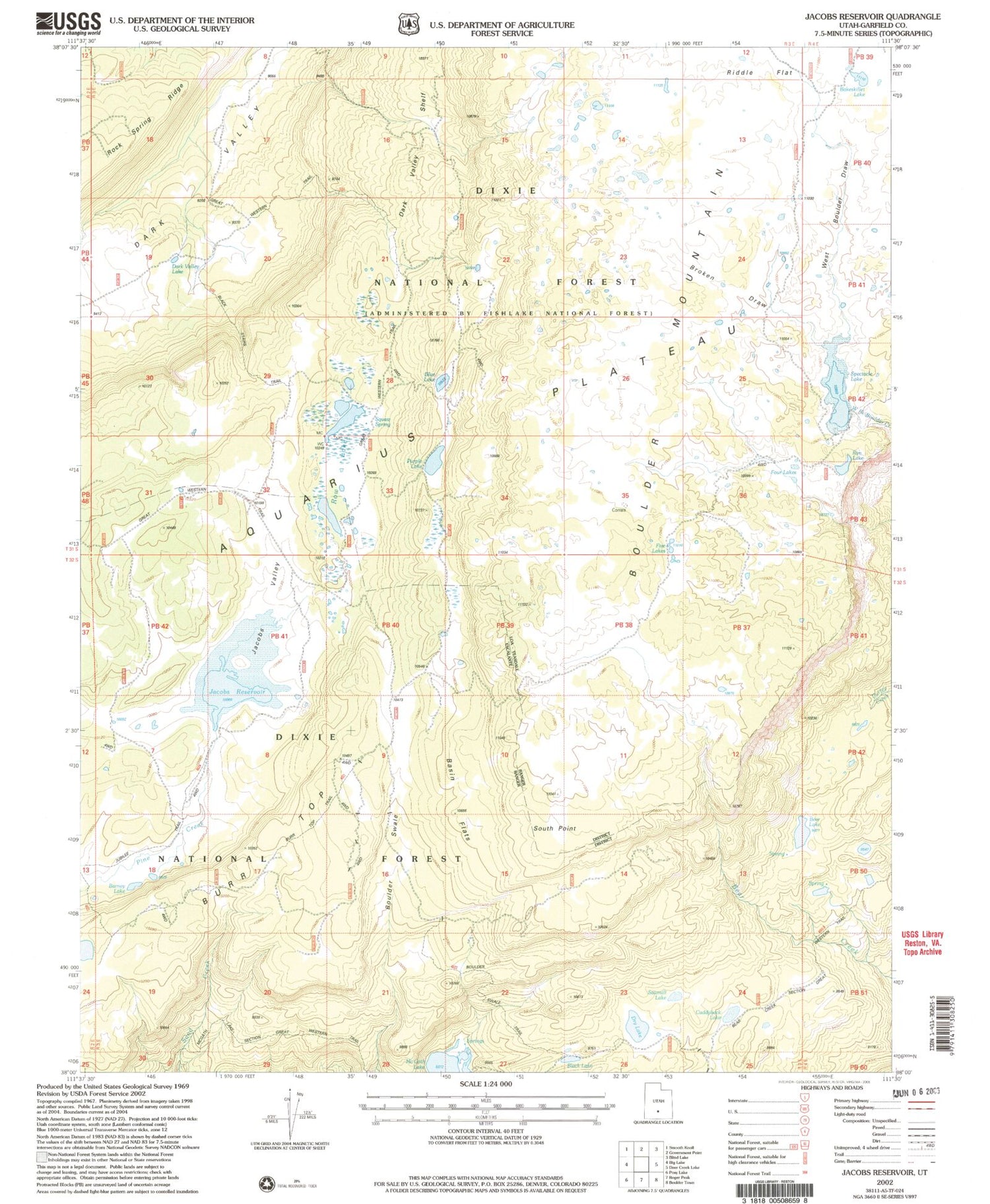
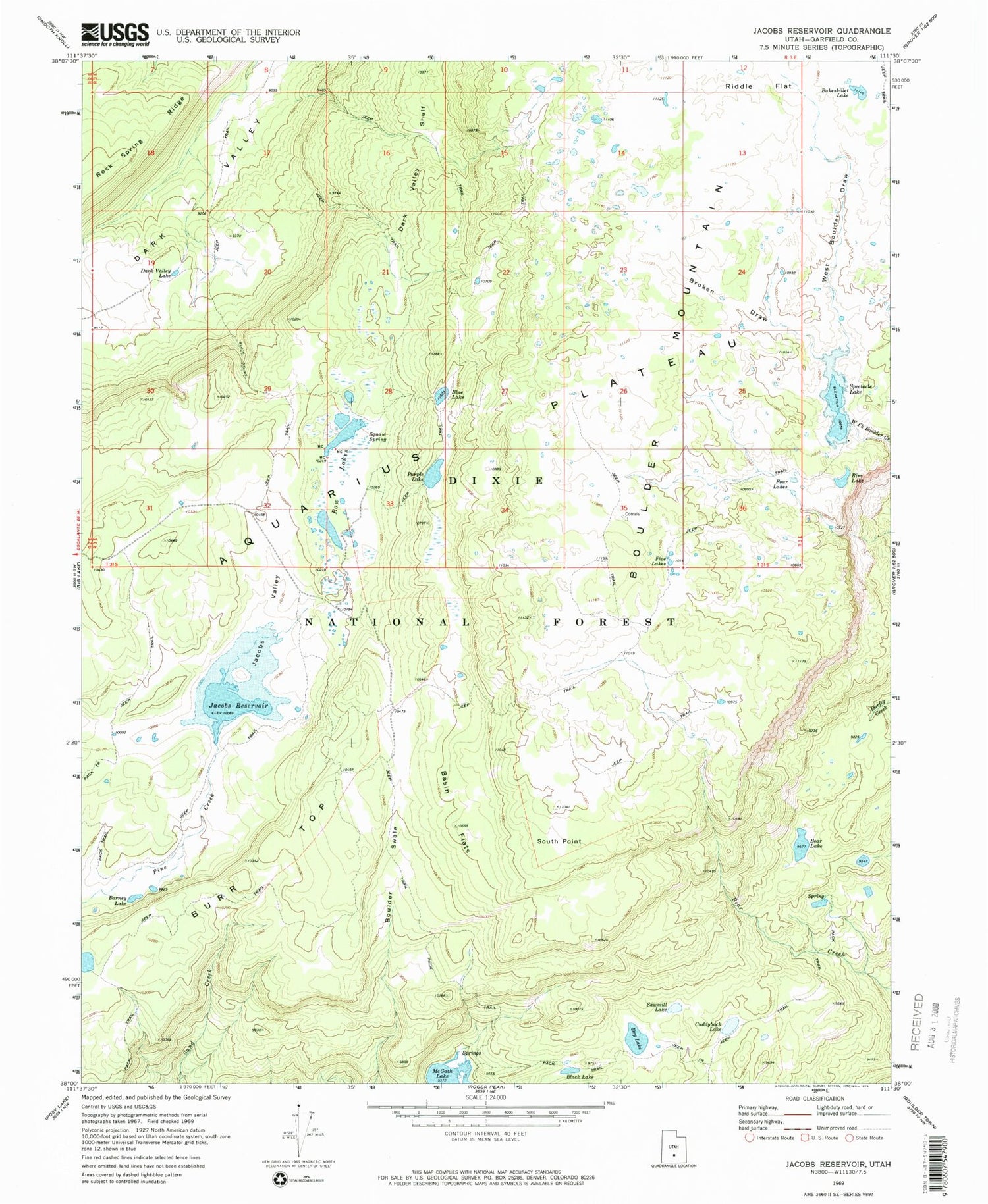
Historical USGS topographic quad map of Jacobs Reservoir in the state of Utah. Typical map scale is 1:24,000, but may vary for certain years, if available. Print size: 24" x 27"
This quadrangle is in the following counties: Garfield.
The map contains contour lines, roads, rivers, towns, and lakes. Printed on high-quality waterproof paper with UV fade-resistant inks, and shipped rolled.
Contains the following named places: Bakeskillet Lake, Barney Lake, Basin Flats, Bear Lake, Black Lake, Blue Lake, Boulder Swale, Broken Draw, Cuddyback Lake, Dark Valley Lake, Dark Valley Shelf, Dry Lake, Five Lakes, Four Lakes, Jacobs Valley, Purple Lake, Rim Lake, Row Lakes, Sawmill Lake, South Point, Squaw Spring, West Boulder Draw, Jacobs Valley Dam, Spectacle Lake, Spectacle Lake Dam, Riddle Flat, Jacobs Reservoir, Burr Top, McGath Lake, Stairs Slope