MyTopo
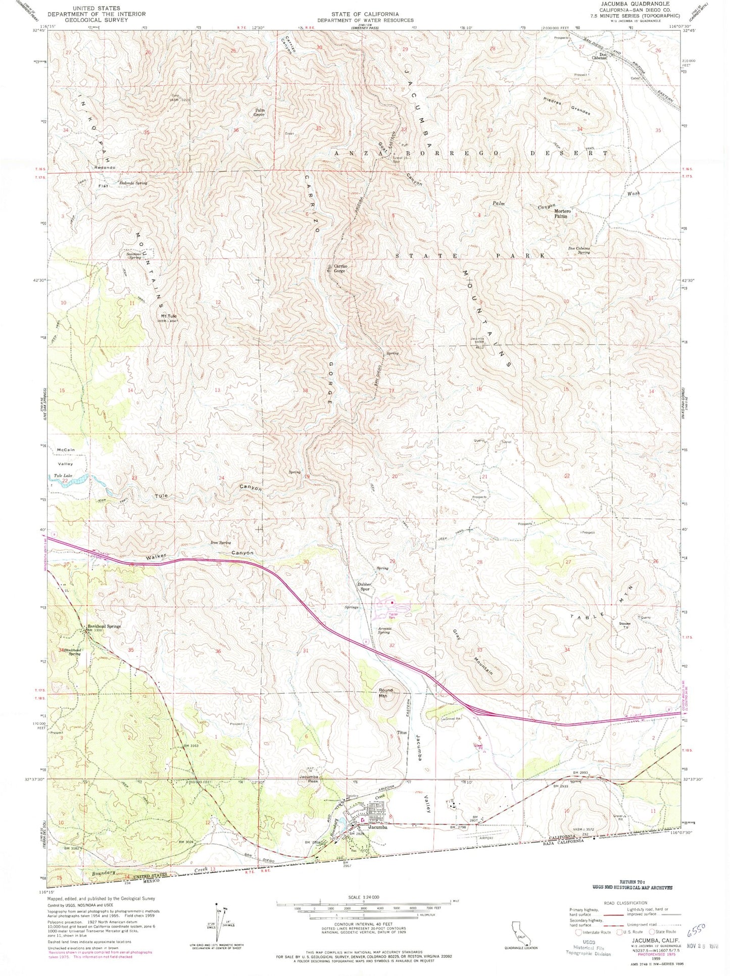
Classic USGS Jacumba California 7.5'x7.5' Topo Map
Couldn't load pickup availability
Historical USGS topographic quad map of Jacumba in the state of California. Typical map scale is 1:24,000, but may vary for certain years, if available. Print size: 24" x 27"
This quadrangle is in the following counties: San Diego.
The map contains contour lines, roads, rivers, towns, and lakes. Printed on high-quality waterproof paper with UV fade-resistant inks, and shipped rolled.
Contains the following named places: Arsenic Spring, Bankhead Spring, Bankhead Springs, Carrizo Gorge, Dos Cabezas Spring, Goat Canyon, Gray Mountain, Iron Spring, Jacumba Mountains, Jacumba Valley, McCain Valley, Piedras Grandes, Redondo Flat, Redondo Spring, Round Mountain, Sacotone Spring, Table Mountain, Tule Canyon, Tule Lake, Mount Tule, Dubber Spur, Carrizo Gorge, Tunnel Fifteen Spur, Dos Cabezas, Mortero Palms, Palm Grove, Squaw Tit, Titus, West 844 Dam, Boundary Creek, Camp Sizzle Spring, Carrizo Gorge Siding, Dos Cabezas Siding, Lone Tiger Spring, Jacumba Census Designated Place, Piedras Grandes Cultural Preserve