
MyTopo
Classic USGS James Peak Utah 7.5'x7.5' Topo Map
Couldn't load pickup availability
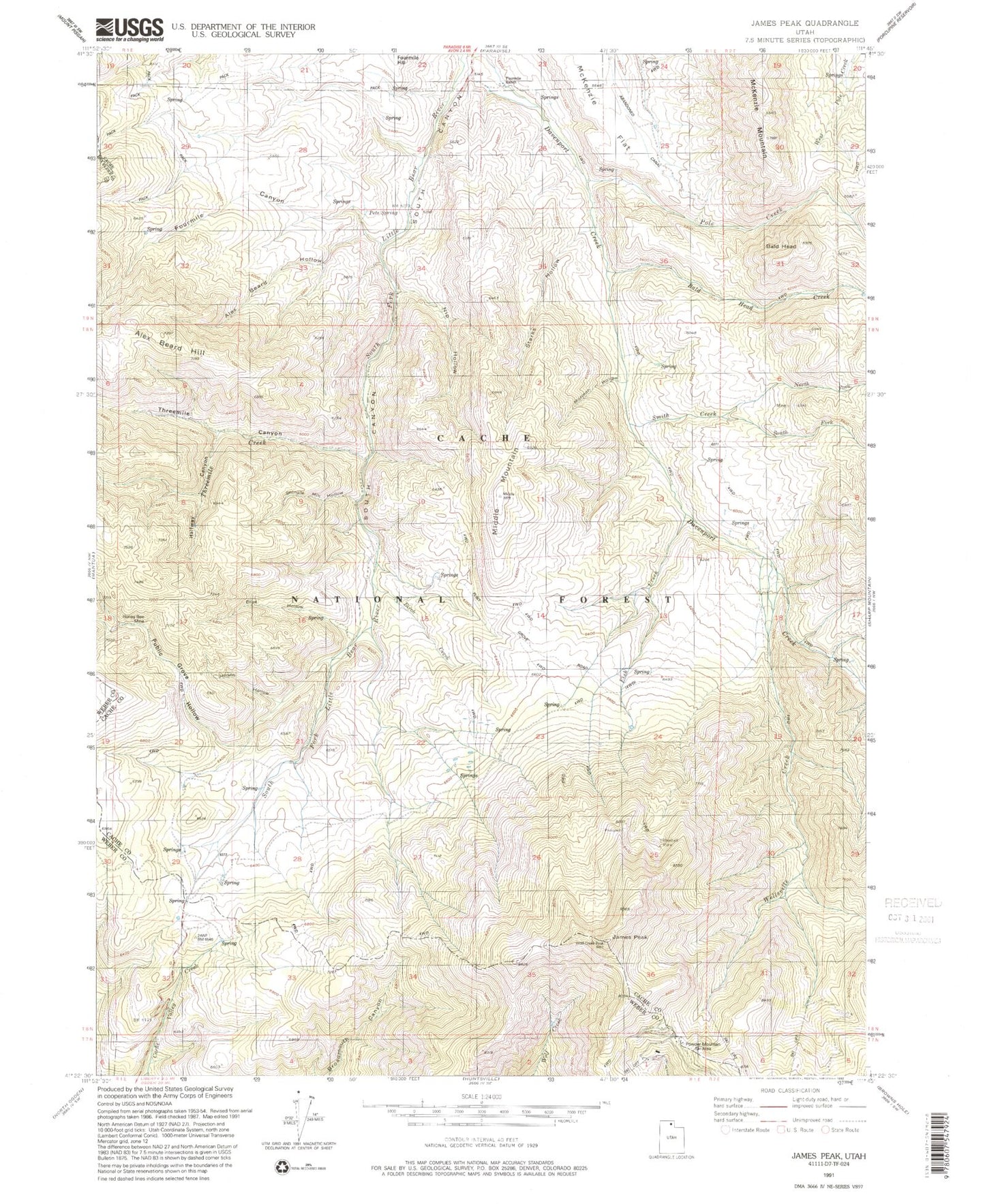
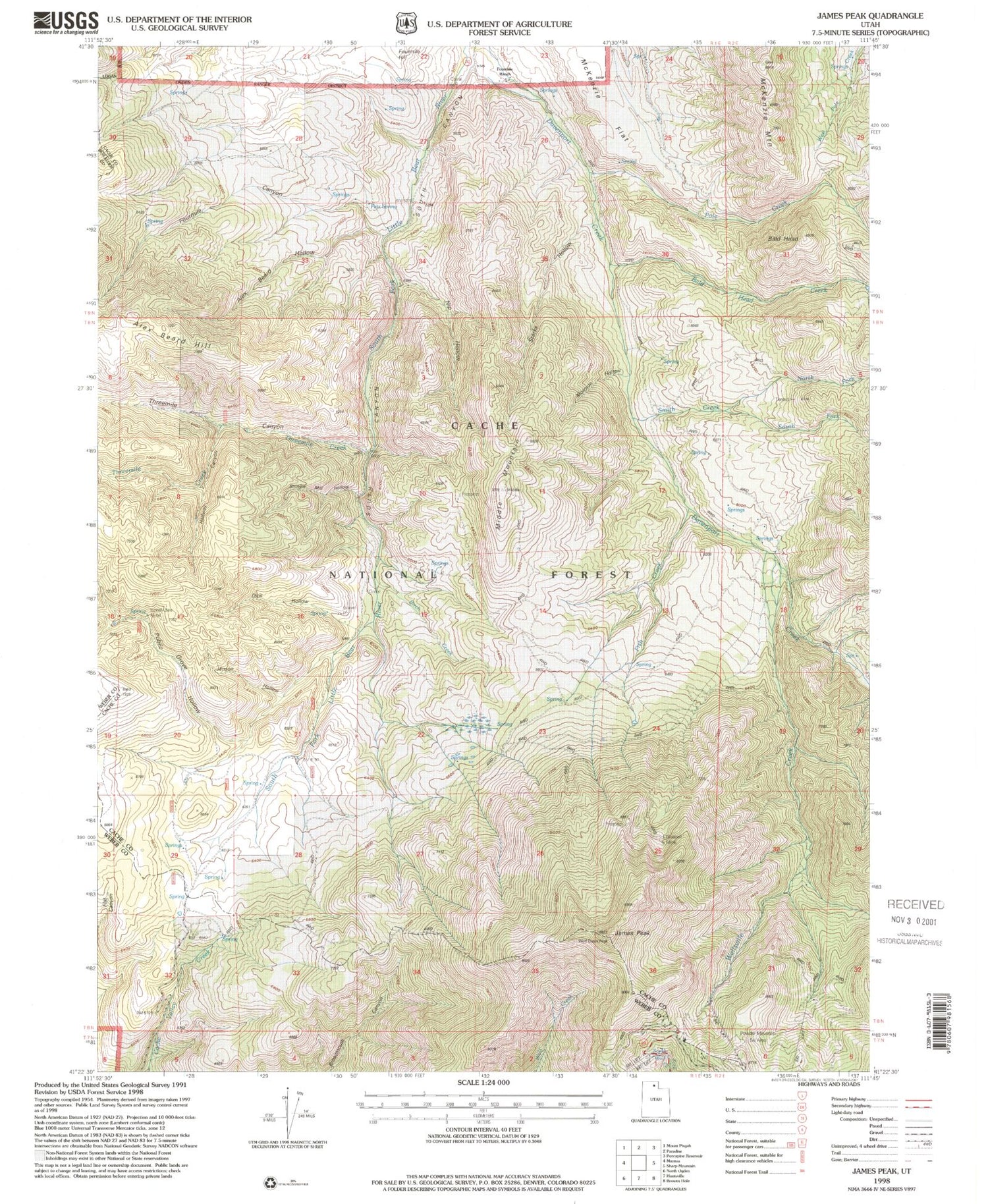
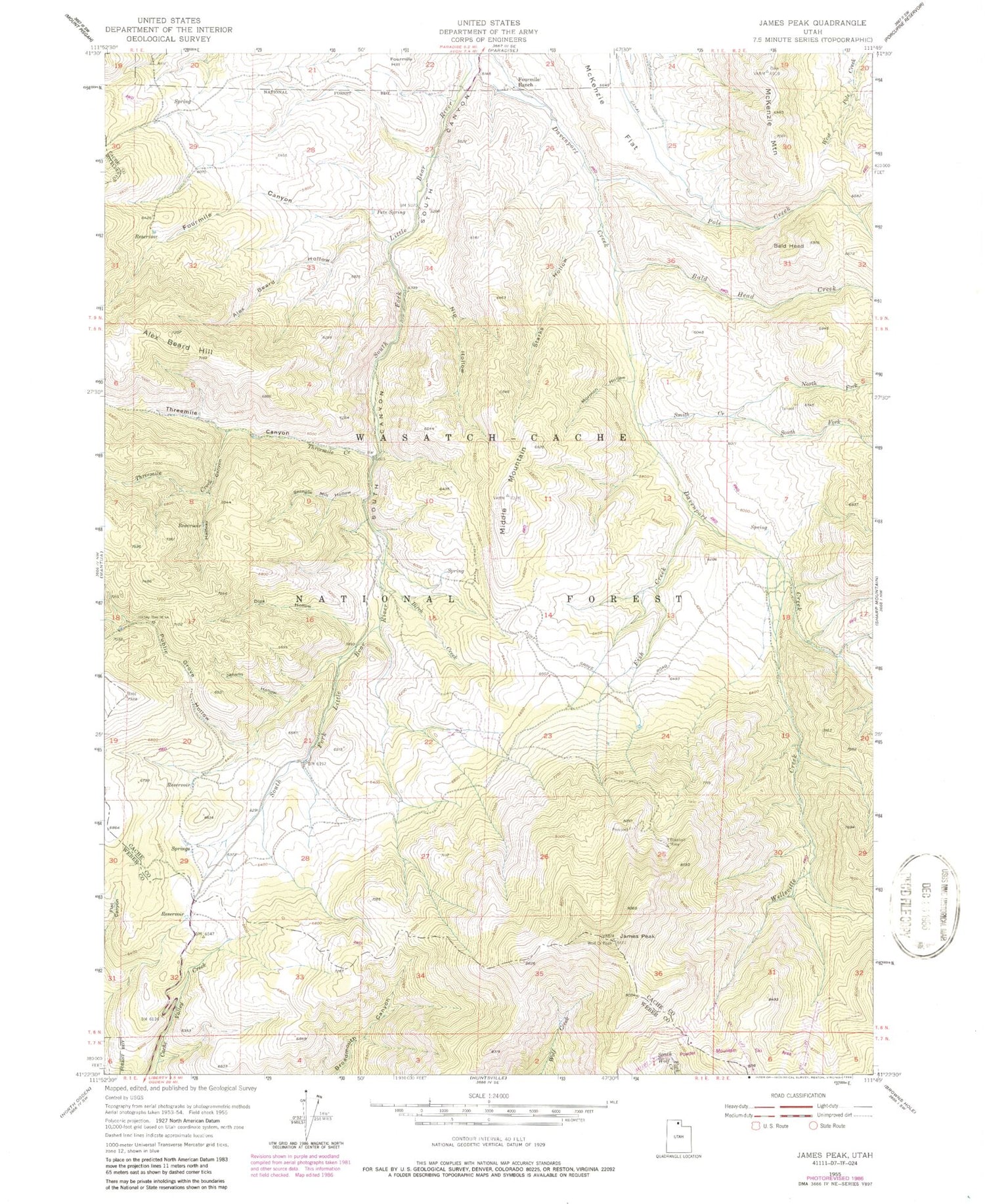
Historical USGS topographic quad map of James Peak in the state of Utah. Typical map scale is 1:24,000, but may vary for certain years, if available. Print size: 24" x 27"
This quadrangle is in the following counties: Box Elder, Cache, Weber.
The map contains contour lines, roads, rivers, towns, and lakes. Printed on high-quality waterproof paper with UV fade-resistant inks, and shipped rolled.
Contains the following named places: Alex Beard Hill, Alex Beard Hollow, Bald Head, Bald Head Creek, Birch Creek, Bluebell Mine, Dips Hollow, Fish Creek, Fourmile Canyon, Fourmile Ranch, Halfway Canyon, Honey Bee Mine, James Peak, Jenson Hollow, McKenzie Flat, McKenzie Mountain, Middle Mountain, Mormon Hollow, Nip Hollow, North Fork Smith Creek, Pets Spring, Pole Creek, Public Grove Hollow, Shingle Mill Hollow, Smith Creek, South Fork Smith Creek, Starks Hollow, Threemile Canyon, Threemile Creek, Wellsville Creek, Powder Mountain West, Powder Mountain Ski Area, Hidden Lake, Cobabe Peak, Alex Beard Hill, Alex Beard Hollow, Bald Head, Bald Head Creek, Birch Creek, Bluebell Mine, Dips Hollow, Fish Creek, Fourmile Canyon, Fourmile Ranch, Halfway Canyon, Honey Bee Mine, James Peak, Jenson Hollow, McKenzie Flat, McKenzie Mountain, Middle Mountain, Mormon Hollow, Nip Hollow, North Fork Smith Creek, Pets Spring, Pole Creek, Public Grove Hollow, Shingle Mill Hollow, Smith Creek, South Fork Smith Creek, Starks Hollow, Threemile Canyon, Threemile Creek, Wellsville Creek, Powder Mountain West, Powder Mountain Ski Area, Hidden Lake, Cobabe Peak