MyTopo
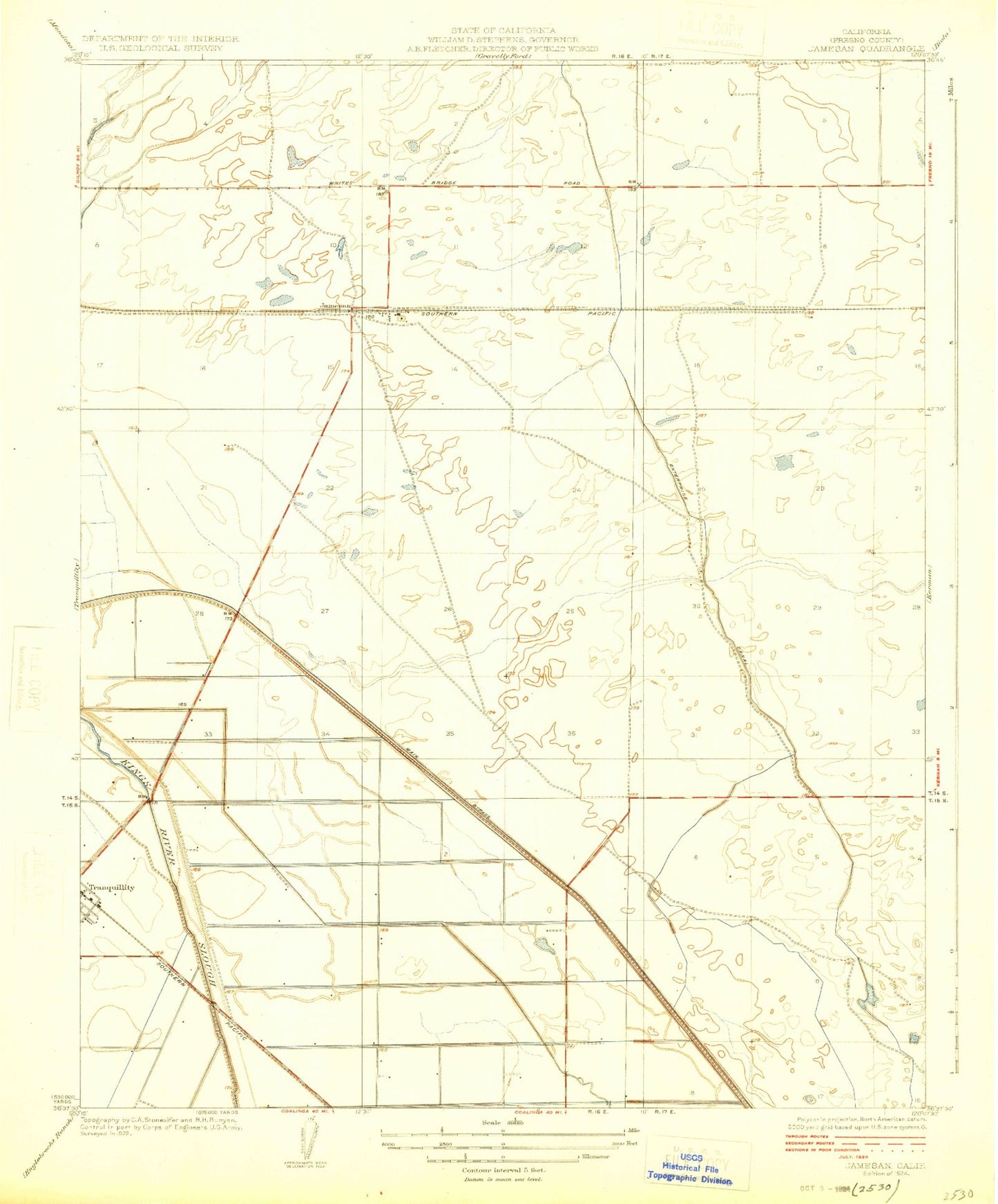
Classic USGS Jamesan California 7.5'x7.5' Topo Map
Regular price
$16.95
Regular price
Sale price
$16.95
Unit price
per
Couldn't load pickup availability
Historical USGS topographic quad map of Jamesan in the state of California. Map scale may vary for some years, but is generally around 1:24,000. Print size is approximately 24" x 27"
This quadrangle is in the following counties: Fresno.
The map contains contour lines, roads, rivers, towns, and lakes. Printed on high-quality waterproof paper with UV fade-resistant inks, and shipped rolled.
Contains the following named places: American Avenue Landfill, Bar 20 Dairy Number 2, Du Bois Ranch Airport, Fresno County Fire Protection District Tranquility Station 95, James Bypass, Jamesan, Kerman Management Area, Traction Ranch